Winfred Se Topo Map South Dakota
To zoom in, hover over the map of Winfred Se
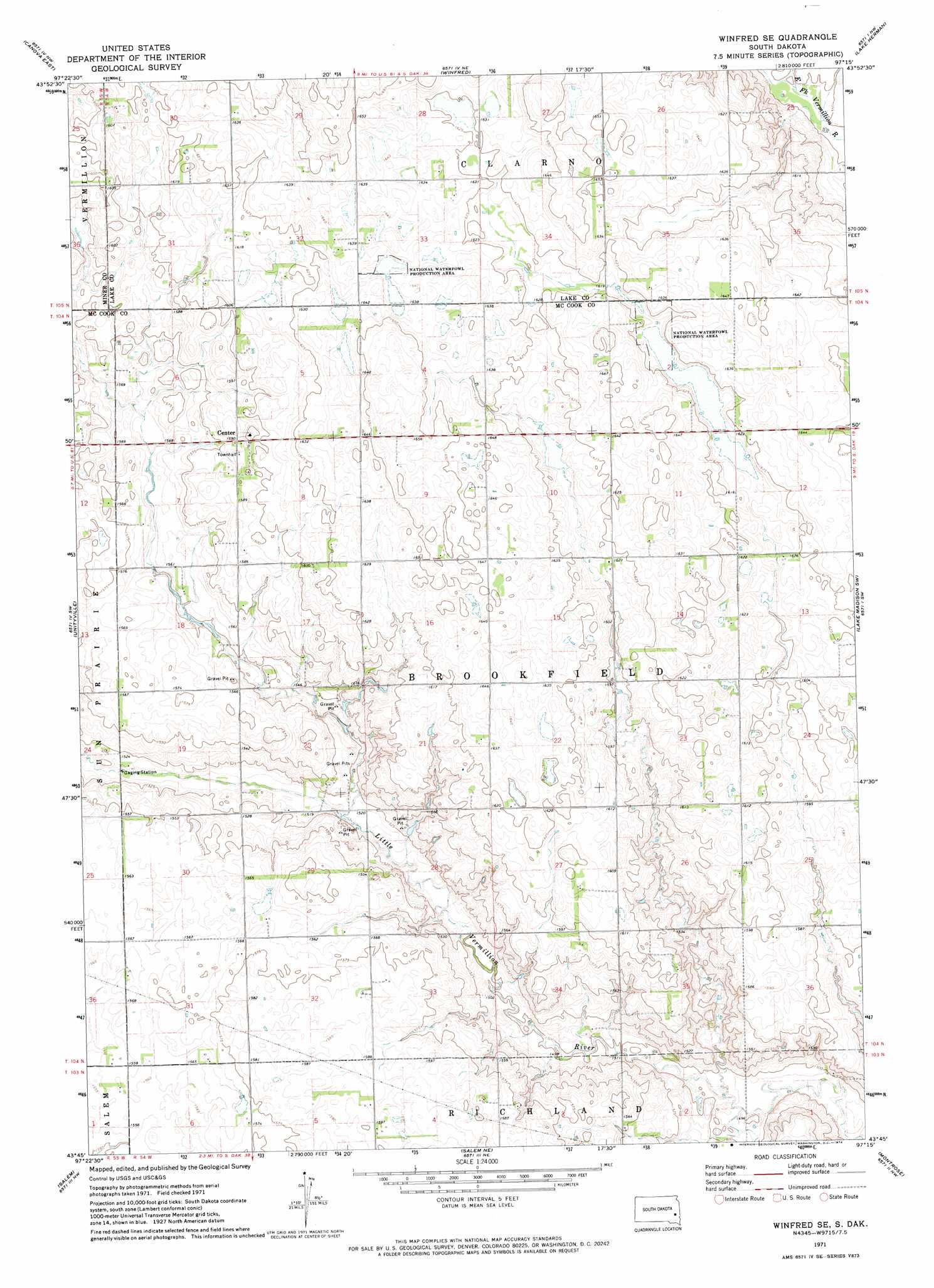
USGS Topo Quad 43097g3 - 1:24,000 scale
| Topo Map Name: | Winfred Se |
| USGS Topo Quad ID: | 43097g3 |
| Print Size: | ca. 21 1/4" wide x 27" high |
| Southeast Coordinates: | 43.75° N latitude / 97.25° W longitude |
| Map Center Coordinates: | 43.8125° N latitude / 97.3125° W longitude |
| U.S. State: | SD |
| Filename: | o43097g3.jpg |
| Download Map JPG Image: | Winfred Se topo map 1:24,000 scale |
| Map Type: | Topographic |
| Topo Series: | 7.5´ |
| Map Scale: | 1:24,000 |
| Source of Map Images: | United States Geological Survey (USGS) |
| Alternate Map Versions: |
Winfred SE SD 1971, updated 1974 Download PDF Buy paper map Winfred SE SD 2012 Download PDF Buy paper map Winfred SE SD 2015 Download PDF Buy paper map |
1:24,000 Topo Quads surrounding Winfred Se
Howard |
Oldham Sw |
Oldham Se |
Ramona |
Madison |
Canova West |
Canova East |
Winfred |
Lake Herman |
Lake Madison |
Canova Se |
Unityville |
Winfred Se |
Lake Madison Sw |
Buffalo Trading Post |
Spencer |
Salem |
Salem Ne |
Montrose |
Humboldt |
Bridgewater West |
Bridgewater East |
Canistota |
East Vermillion Lake |
Grass Lake |
> Back to 43097e1 at 1:100,000 scale
> Back to 43096a1 at 1:250,000 scale
> Back to U.S. Topo Maps home
No gazetteer data is available for the Winfred Se topo map sheet.
Winfred Se digital topo map on disk
Buy this Winfred Se topo map showing relief, roads, GPS coordinates and other geographical features, as a high-resolution digital map file on DVD:
Eastern North Dakota & Eastern South Dakota
Buy digital topo maps: Eastern North Dakota & Eastern South Dakota