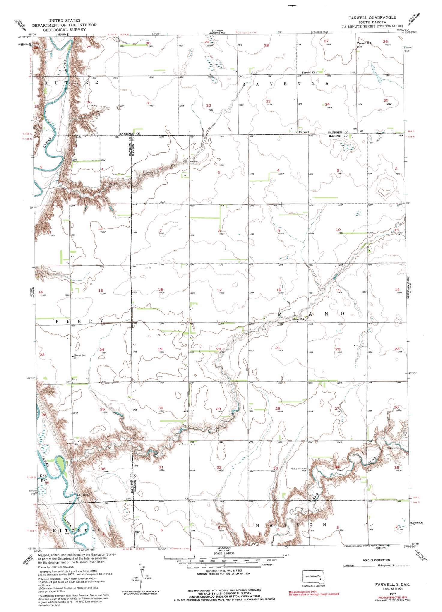
Farwell Topo Map South Dakota
To zoom in, hover over the map of Farwell
USGS Topo Quad 43097g8 - 1:24,000 scale
| Topo Map Name: | Farwell |
| USGS Topo Quad ID: | 43097g8 |
| Print Size: | ca. 21 1/4" wide x 27" high |
| Southeast Coordinates: | 43.75° N latitude / 97.875° W longitude |
| Map Center Coordinates: | 43.8125° N latitude / 97.9375° W longitude |
| U.S. State: | SD |
| Filename: | o43097g8.jpg |
| Download Map JPG Image: | Farwell topo map 1:24,000 scale |
| Map Type: | Topographic |
| Topo Series: | 7.5´ |
| Map Scale: | 1:24,000 |
| Source of Map Images: | United States Geological Survey (USGS) |
| Alternate Map Versions: |
Farwell SD 1957, updated 1959 Download PDF Buy paper map Farwell SD 1957, updated 1991 Download PDF Buy paper map Farwell SD 2012 Download PDF Buy paper map Farwell SD 2015 Download PDF Buy paper map |
1:24,000 Topo Quads surrounding Farwell
Forestburg Sw |
Forestburg |
Artesian |
Fedora |
Roswell |
Letcher |
Letcher Ne |
Farwell Nw |
Morris Lake |
Bitter Lake |
Letcher Sw |
Loomis |
Farwell |
Ness Chain Lakes |
Epiphany |
Betts |
Mitchell |
Riverside |
Alexandria |
Farmer |
Mitchell Sw |
Shoemaker Dam |
Ethan |
Rockport Colony |
Spencer Sw |
> Back to 43097e1 at 1:100,000 scale
> Back to 43096a1 at 1:250,000 scale
> Back to U.S. Topo Maps home
Farwell digital topo map on disk
Buy this Farwell topo map showing relief, roads, GPS coordinates and other geographical features, as a high-resolution digital map file on DVD:
Eastern North Dakota & Eastern South Dakota
Buy digital topo maps: Eastern North Dakota & Eastern South Dakota