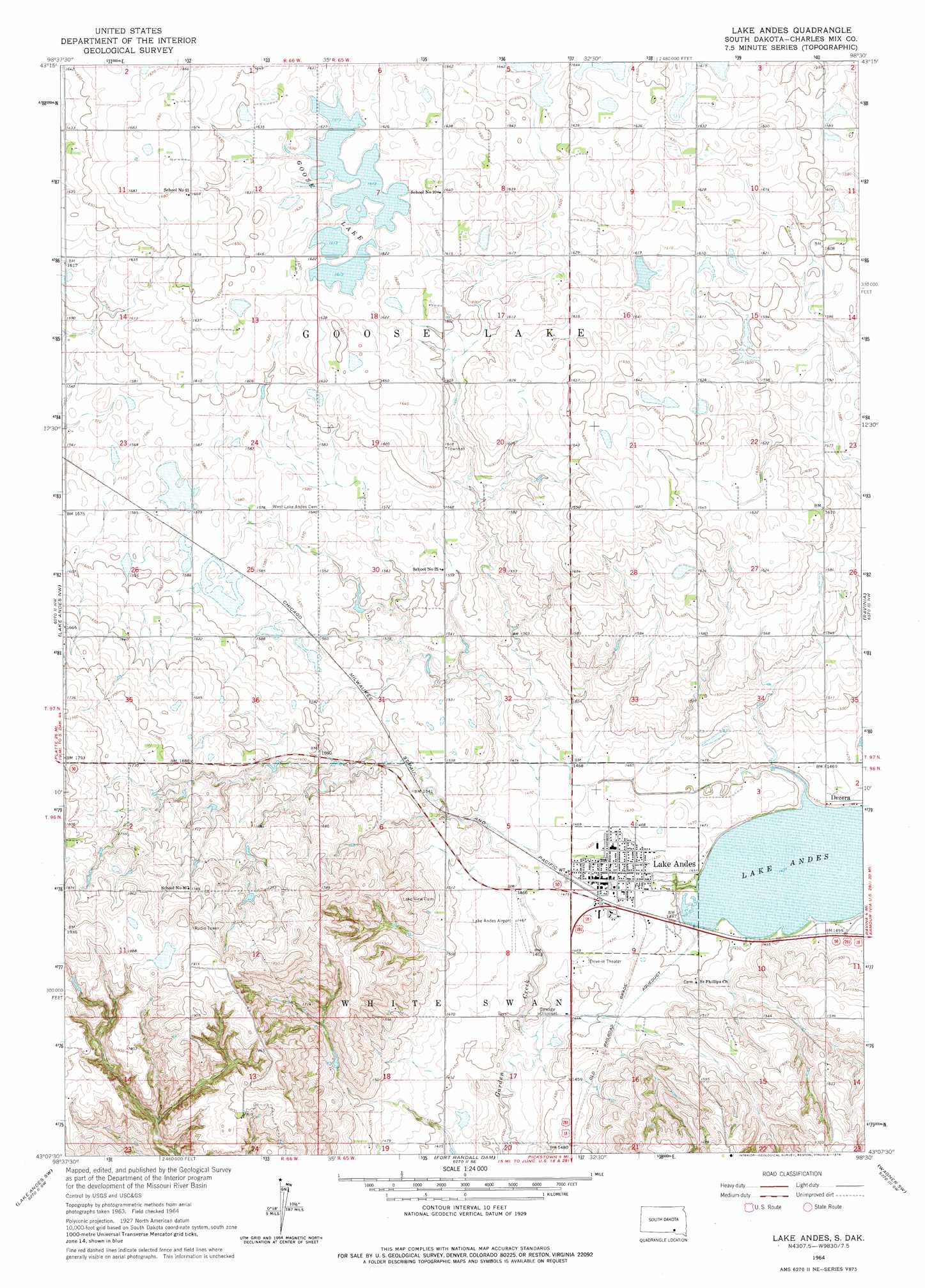
Lake Andes Topo Map South Dakota
To zoom in, hover over the map of Lake Andes
USGS Topo Quad 43098b5 - 1:24,000 scale
| Topo Map Name: | Lake Andes |
| USGS Topo Quad ID: | 43098b5 |
| Print Size: | ca. 21 1/4" wide x 27" high |
| Southeast Coordinates: | 43.125° N latitude / 98.5° W longitude |
| Map Center Coordinates: | 43.1875° N latitude / 98.5625° W longitude |
| U.S. State: | SD |
| Filename: | o43098b5.jpg |
| Download Map JPG Image: | Lake Andes topo map 1:24,000 scale |
| Map Type: | Topographic |
| Topo Series: | 7.5´ |
| Map Scale: | 1:24,000 |
| Source of Map Images: | United States Geological Survey (USGS) |
| Alternate Map Versions: |
Lake Andes SD 1964, updated 1965 Download PDF Buy paper map Lake Andes SD 1964, updated 1976 Download PDF Buy paper map Lake Andes SD 1977, updated 1979 Download PDF Buy paper map Lake Andes SD 2012 Download PDF Buy paper map Lake Andes SD 2015 Download PDF Buy paper map |
1:24,000 Topo Quads surrounding Lake Andes
Platte |
Joubert |
New Holland |
Corsica |
Corsica Lake |
Bovee |
Geddes |
Geddes Se |
Armour Sw |
Armour |
Campbell Creek |
Lake Andes Nw |
Lake Andes |
Ravinia |
Wagner Ne |
South Scalp Creek |
Lake Andes Sw |
Fort Randall Dam |
Wagner Sw |
Wagner |
Butte |
Spencer North |
Gross |
Marty |
Lynch Ne |
> Back to 43098a1 at 1:100,000 scale
> Back to 43098a1 at 1:250,000 scale
> Back to U.S. Topo Maps home
Lake Andes topo map: Gazetteer
Lake Andes: Airports
Lake Andes Municipal Airport elevation 451m 1479′Lake Andes: Lakes
Goose Lake elevation 494m 1620′Lake Andes: Populated Places
Dezera elevation 443m 1453′Lake Andes elevation 451m 1479′
Lake Andes digital topo map on disk
Buy this Lake Andes topo map showing relief, roads, GPS coordinates and other geographical features, as a high-resolution digital map file on DVD:
Eastern North Dakota & Eastern South Dakota
Buy digital topo maps: Eastern North Dakota & Eastern South Dakota