Delmont Topo Map South Dakota
To zoom in, hover over the map of Delmont
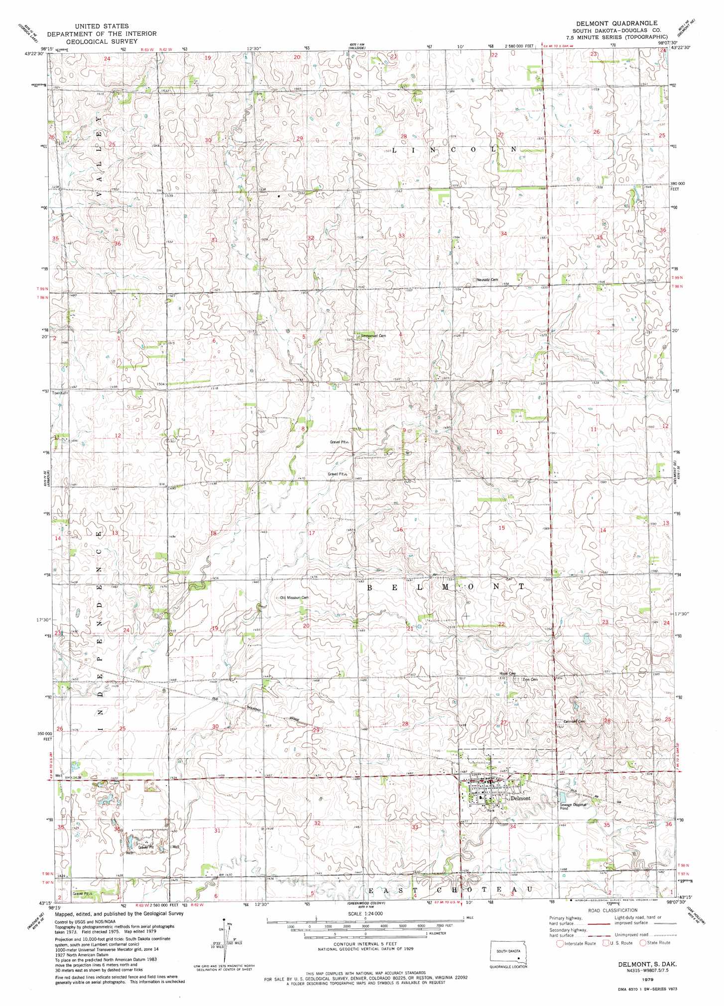
USGS Topo Quad 43098c2 - 1:24,000 scale
| Topo Map Name: | Delmont |
| USGS Topo Quad ID: | 43098c2 |
| Print Size: | ca. 21 1/4" wide x 27" high |
| Southeast Coordinates: | 43.25° N latitude / 98.125° W longitude |
| Map Center Coordinates: | 43.3125° N latitude / 98.1875° W longitude |
| U.S. State: | SD |
| Filename: | o43098c2.jpg |
| Download Map JPG Image: | Delmont topo map 1:24,000 scale |
| Map Type: | Topographic |
| Topo Series: | 7.5´ |
| Map Scale: | 1:24,000 |
| Source of Map Images: | United States Geological Survey (USGS) |
| Alternate Map Versions: |
Delmont SD 1979, updated 1980 Download PDF Buy paper map Delmont SD 2012 Download PDF Buy paper map Delmont SD 2015 Download PDF Buy paper map |
1:24,000 Topo Quads surrounding Delmont
Stickney |
Old Stickney Lake |
Mitchell Sw |
Shoemaker Dam |
Ethan |
Corsica |
Corsica Lake |
Hillside |
Delmont Ne |
Parkston |
Armour Sw |
Armour |
Delmont |
Delmont Se |
Beardsley |
Ravinia |
Wagner Ne |
Greenwood Colony |
Oak Hollow |
Tripp |
Wagner Sw |
Wagner |
Dante |
Avon |
Haucks Lake |
> Back to 43098a1 at 1:100,000 scale
> Back to 43098a1 at 1:250,000 scale
> Back to U.S. Topo Maps home
Delmont digital topo map on disk
Buy this Delmont topo map showing relief, roads, GPS coordinates and other geographical features, as a high-resolution digital map file on DVD:
Eastern North Dakota & Eastern South Dakota
Buy digital topo maps: Eastern North Dakota & Eastern South Dakota