Castalia Topo Map South Dakota
To zoom in, hover over the map of Castalia
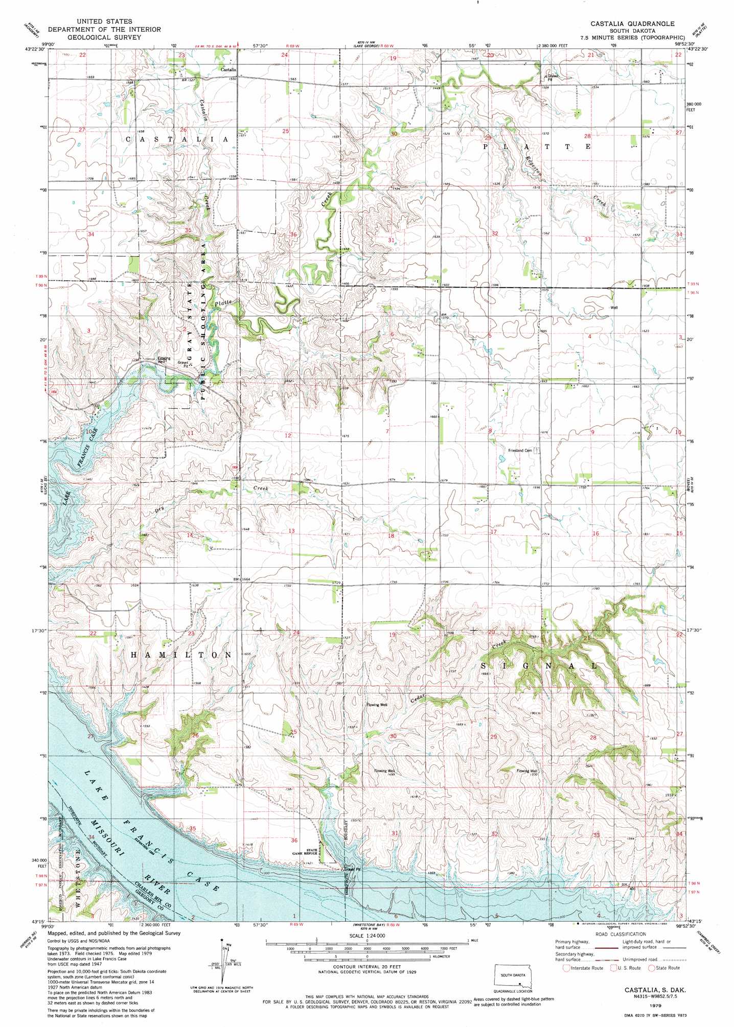
USGS Topo Quad 43098c8 - 1:24,000 scale
| Topo Map Name: | Castalia |
| USGS Topo Quad ID: | 43098c8 |
| Print Size: | ca. 21 1/4" wide x 27" high |
| Southeast Coordinates: | 43.25° N latitude / 98.875° W longitude |
| Map Center Coordinates: | 43.3125° N latitude / 98.9375° W longitude |
| U.S. State: | SD |
| Filename: | o43098c8.jpg |
| Download Map JPG Image: | Castalia topo map 1:24,000 scale |
| Map Type: | Topographic |
| Topo Series: | 7.5´ |
| Map Scale: | 1:24,000 |
| Source of Map Images: | United States Geological Survey (USGS) |
| Alternate Map Versions: |
Castalia SD 1979, updated 1980 Download PDF Buy paper map Castalia SD 2012 Download PDF Buy paper map Castalia SD 2015 Download PDF Buy paper map |
1:24,000 Topo Quads surrounding Castalia
Bijou Hills |
Eagle |
Snow Lake |
Cedar Grove Colony |
Laffey Lake |
Lucas Nw |
Academy |
Lake George |
Platte |
Joubert |
Lucas |
Lucas Se |
Castalia |
Bovee |
Geddes |
Herrick Nw |
Herrick Ne |
Whetstone Bay |
Campbell Creek |
Lake Andes Nw |
Herrick |
Saint Charles |
Bonesteel |
South Scalp Creek |
Lake Andes Sw |
> Back to 43098a1 at 1:100,000 scale
> Back to 43098a1 at 1:250,000 scale
> Back to U.S. Topo Maps home
Castalia topo map: Gazetteer
Castalia: Islands
Cottonwood Island (historical) elevation 413m 1354′Little Cedar Island (historical) elevation 413m 1354′
Castalia: Parks
Gray State Public Shooting Area elevation 451m 1479′Castalia: Streams
Castalia Creek elevation 432m 1417′Cedar Creek elevation 413m 1354′
Dry Creek elevation 413m 1354′
Edgerton Creek elevation 500m 1640′
Little Cedar Creek (historical) elevation 413m 1354′
Castalia digital topo map on disk
Buy this Castalia topo map showing relief, roads, GPS coordinates and other geographical features, as a high-resolution digital map file on DVD:
Eastern North Dakota & Eastern South Dakota
Buy digital topo maps: Eastern North Dakota & Eastern South Dakota