New Holland Topo Map South Dakota
To zoom in, hover over the map of New Holland
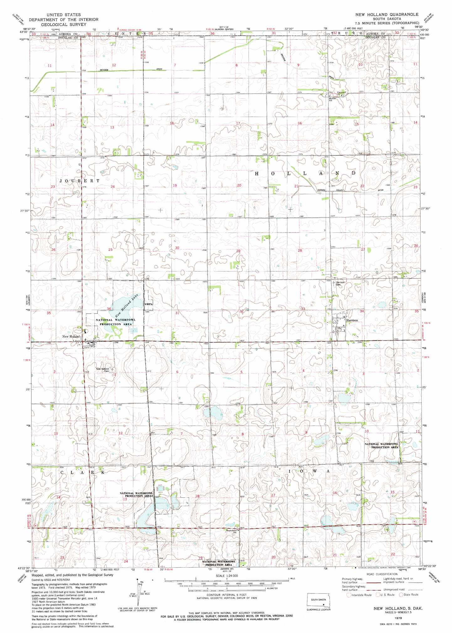
USGS Topo Quad 43098d5 - 1:24,000 scale
| Topo Map Name: | New Holland |
| USGS Topo Quad ID: | 43098d5 |
| Print Size: | ca. 21 1/4" wide x 27" high |
| Southeast Coordinates: | 43.375° N latitude / 98.5° W longitude |
| Map Center Coordinates: | 43.4375° N latitude / 98.5625° W longitude |
| U.S. State: | SD |
| Filename: | o43098d5.jpg |
| Download Map JPG Image: | New Holland topo map 1:24,000 scale |
| Map Type: | Topographic |
| Topo Series: | 7.5´ |
| Map Scale: | 1:24,000 |
| Source of Map Images: | United States Geological Survey (USGS) |
| Alternate Map Versions: |
New Holland SD 1979, updated 1980 Download PDF Buy paper map New Holland SD 2012 Download PDF Buy paper map New Holland SD 2015 Download PDF Buy paper map |
1:24,000 Topo Quads surrounding New Holland
Platte Lake |
White Lake |
Crystal Lake |
Plankinton |
Mount Vernon |
Cedar Grove Colony |
Laffey Lake |
Aurora Center |
Stickney |
Old Stickney Lake |
Platte |
Joubert |
New Holland |
Corsica |
Corsica Lake |
Bovee |
Geddes |
Geddes Se |
Armour Sw |
Armour |
Campbell Creek |
Lake Andes Nw |
Lake Andes |
Ravinia |
Wagner Ne |
> Back to 43098a1 at 1:100,000 scale
> Back to 43098a1 at 1:250,000 scale
> Back to U.S. Topo Maps home
New Holland topo map: Gazetteer
New Holland: Canals
Garden Valley Ditch elevation 480m 1574′Meadow Drain elevation 475m 1558′
New Holland: Lakes
New Holland Lake elevation 483m 1584′New Holland: Populated Places
Harrison elevation 488m 1601′New Holland elevation 488m 1601′
New Holland digital topo map on disk
Buy this New Holland topo map showing relief, roads, GPS coordinates and other geographical features, as a high-resolution digital map file on DVD:
Eastern North Dakota & Eastern South Dakota
Buy digital topo maps: Eastern North Dakota & Eastern South Dakota