Mitchell Topo Map South Dakota
To zoom in, hover over the map of Mitchell
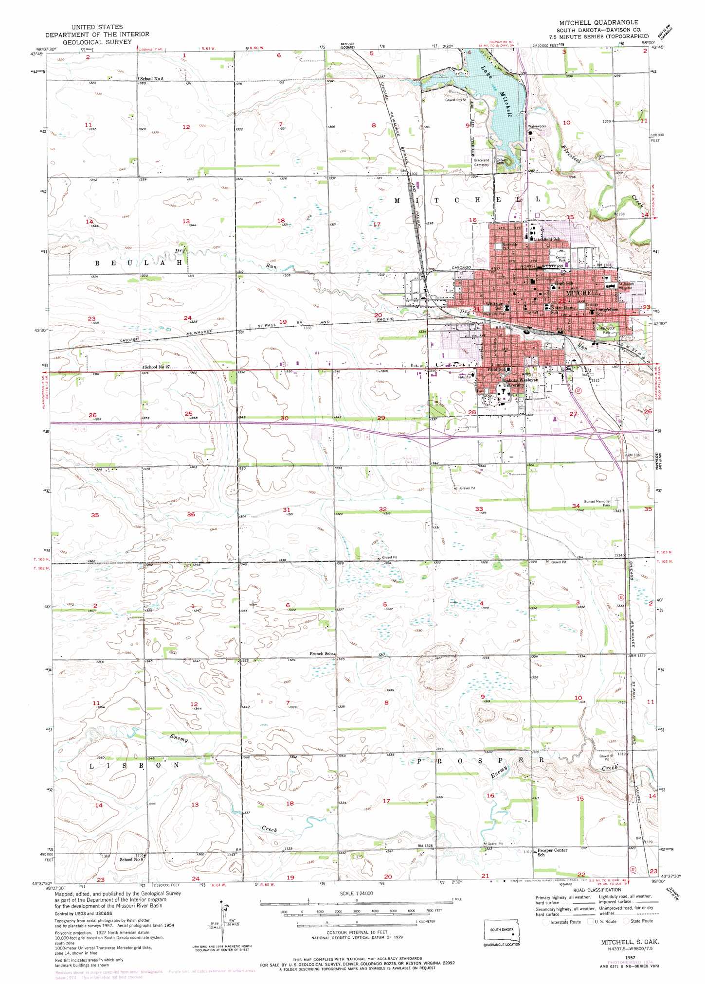
USGS Topo Quad 43098f1 - 1:24,000 scale
| Topo Map Name: | Mitchell |
| USGS Topo Quad ID: | 43098f1 |
| Print Size: | ca. 21 1/4" wide x 27" high |
| Southeast Coordinates: | 43.625° N latitude / 98° W longitude |
| Map Center Coordinates: | 43.6875° N latitude / 98.0625° W longitude |
| U.S. State: | SD |
| Filename: | o43098f1.jpg |
| Download Map JPG Image: | Mitchell topo map 1:24,000 scale |
| Map Type: | Topographic |
| Topo Series: | 7.5´ |
| Map Scale: | 1:24,000 |
| Source of Map Images: | United States Geological Survey (USGS) |
| Alternate Map Versions: |
Mitchell SD 1957, updated 1959 Download PDF Buy paper map Mitchell SD 1957, updated 1977 Download PDF Buy paper map Mitchell SD 2012 Download PDF Buy paper map Mitchell SD 2015 Download PDF Buy paper map |
1:24,000 Topo Quads surrounding Mitchell
Twin Lakes |
Letcher |
Letcher Ne |
Farwell Nw |
Morris Lake |
Storla |
Letcher Sw |
Loomis |
Farwell |
Ness Chain Lakes |
Mount Vernon |
Betts |
Mitchell |
Riverside |
Alexandria |
Old Stickney Lake |
Mitchell Sw |
Shoemaker Dam |
Ethan |
Rockport Colony |
Corsica Lake |
Hillside |
Delmont Ne |
Parkston |
Milltown |
> Back to 43098e1 at 1:100,000 scale
> Back to 43098a1 at 1:250,000 scale
> Back to U.S. Topo Maps home
Mitchell topo map: Gazetteer
Mitchell: Airports
Telstar Landing Field elevation 399m 1309′Mitchell: Dams
Mitchell Dam elevation 385m 1263′Mitchell: Parks
Eastside Park elevation 399m 1309′Hitchcock Park elevation 397m 1302′
Ketnel Park elevation 404m 1325′
Northside Park elevation 400m 1312′
Westside Park elevation 400m 1312′
Mitchell: Populated Places
Kargas Subdivision elevation 409m 1341′Mitchell elevation 400m 1312′
River Bluff Addition elevation 402m 1318′
Sand Hill Subdivision elevation 411m 1348′
Mitchell: Reservoirs
Lake Mitchell elevation 385m 1263′Mitchell digital topo map on disk
Buy this Mitchell topo map showing relief, roads, GPS coordinates and other geographical features, as a high-resolution digital map file on DVD:
Eastern North Dakota & Eastern South Dakota
Buy digital topo maps: Eastern North Dakota & Eastern South Dakota