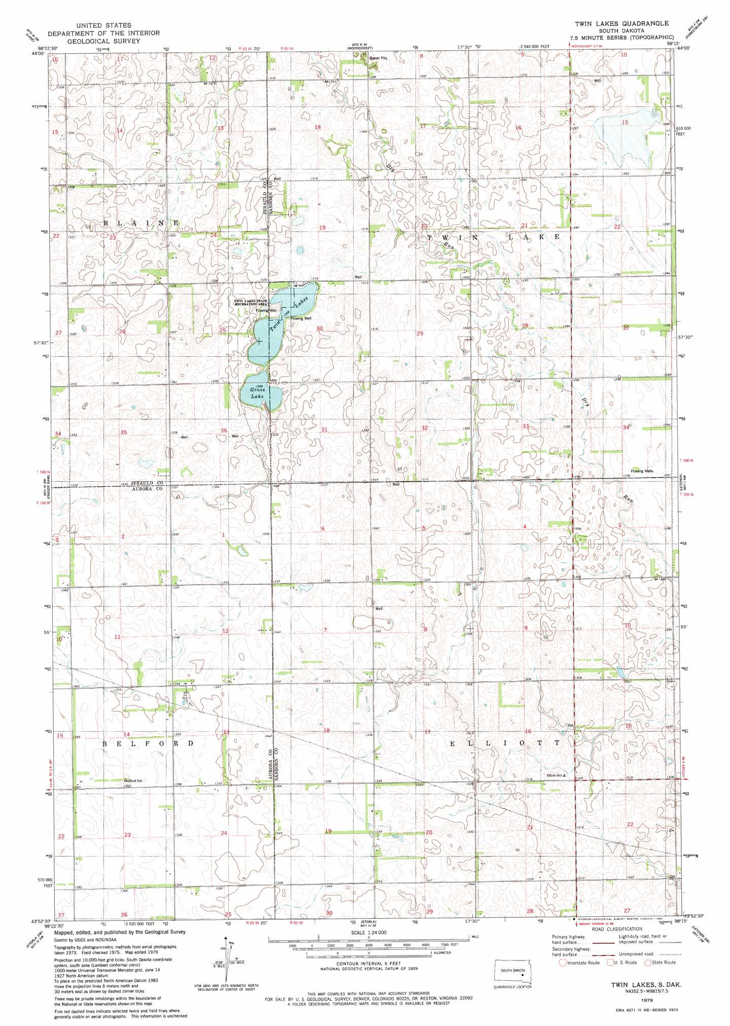
Twin Lakes Topo Map South Dakota
To zoom in, hover over the map of Twin Lakes
USGS Topo Quad 43098h3 - 1:24,000 scale
| Topo Map Name: | Twin Lakes |
| USGS Topo Quad ID: | 43098h3 |
| Print Size: | ca. 21 1/4" wide x 27" high |
| Southeast Coordinates: | 43.875° N latitude / 98.25° W longitude |
| Map Center Coordinates: | 43.9375° N latitude / 98.3125° W longitude |
| U.S. State: | SD |
| Filename: | o43098h3.jpg |
| Download Map JPG Image: | Twin Lakes topo map 1:24,000 scale |
| Map Type: | Topographic |
| Topo Series: | 7.5´ |
| Map Scale: | 1:24,000 |
| Source of Map Images: | United States Geological Survey (USGS) |
| Alternate Map Versions: |
Twin Lakes SD 1979, updated 1980 Download PDF Buy paper map Twin Lakes SD 2012 Download PDF Buy paper map Twin Lakes SD 2015 Download PDF Buy paper map |
1:24,000 Topo Quads surrounding Twin Lakes
Wessington Springs Ne |
Woonsocket Nw |
Alpena |
Forestburg Nw |
Forestburg Ne |
Wessington Springs |
Lane |
Woonsocket |
Forestburg Sw |
Forestburg |
Hoagland Lake |
Fraser Dam |
Twin Lakes |
Letcher |
Letcher Ne |
Wilmarth Lake |
Storla Sw |
Storla |
Letcher Sw |
Loomis |
Crystal Lake |
Plankinton |
Mount Vernon |
Betts |
Mitchell |
> Back to 43098e1 at 1:100,000 scale
> Back to 43098a1 at 1:250,000 scale
> Back to U.S. Topo Maps home
Twin Lakes topo map: Gazetteer
Twin Lakes: Lakes
Grass Lake elevation 398m 1305′Twin Lakes elevation 398m 1305′
Twin Lakes: Parks
Twin Lakes State Recreation Area elevation 398m 1305′Twin Lakes digital topo map on disk
Buy this Twin Lakes topo map showing relief, roads, GPS coordinates and other geographical features, as a high-resolution digital map file on DVD:
Eastern North Dakota & Eastern South Dakota
Buy digital topo maps: Eastern North Dakota & Eastern South Dakota