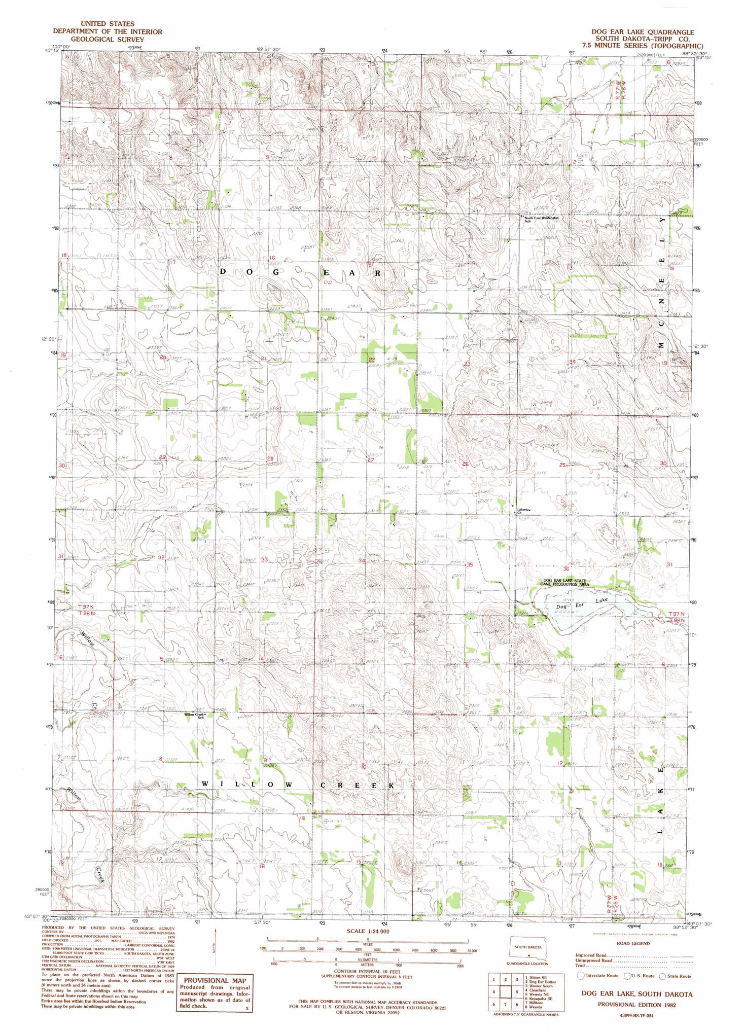
Dog Ear Lake Topo Map South Dakota
To zoom in, hover over the map of Dog Ear Lake
USGS Topo Quad 43099b8 - 1:24,000 scale
| Topo Map Name: | Dog Ear Lake |
| USGS Topo Quad ID: | 43099b8 |
| Print Size: | ca. 21 1/4" wide x 27" high |
| Southeast Coordinates: | 43.125° N latitude / 99.875° W longitude |
| Map Center Coordinates: | 43.1875° N latitude / 99.9375° W longitude |
| U.S. State: | SD |
| Filename: | o43099b8.jpg |
| Download Map JPG Image: | Dog Ear Lake topo map 1:24,000 scale |
| Map Type: | Topographic |
| Topo Series: | 7.5´ |
| Map Scale: | 1:24,000 |
| Source of Map Images: | United States Geological Survey (USGS) |
| Alternate Map Versions: |
Dog Ear Lake SD 1982, updated 1983 Download PDF Buy paper map Dog Ear Lake SD 2012 Download PDF Buy paper map Dog Ear Lake SD 2015 Download PDF Buy paper map |
1:24,000 Topo Quads surrounding Dog Ear Lake
Carter |
Witten |
Miller Hill |
Winner North |
Rattlesnake Butte West |
Witten Sw |
Witten Se |
Dog Ear Buttes |
Winner South |
Colome |
Keyapaha Nw |
Clearfield |
Dog Ear Lake |
Wewela Ne |
Dallas Nw |
Keyapaha |
Keyapaha Se |
Millboro |
Wewela |
Dallas Sw |
Norden Nw |
Haford Lake |
Meadville Nw |
Meadville Ne |
Springview Nw |
> Back to 43099a1 at 1:100,000 scale
> Back to 43098a1 at 1:250,000 scale
> Back to U.S. Topo Maps home
Dog Ear Lake topo map: Gazetteer
Dog Ear Lake: Lakes
Dog Ear Lake elevation 702m 2303′Dog Ear Lake: Parks
Dog Ear Lake State Production Area elevation 702m 2303′Dog Ear Lake digital topo map on disk
Buy this Dog Ear Lake topo map showing relief, roads, GPS coordinates and other geographical features, as a high-resolution digital map file on DVD:
Eastern North Dakota & Eastern South Dakota
Buy digital topo maps: Eastern North Dakota & Eastern South Dakota