Colome Topo Map South Dakota
To zoom in, hover over the map of Colome
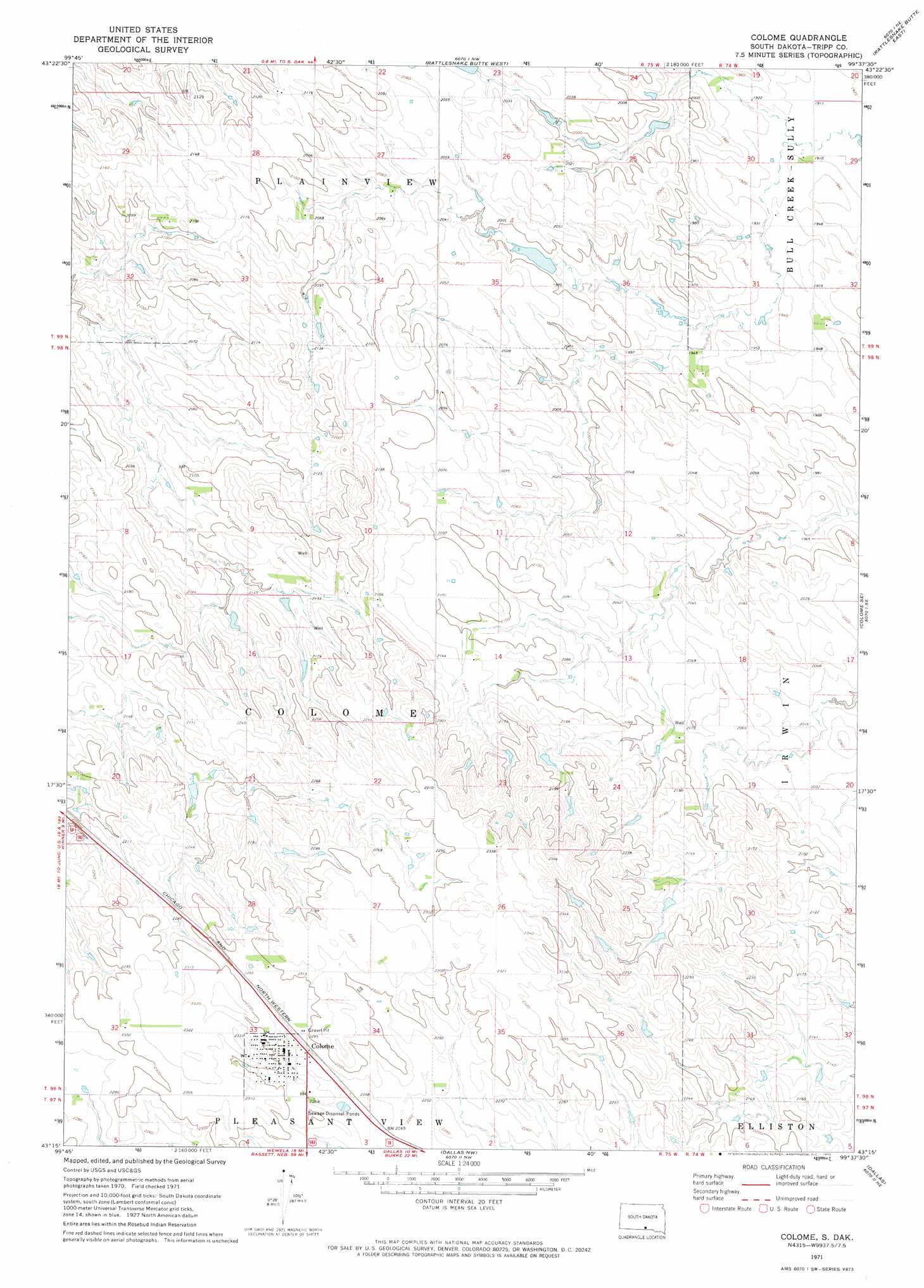
USGS Topo Quad 43099c6 - 1:24,000 scale
| Topo Map Name: | Colome |
| USGS Topo Quad ID: | 43099c6 |
| Print Size: | ca. 21 1/4" wide x 27" high |
| Southeast Coordinates: | 43.25° N latitude / 99.625° W longitude |
| Map Center Coordinates: | 43.3125° N latitude / 99.6875° W longitude |
| U.S. State: | SD |
| Filename: | o43099c6.jpg |
| Download Map JPG Image: | Colome topo map 1:24,000 scale |
| Map Type: | Topographic |
| Topo Series: | 7.5´ |
| Map Scale: | 1:24,000 |
| Source of Map Images: | United States Geological Survey (USGS) |
| Alternate Map Versions: |
Colome SD 1971, updated 1974 Download PDF Buy paper map Colome SD 2012 Download PDF Buy paper map Colome SD 2015 Download PDF Buy paper map |
1:24,000 Topo Quads surrounding Colome
Ideal |
King Dam |
Hamill |
Hamill Se |
Iona |
Miller Hill |
Winner North |
Rattlesnake Butte West |
Rattlesnake Butte East |
Dixon |
Dog Ear Buttes |
Winner South |
Colome |
Colome Se |
Dixon Sw |
Dog Ear Lake |
Wewela Ne |
Dallas Nw |
Dallas |
Gregory |
Millboro |
Wewela |
Dallas Sw |
Paxton |
Carlock |
> Back to 43099a1 at 1:100,000 scale
> Back to 43098a1 at 1:250,000 scale
> Back to U.S. Topo Maps home
Colome digital topo map on disk
Buy this Colome topo map showing relief, roads, GPS coordinates and other geographical features, as a high-resolution digital map file on DVD:
Eastern North Dakota & Eastern South Dakota
Buy digital topo maps: Eastern North Dakota & Eastern South Dakota