Dixon Ne Topo Map South Dakota
To zoom in, hover over the map of Dixon Ne
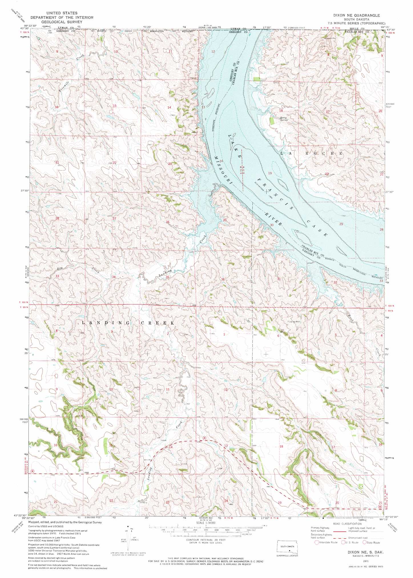
USGS Topo Quad 43099d3 - 1:24,000 scale
| Topo Map Name: | Dixon Ne |
| USGS Topo Quad ID: | 43099d3 |
| Print Size: | ca. 21 1/4" wide x 27" high |
| Southeast Coordinates: | 43.375° N latitude / 99.25° W longitude |
| Map Center Coordinates: | 43.4375° N latitude / 99.3125° W longitude |
| U.S. State: | SD |
| Filename: | o43099d3.jpg |
| Download Map JPG Image: | Dixon Ne topo map 1:24,000 scale |
| Map Type: | Topographic |
| Topo Series: | 7.5´ |
| Map Scale: | 1:24,000 |
| Source of Map Images: | United States Geological Survey (USGS) |
| Alternate Map Versions: |
Dixon NE SD 1971, updated 1974 Download PDF Buy paper map Dixon NE SD 2012 Download PDF Buy paper map Dixon NE SD 2015 Download PDF Buy paper map |
1:24,000 Topo Quads surrounding Dixon Ne
Hamill Ne |
Iona Nw |
Red Lake West |
Red Lake East |
Bijou Hills Ne |
Hamill Se |
Iona |
Bond Bottom |
Bijou Hills |
Eagle |
Rattlesnake Butte East |
Dixon |
Dixon Ne |
Lucas Nw |
Academy |
Colome Se |
Dixon Sw |
Dixon Se |
Lucas |
Lucas Se |
Dallas |
Gregory |
Burke |
Herrick Nw |
Herrick Ne |
> Back to 43099a1 at 1:100,000 scale
> Back to 43098a1 at 1:250,000 scale
> Back to U.S. Topo Maps home
Dixon Ne topo map: Gazetteer
Dixon Ne: Islands
Durex Island (historical) elevation 413m 1354′Dixon Ne: Springs
Berry Spring elevation 437m 1433′Dixon Ne: Streams
Dry Creek elevation 428m 1404′Landing Creek elevation 413m 1354′
Rush Creek elevation 413m 1354′
Dixon Ne digital topo map on disk
Buy this Dixon Ne topo map showing relief, roads, GPS coordinates and other geographical features, as a high-resolution digital map file on DVD:
Eastern North Dakota & Eastern South Dakota
Buy digital topo maps: Eastern North Dakota & Eastern South Dakota