Red Lake East Topo Map South Dakota
To zoom in, hover over the map of Red Lake East
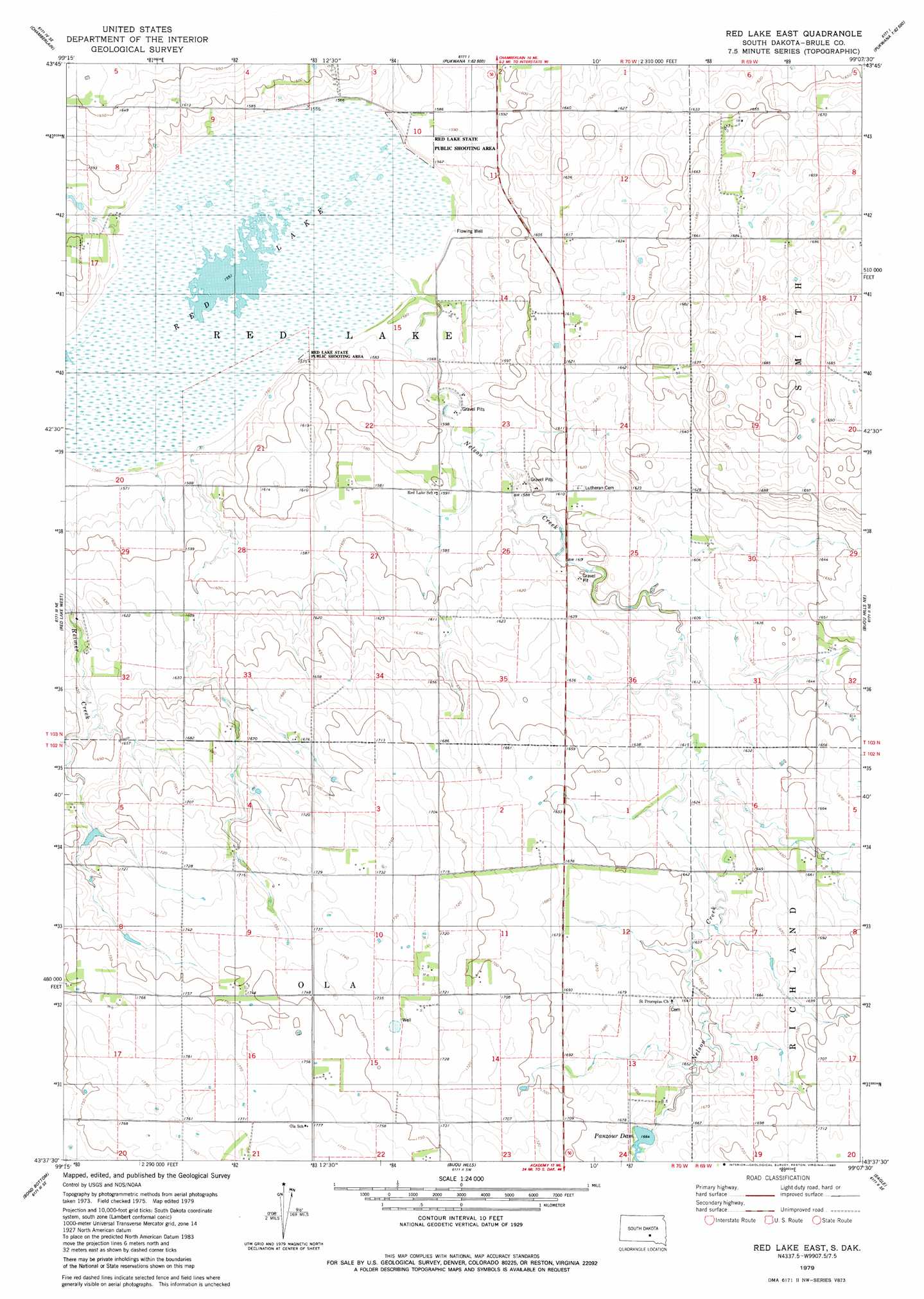
USGS Topo Quad 43099f2 - 1:24,000 scale
| Topo Map Name: | Red Lake East |
| USGS Topo Quad ID: | 43099f2 |
| Print Size: | ca. 21 1/4" wide x 27" high |
| Southeast Coordinates: | 43.625° N latitude / 99.125° W longitude |
| Map Center Coordinates: | 43.6875° N latitude / 99.1875° W longitude |
| U.S. State: | SD |
| Filename: | o43099f2.jpg |
| Download Map JPG Image: | Red Lake East topo map 1:24,000 scale |
| Map Type: | Topographic |
| Topo Series: | 7.5´ |
| Map Scale: | 1:24,000 |
| Source of Map Images: | United States Geological Survey (USGS) |
| Alternate Map Versions: |
Red Lake East SD 1979, updated 1980 Download PDF Buy paper map Red Lake East SD 2012 Download PDF Buy paper map Red Lake East SD 2015 Download PDF Buy paper map |
1:24,000 Topo Quads surrounding Red Lake East
Short Creek |
Bedashosha Lake |
Shelby |
Pukwana Ne |
|
Oacoma |
Chamberlain |
Pukwana |
Pukwana Se |
|
Iona Nw |
Red Lake West |
Red Lake East |
Bijou Hills Ne |
Kimball South |
Iona |
Bond Bottom |
Bijou Hills |
Eagle |
Snow Lake |
Dixon |
Dixon Ne |
Lucas Nw |
Academy |
Lake George |
> Back to 43099e1 at 1:100,000 scale
> Back to 43098a1 at 1:250,000 scale
> Back to U.S. Topo Maps home
Red Lake East topo map: Gazetteer
Red Lake East: Dams
Panzour Lake Dam elevation 509m 1669′Red Lake East: Lakes
Red Lake elevation 473m 1551′Red Lake East: Parks
Red Lake State Public Shooting Area elevation 483m 1584′Red Lake East: Reservoirs
Panzour Dam elevation 509m 1669′Red Lake East: Streams
Nelson Creek elevation 475m 1558′Red Lake East digital topo map on disk
Buy this Red Lake East topo map showing relief, roads, GPS coordinates and other geographical features, as a high-resolution digital map file on DVD:
Eastern North Dakota & Eastern South Dakota
Buy digital topo maps: Eastern North Dakota & Eastern South Dakota