Pukwana Topo Map South Dakota
To zoom in, hover over the map of Pukwana
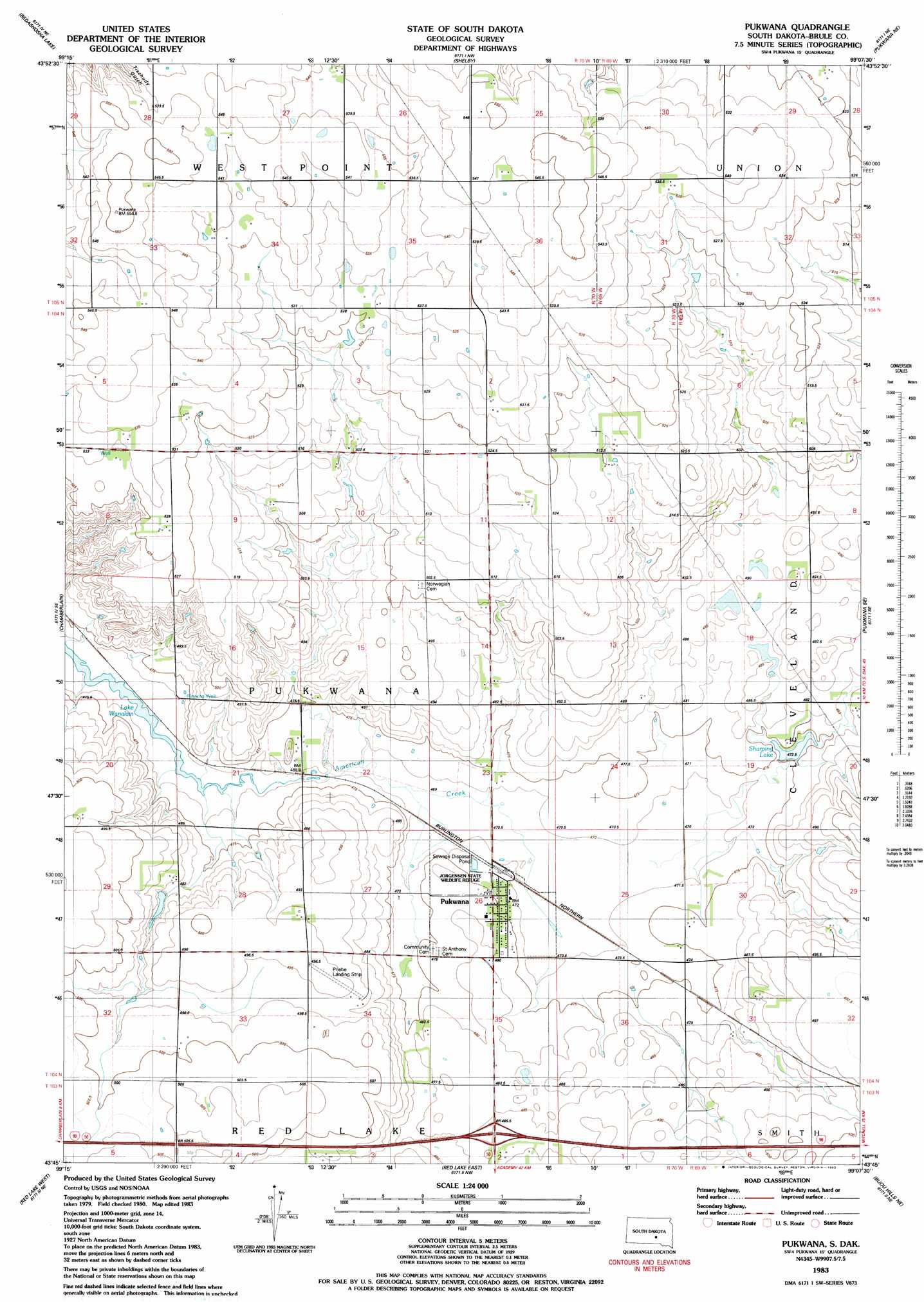
USGS Topo Quad 43099g2 - 1:24,000 scale
| Topo Map Name: | Pukwana |
| USGS Topo Quad ID: | 43099g2 |
| Print Size: | ca. 21 1/4" wide x 27" high |
| Southeast Coordinates: | 43.75° N latitude / 99.125° W longitude |
| Map Center Coordinates: | 43.8125° N latitude / 99.1875° W longitude |
| U.S. State: | SD |
| Filename: | o43099g2.jpg |
| Download Map JPG Image: | Pukwana topo map 1:24,000 scale |
| Map Type: | Topographic |
| Topo Series: | 7.5´ |
| Map Scale: | 1:24,000 |
| Source of Map Images: | United States Geological Survey (USGS) |
| Alternate Map Versions: |
Pukwana SD 1983, updated 1983 Download PDF Buy paper map Pukwana SD 2012 Download PDF Buy paper map Pukwana SD 2015 Download PDF Buy paper map |
1:24,000 Topo Quads surrounding Pukwana
Big Bend Dam |
Big Bend Dam Se |
Big Bend Dam 4 Sw |
Big Bend Dam 4 Se |
Gannvalley |
Short Creek |
Bedashosha Lake |
Shelby |
Pukwana Ne |
|
Oacoma |
Chamberlain |
Pukwana |
Pukwana Se |
|
Iona Nw |
Red Lake West |
Red Lake East |
Bijou Hills Ne |
Kimball South |
Iona |
Bond Bottom |
Bijou Hills |
Eagle |
Snow Lake |
> Back to 43099e1 at 1:100,000 scale
> Back to 43098a1 at 1:250,000 scale
> Back to U.S. Topo Maps home
Pukwana topo map: Gazetteer
Pukwana: Airports
Priebe Landing Strip elevation 495m 1624′Pukwana: Dams
Busack Dam elevation 511m 1676′Healy Dam elevation 489m 1604′
Sharpings Lake Dam elevation 473m 1551′
Pukwana: Lakes
Sharping Lake elevation 473m 1551′Pukwana: Parks
Jorgensen State Wildlife Refuge elevation 477m 1564′Pukwana: Populated Places
Pukwana elevation 475m 1558′Pukwana digital topo map on disk
Buy this Pukwana topo map showing relief, roads, GPS coordinates and other geographical features, as a high-resolution digital map file on DVD:
Eastern North Dakota & Eastern South Dakota
Buy digital topo maps: Eastern North Dakota & Eastern South Dakota