Saint Francis Topo Map South Dakota
To zoom in, hover over the map of Saint Francis
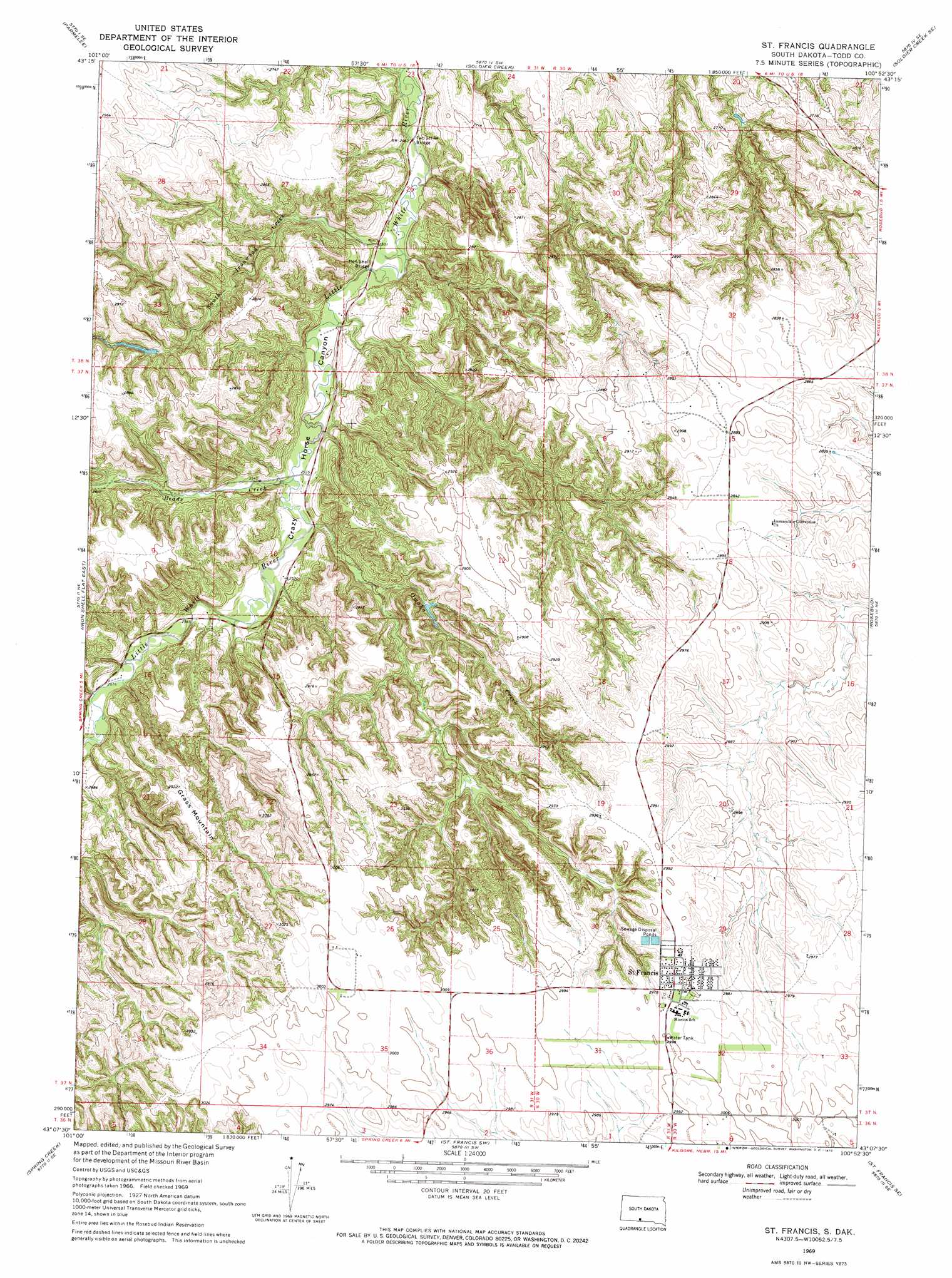
USGS Topo Quad 43100b8 - 1:24,000 scale
| Topo Map Name: | Saint Francis |
| USGS Topo Quad ID: | 43100b8 |
| Print Size: | ca. 21 1/4" wide x 27" high |
| Southeast Coordinates: | 43.125° N latitude / 100.875° W longitude |
| Map Center Coordinates: | 43.1875° N latitude / 100.9375° W longitude |
| U.S. State: | SD |
| Filename: | o43100b8.jpg |
| Download Map JPG Image: | Saint Francis topo map 1:24,000 scale |
| Map Type: | Topographic |
| Topo Series: | 7.5´ |
| Map Scale: | 1:24,000 |
| Source of Map Images: | United States Geological Survey (USGS) |
| Alternate Map Versions: |
St. Francis SD 1969, updated 1972 Download PDF Buy paper map Saint Francis SD 2012 Download PDF Buy paper map Saint Francis SD 2015 Download PDF Buy paper map |
1:24,000 Topo Quads surrounding Saint Francis
Norris |
Parmelee Ne |
Soldier Creek Nw |
Soldier Creek Ne |
Mission Nw |
Eagle Mans Butte |
Parmelee |
Soldier Creek |
Soldier Creek Se |
Mission |
Iron Shell Flat West |
Iron Shell Flat East |
Saint Francis |
Rosebud |
Olsonville Nw |
Spring Creek Sw |
Spring Creek |
Saint Francis Sw |
Saint Francis Se |
Olsonville Sw |
Cody East |
Nenzel |
Kilgore |
Crookston West |
Crookston East |
> Back to 43100a1 at 1:100,000 scale
> Back to 43100a1 at 1:250,000 scale
> Back to U.S. Topo Maps home
Saint Francis topo map: Gazetteer
Saint Francis: Bridges
Iron Shell Bridge elevation 756m 2480′Two Strike Bridge elevation 751m 2463′
Saint Francis: Populated Places
Saint Francis elevation 911m 2988′Two Strike elevation 850m 2788′
Saint Francis: Streams
Beads Creek elevation 767m 2516′Omaha Creek elevation 769m 2522′
South Ironwood Creek elevation 758m 2486′
Saint Francis: Summits
Grass Mountain elevation 890m 2919′Saint Francis digital topo map on disk
Buy this Saint Francis topo map showing relief, roads, GPS coordinates and other geographical features, as a high-resolution digital map file on DVD:
Eastern North Dakota & Eastern South Dakota
Buy digital topo maps: Eastern North Dakota & Eastern South Dakota