Mission Ne Topo Map South Dakota
To zoom in, hover over the map of Mission Ne
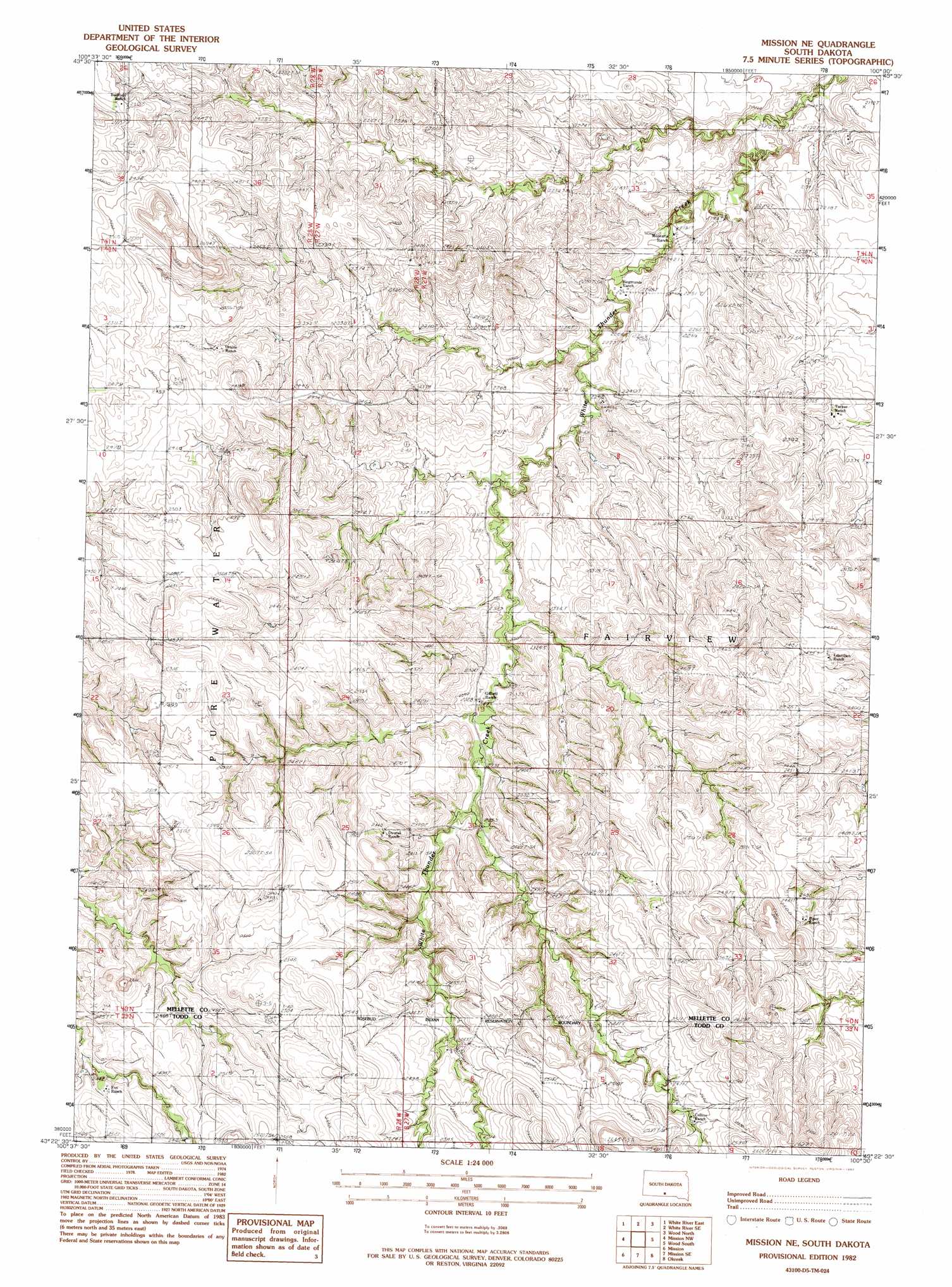
USGS Topo Quad 43100d5 - 1:24,000 scale
| Topo Map Name: | Mission Ne |
| USGS Topo Quad ID: | 43100d5 |
| Print Size: | ca. 21 1/4" wide x 27" high |
| Southeast Coordinates: | 43.375° N latitude / 100.5° W longitude |
| Map Center Coordinates: | 43.4375° N latitude / 100.5625° W longitude |
| U.S. State: | SD |
| Filename: | o43100d5.jpg |
| Download Map JPG Image: | Mission Ne topo map 1:24,000 scale |
| Map Type: | Topographic |
| Topo Series: | 7.5´ |
| Map Scale: | 1:24,000 |
| Source of Map Images: | United States Geological Survey (USGS) |
| Alternate Map Versions: |
Mission NE SD 1982, updated 1982 Download PDF Buy paper map Mission NE SD 2012 Download PDF Buy paper map Mission NE SD 2015 Download PDF Buy paper map |
1:24,000 Topo Quads surrounding Mission Ne
Murdo 3 Ne |
Westover |
White River Ne |
Badnation Nw |
Badnation |
White River West |
White River East |
White River Se |
Wood North |
Badnation Se |
Soldier Creek Ne |
Mission Nw |
Mission Ne |
Wood South |
Mosher |
Soldier Creek Se |
Mission |
Mission Se |
Okreek |
Okreek Se |
Rosebud |
Olsonville Nw |
Olsonville |
Hidden Timber |
Hidden Timber Ne |
> Back to 43100a1 at 1:100,000 scale
> Back to 43100a1 at 1:250,000 scale
> Back to U.S. Topo Maps home
Mission Ne digital topo map on disk
Buy this Mission Ne topo map showing relief, roads, GPS coordinates and other geographical features, as a high-resolution digital map file on DVD:
Eastern North Dakota & Eastern South Dakota
Buy digital topo maps: Eastern North Dakota & Eastern South Dakota