Mission Nw Topo Map South Dakota
To zoom in, hover over the map of Mission Nw
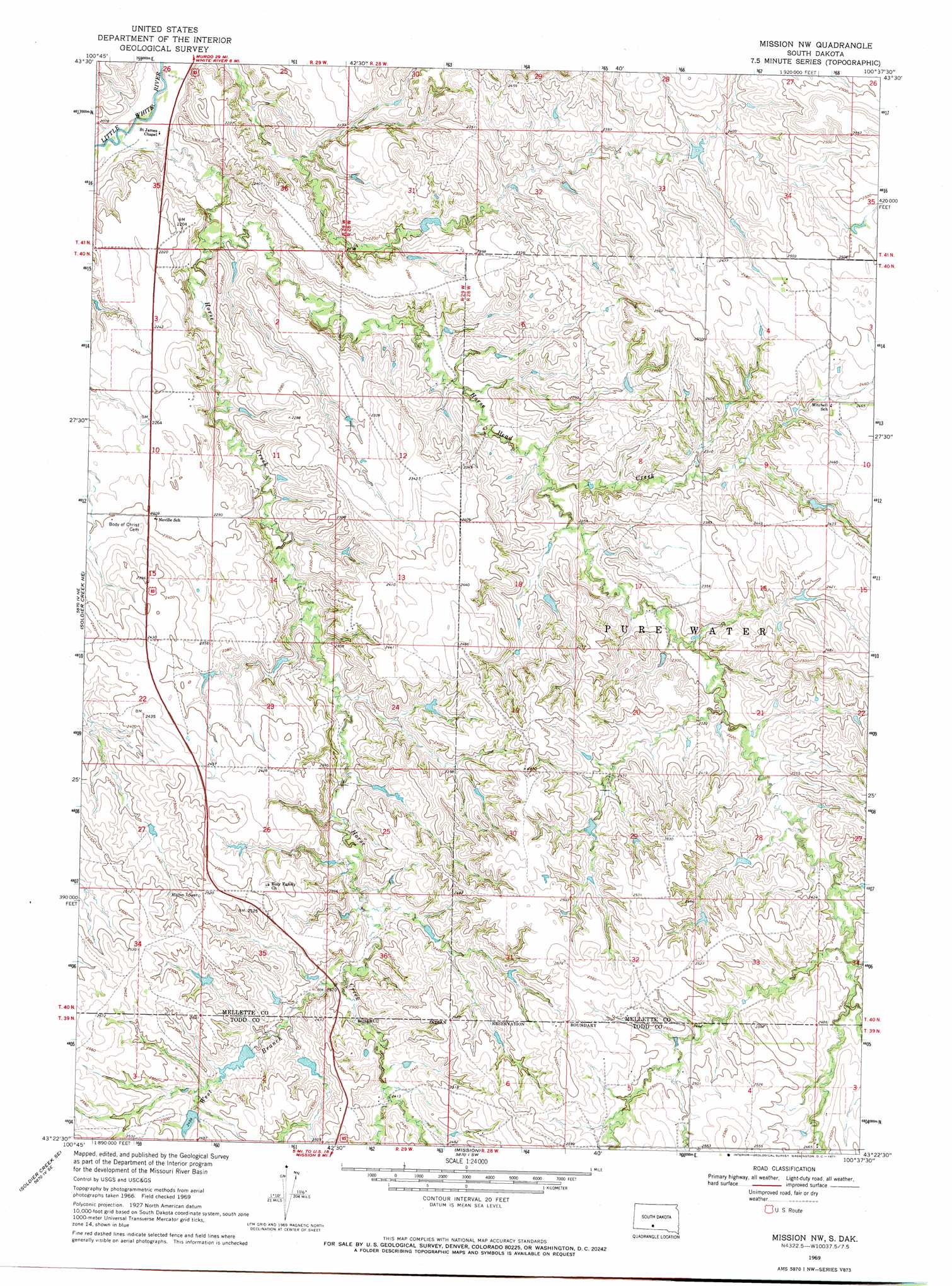
USGS Topo Quad 43100d6 - 1:24,000 scale
| Topo Map Name: | Mission Nw |
| USGS Topo Quad ID: | 43100d6 |
| Print Size: | ca. 21 1/4" wide x 27" high |
| Southeast Coordinates: | 43.375° N latitude / 100.625° W longitude |
| Map Center Coordinates: | 43.4375° N latitude / 100.6875° W longitude |
| U.S. State: | SD |
| Filename: | o43100d6.jpg |
| Download Map JPG Image: | Mission Nw topo map 1:24,000 scale |
| Map Type: | Topographic |
| Topo Series: | 7.5´ |
| Map Scale: | 1:24,000 |
| Source of Map Images: | United States Geological Survey (USGS) |
| Alternate Map Versions: |
Mission NW SD 1969, updated 1971 Download PDF Buy paper map Mission NW SD 2012 Download PDF Buy paper map Mission NW SD 2015 Download PDF Buy paper map |
1:24,000 Topo Quads surrounding Mission Nw
Murdo 3 Nw |
Murdo 3 Ne |
Westover |
White River Ne |
Badnation Nw |
Murdo 3 Sw |
White River West |
White River East |
White River Se |
Wood North |
Soldier Creek Nw |
Soldier Creek Ne |
Mission Nw |
Mission Ne |
Wood South |
Soldier Creek |
Soldier Creek Se |
Mission |
Mission Se |
Okreek |
Saint Francis |
Rosebud |
Olsonville Nw |
Olsonville |
Hidden Timber |
> Back to 43100a1 at 1:100,000 scale
> Back to 43100a1 at 1:250,000 scale
> Back to U.S. Topo Maps home
Mission Nw topo map: Gazetteer
Mission Nw: Dams
Astleford Number 3 Dam elevation 757m 2483′Dolezal John Number 7 Dam elevation 687m 2253′
Jones Eugene Number 1 Dam elevation 676m 2217′
Kolezal John Number 8 Dam elevation 680m 2230′
Krogman Louie Number 3 Dam elevation 721m 2365′
Krogman Number 5 Dam elevation 763m 2503′
Rohloff Number 1 Dam elevation 719m 2358′
Schmidt Road Number 1 Dam elevation 678m 2224′
Mission Nw: Streams
Horse Creek elevation 623m 2043′Horse Head Creek elevation 638m 2093′
West Branch Horse Creek elevation 719m 2358′
Mission Nw digital topo map on disk
Buy this Mission Nw topo map showing relief, roads, GPS coordinates and other geographical features, as a high-resolution digital map file on DVD:
Eastern North Dakota & Eastern South Dakota
Buy digital topo maps: Eastern North Dakota & Eastern South Dakota