Badnation Se Topo Map South Dakota
To zoom in, hover over the map of Badnation Se
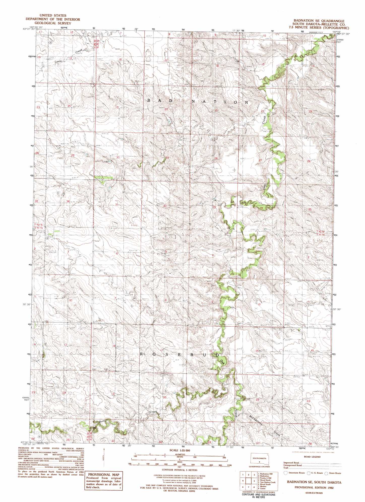
USGS Topo Quad 43100e3 - 1:25,000 scale
| Topo Map Name: | Badnation Se |
| USGS Topo Quad ID: | 43100e3 |
| Print Size: | ca. 21 1/4" wide x 27" high |
| Southeast Coordinates: | 43.5° N latitude / 100.25° W longitude |
| Map Center Coordinates: | 43.5625° N latitude / 100.3125° W longitude |
| U.S. State: | SD |
| Filename: | l43100e3.jpg |
| Download Map JPG Image: | Badnation Se topo map 1:25,000 scale |
| Map Type: | Topographic |
| Topo Series: | 7.5´ |
| Map Scale: | 1:25,000 |
| Source of Map Images: | United States Geological Survey (USGS) |
| Alternate Map Versions: |
Badnation SE SD 1982, updated 1982 Download PDF Buy paper map |
1:24,000 Topo Quads surrounding Badnation Se
Murdo Se |
Vivian Sw |
Vivian Se |
Presho Sw |
Presho Se |
White River Ne |
Badnation Nw |
Badnation |
Presho 4 Nw |
Presho 4 Ne |
White River Se |
Wood North |
Badnation Se |
Two Nation Creek |
Presho 4 Se |
Mission Ne |
Wood South |
Mosher |
Carter |
Witten |
Mission Se |
Okreek |
Okreek Se |
Witten Sw |
Witten Se |
> Back to 43100e1 at 1:100,000 scale
> Back to 43100a1 at 1:250,000 scale
> Back to U.S. Topo Maps home
Badnation Se topo map: Gazetteer
Badnation Se: Dams
Anderson Number 1 Dam elevation 574m 1883′Anderson Number 2 Dam elevation 555m 1820′
Eckland A W Number 1 Dam elevation 608m 1994′
Eklund Number 4 Dam elevation 616m 2020′
Eklund Number 5 Dam elevation 619m 2030′
Nelson Number 1 Dam elevation 574m 1883′
Badnation Se: Streams
McChesneys Creek elevation 580m 1902′Badnation Se digital topo map on disk
Buy this Badnation Se topo map showing relief, roads, GPS coordinates and other geographical features, as a high-resolution digital map file on DVD:
Eastern North Dakota & Eastern South Dakota
Buy digital topo maps: Eastern North Dakota & Eastern South Dakota