White River East Topo Map South Dakota
To zoom in, hover over the map of White River East
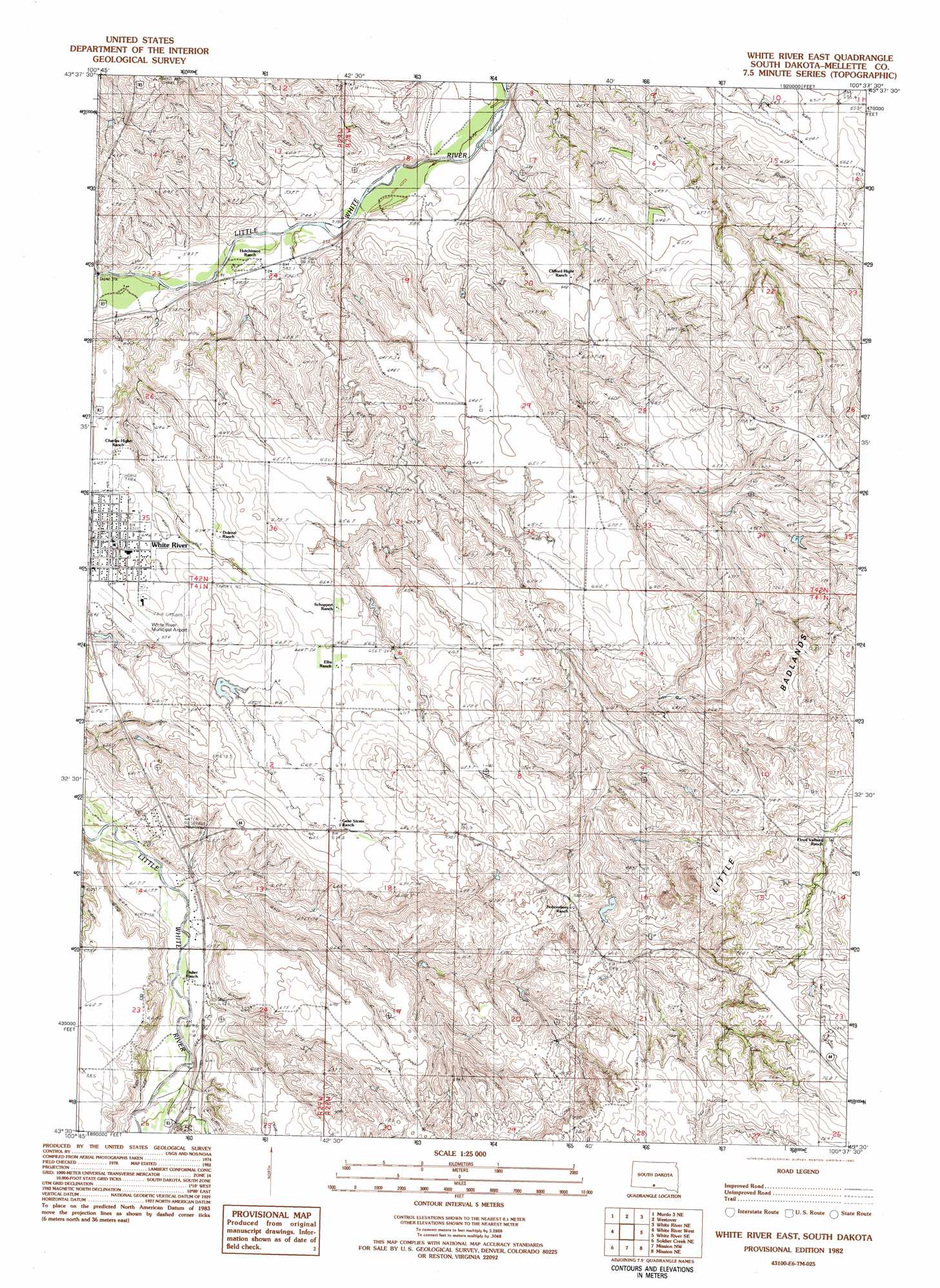
USGS Topo Quad 43100e6 - 1:25,000 scale
| Topo Map Name: | White River East |
| USGS Topo Quad ID: | 43100e6 |
| Print Size: | ca. 21 1/4" wide x 27" high |
| Southeast Coordinates: | 43.5° N latitude / 100.625° W longitude |
| Map Center Coordinates: | 43.5625° N latitude / 100.6875° W longitude |
| U.S. State: | SD |
| Filename: | l43100e6.jpg |
| Download Map JPG Image: | White River East topo map 1:25,000 scale |
| Map Type: | Topographic |
| Topo Series: | 7.5´ |
| Map Scale: | 1:25,000 |
| Source of Map Images: | United States Geological Survey (USGS) |
| Alternate Map Versions: |
1:24,000 Topo Quads surrounding White River East
Okaton Sw |
Okaton Se |
Murdo Sw |
Murdo Se |
Vivian Sw |
Murdo 3 Nw |
Murdo 3 Ne |
Westover |
White River Ne |
Badnation Nw |
Murdo 3 Sw |
White River West |
White River East |
White River Se |
Wood North |
Soldier Creek Nw |
Soldier Creek Ne |
Mission Nw |
Mission Ne |
Wood South |
Soldier Creek |
Soldier Creek Se |
Mission |
Mission Se |
Okreek |
> Back to 43100e1 at 1:100,000 scale
> Back to 43100a1 at 1:250,000 scale
> Back to U.S. Topo Maps home
White River East topo map: Gazetteer
White River East: Airports
White River Municipal Airport elevation 653m 2142′White River East: Areas
Little Badlands elevation 705m 2312′White River East: Dams
Bak Number 1 Dam elevation 655m 2148′Highway 44 Number 4 Dam elevation 652m 2139′
Highway Department Number 2 Dam elevation 629m 2063′
Krogman Lawrence Number 3 Dam elevation 669m 2194′
Nohrenberg Number 3 Dam elevation 746m 2447′
Petranek Number 1 Dam elevation 653m 2142′
Stromer Herman Number 2 Dam elevation 638m 2093′
White River East: Populated Places
White River elevation 651m 2135′White River East digital topo map on disk
Buy this White River East topo map showing relief, roads, GPS coordinates and other geographical features, as a high-resolution digital map file on DVD:
Eastern North Dakota & Eastern South Dakota
Buy digital topo maps: Eastern North Dakota & Eastern South Dakota