Murdo 3 Sw Topo Map South Dakota
To zoom in, hover over the map of Murdo 3 Sw
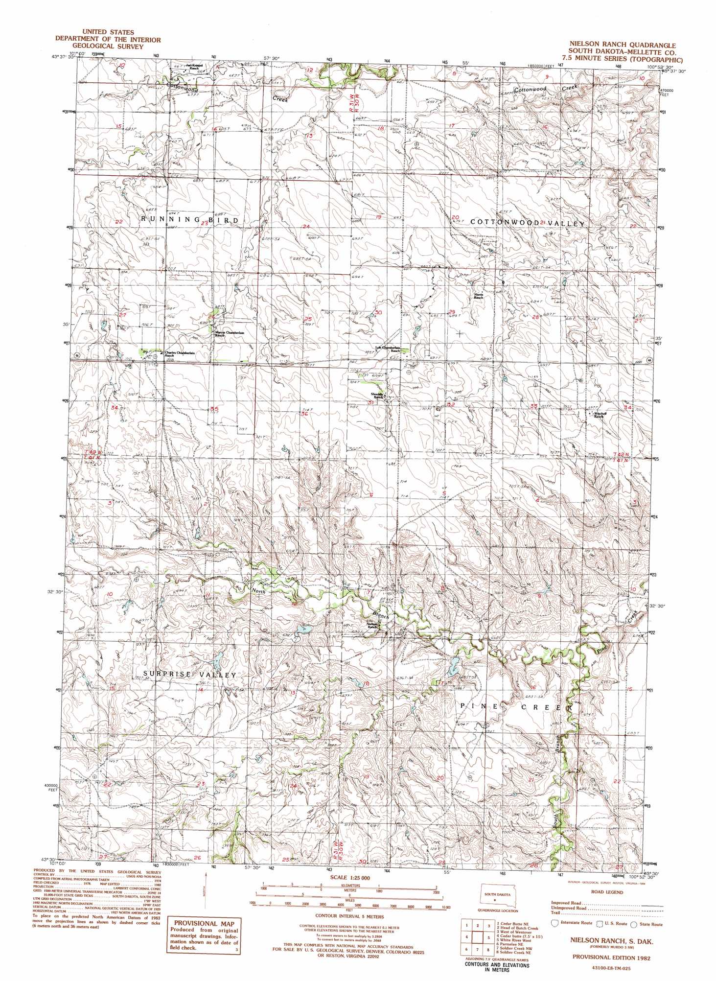
USGS Topo Quad 43100e8 - 1:25,000 scale
| Topo Map Name: | Murdo 3 Sw |
| USGS Topo Quad ID: | 43100e8 |
| Print Size: | ca. 21 1/4" wide x 27" high |
| Southeast Coordinates: | 43.5° N latitude / 100.875° W longitude |
| Map Center Coordinates: | 43.5625° N latitude / 100.9375° W longitude |
| U.S. State: | SD |
| Filename: | l43100e8.jpg |
| Download Map JPG Image: | Murdo 3 Sw topo map 1:25,000 scale |
| Map Type: | Topographic |
| Topo Series: | 7.5´ |
| Map Scale: | 1:25,000 |
| Source of Map Images: | United States Geological Survey (USGS) |
| Alternate Map Versions: |
1:24,000 Topo Quads surrounding Murdo 3 Sw
Stamford Sw |
Stamford Se |
Okaton Sw |
Okaton Se |
Murdo Sw |
Cedar Butte Nw |
Cedar Butte Ne |
Murdo 3 Nw |
Murdo 3 Ne |
Westover |
Cedarbutte |
Murdo 3 Sw |
White River West |
White River East |
|
Norris |
Parmelee Ne |
Soldier Creek Nw |
Soldier Creek Ne |
Mission Nw |
Eagle Mans Butte |
Parmelee |
Soldier Creek |
Soldier Creek Se |
Mission |
> Back to 43100e1 at 1:100,000 scale
> Back to 43100a1 at 1:250,000 scale
> Back to U.S. Topo Maps home
Murdo 3 Sw topo map: Gazetteer
Murdo 3 Sw: Dams
Carr Number 1 Dam elevation 689m 2260′Carr Number 2 Dam elevation 707m 2319′
Carr Number 4 Dam elevation 684m 2244′
Carr Number 5 Dam elevation 704m 2309′
Jarl Oswarld Number 2 Dam elevation 665m 2181′
John Catron Junior Number 3 Dam elevation 694m 2276′
Murdo 3 Sw: Streams
North Branch Pine Creek elevation 644m 2112′South Branch Pine Creek elevation 644m 2112′
Murdo 3 Sw digital topo map on disk
Buy this Murdo 3 Sw topo map showing relief, roads, GPS coordinates and other geographical features, as a high-resolution digital map file on DVD:
Eastern North Dakota & Eastern South Dakota
Buy digital topo maps: Eastern North Dakota & Eastern South Dakota