Vivian Se Topo Map South Dakota
To zoom in, hover over the map of Vivian Se
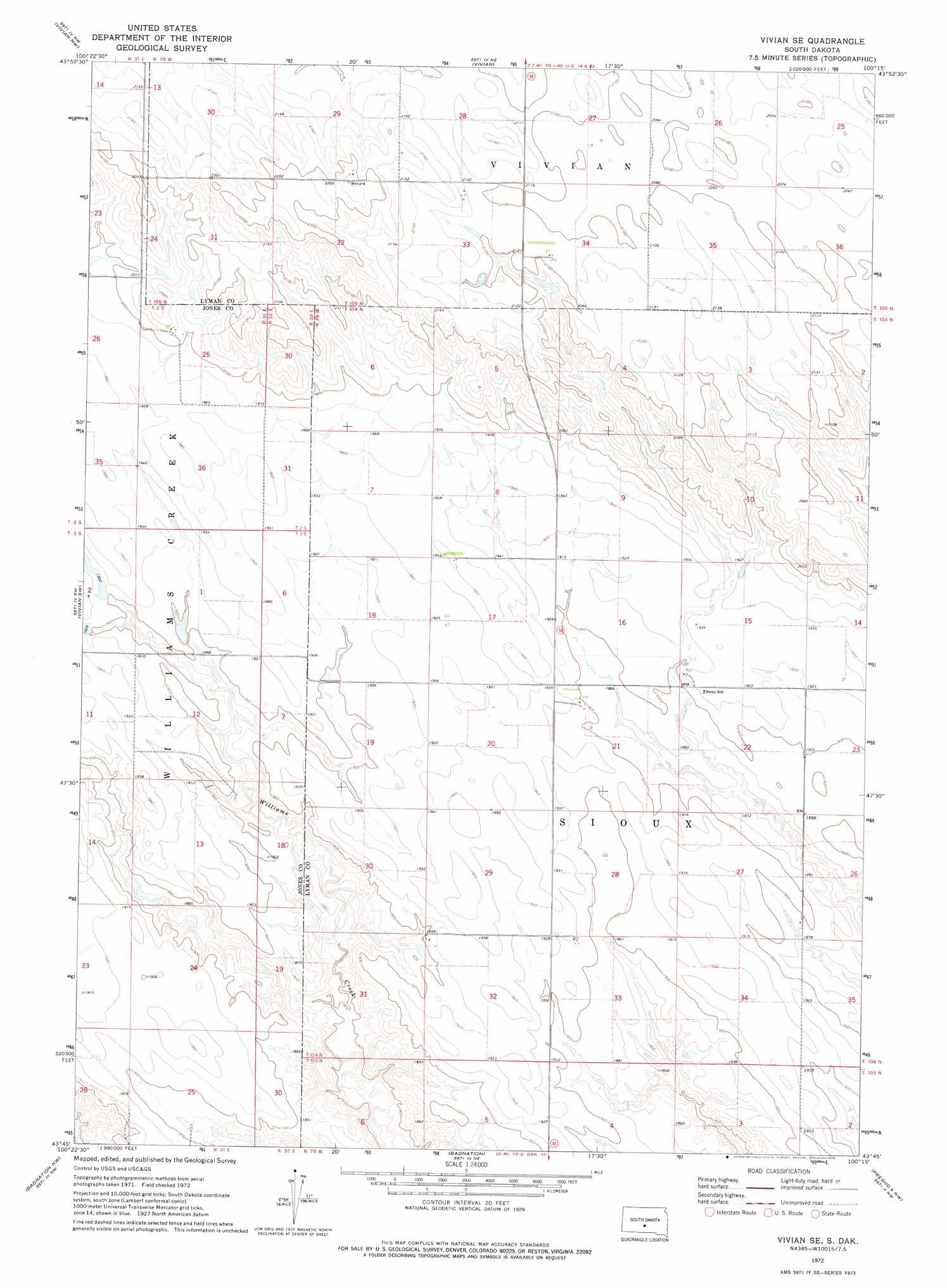
USGS Topo Quad 43100g3 - 1:24,000 scale
| Topo Map Name: | Vivian Se |
| USGS Topo Quad ID: | 43100g3 |
| Print Size: | ca. 21 1/4" wide x 27" high |
| Southeast Coordinates: | 43.75° N latitude / 100.25° W longitude |
| Map Center Coordinates: | 43.8125° N latitude / 100.3125° W longitude |
| U.S. State: | SD |
| Filename: | o43100g3.jpg |
| Download Map JPG Image: | Vivian Se topo map 1:24,000 scale |
| Map Type: | Topographic |
| Topo Series: | 7.5´ |
| Map Scale: | 1:24,000 |
| Source of Map Images: | United States Geological Survey (USGS) |
| Alternate Map Versions: |
Vivian SE SD 1972, updated 1975 Download PDF Buy paper map Vivian SE SD 2012 Download PDF Buy paper map Vivian SE SD 2015 Download PDF Buy paper map |
1:24,000 Topo Quads surrounding Vivian Se
Wendte Se |
Pierre 3 Sw |
Pierre 3 Se |
Fort George Butte Sw |
Fort George Butte Se |
Draper |
Vivian Nw |
Vivian |
Presho Nw |
Presho |
Murdo Se |
Vivian Sw |
Vivian Se |
Presho Sw |
Presho Se |
White River Ne |
Badnation Nw |
Badnation |
Presho 4 Nw |
Presho 4 Ne |
White River Se |
Wood North |
Badnation Se |
Two Nation Creek |
Presho 4 Se |
> Back to 43100e1 at 1:100,000 scale
> Back to 43100a1 at 1:250,000 scale
> Back to U.S. Topo Maps home
Vivian Se topo map: Gazetteer
Vivian Se: Dams
Hendricks Number 1 Dam elevation 581m 1906′Hendricks Number 2 Dam elevation 585m 1919′
Hendricks Number 3 Dam elevation 580m 1902′
Vivian Se digital topo map on disk
Buy this Vivian Se topo map showing relief, roads, GPS coordinates and other geographical features, as a high-resolution digital map file on DVD:
Eastern North Dakota & Eastern South Dakota
Buy digital topo maps: Eastern North Dakota & Eastern South Dakota