Presho Nw Topo Map South Dakota
To zoom in, hover over the map of Presho Nw
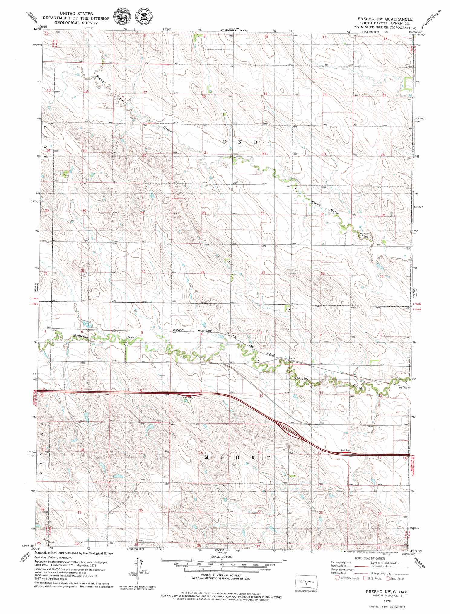
USGS Topo Quad 43100h2 - 1:24,000 scale
| Topo Map Name: | Presho Nw |
| USGS Topo Quad ID: | 43100h2 |
| Print Size: | ca. 21 1/4" wide x 27" high |
| Southeast Coordinates: | 43.875° N latitude / 100.125° W longitude |
| Map Center Coordinates: | 43.9375° N latitude / 100.1875° W longitude |
| U.S. State: | SD |
| Filename: | o43100h2.jpg |
| Download Map JPG Image: | Presho Nw topo map 1:24,000 scale |
| Map Type: | Topographic |
| Topo Series: | 7.5´ |
| Map Scale: | 1:24,000 |
| Source of Map Images: | United States Geological Survey (USGS) |
| Alternate Map Versions: |
Presho NW SD 1978, updated 1979 Download PDF Buy paper map Presho NW SD 2012 Download PDF Buy paper map Presho NW SD 2015 Download PDF Buy paper map |
| FStopo: | US Forest Service topo Presho NW is available: Download FStopo PDF Download FStopo TIF |
1:24,000 Topo Quads surrounding Presho Nw
Pierre 3 Nw |
Pierre 3 Ne |
Fort George Butte Nw |
Fort George Butte |
Joe Creek Nw |
Pierre 3 Sw |
Pierre 3 Se |
Fort George Butte Sw |
Fort George Butte Se |
Joe Creek Sw |
Vivian Nw |
Vivian |
Presho Nw |
Presho |
Brakke Dam |
Vivian Sw |
Vivian Se |
Presho Sw |
Presho Se |
Kennebec Sw |
Badnation Nw |
Badnation |
Presho 4 Nw |
Presho 4 Ne |
Ideal Nw |
> Back to 43100e1 at 1:100,000 scale
> Back to 43100a1 at 1:250,000 scale
> Back to U.S. Topo Maps home
No gazetteer data is available for the Presho Nw topo map sheet.
Presho Nw digital topo map on disk
Buy this Presho Nw topo map showing relief, roads, GPS coordinates and other geographical features, as a high-resolution digital map file on DVD:
Eastern North Dakota & Eastern South Dakota
Buy digital topo maps: Eastern North Dakota & Eastern South Dakota