Spring Creek Sw Topo Map South Dakota
To zoom in, hover over the map of Spring Creek Sw
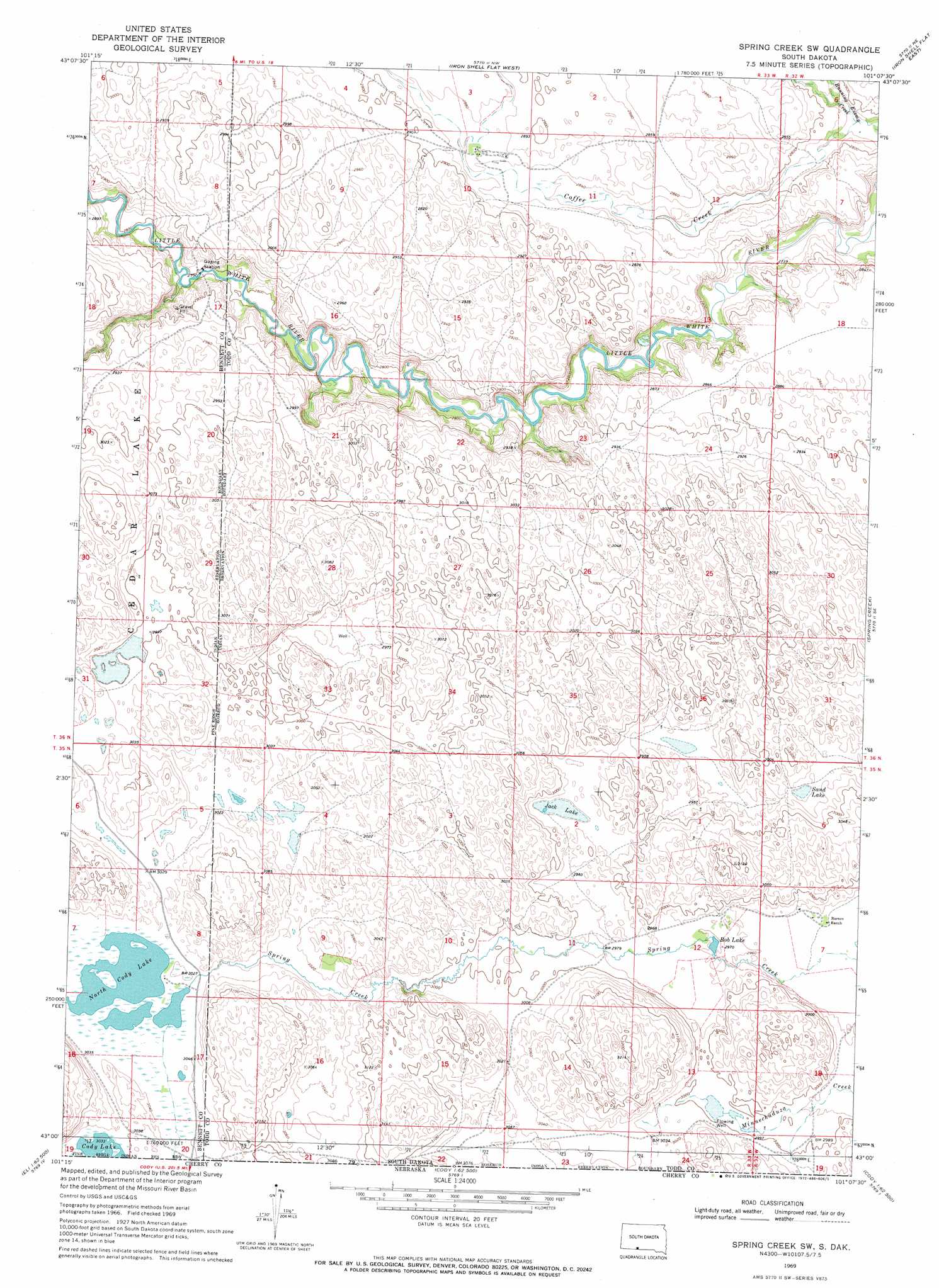
USGS Topo Quad 43101a2 - 1:24,000 scale
| Topo Map Name: | Spring Creek Sw |
| USGS Topo Quad ID: | 43101a2 |
| Print Size: | ca. 21 1/4" wide x 27" high |
| Southeast Coordinates: | 43° N latitude / 101.125° W longitude |
| Map Center Coordinates: | 43.0625° N latitude / 101.1875° W longitude |
| U.S. State: | SD |
| Filename: | o43101a2.jpg |
| Download Map JPG Image: | Spring Creek Sw topo map 1:24,000 scale |
| Map Type: | Topographic |
| Topo Series: | 7.5´ |
| Map Scale: | 1:24,000 |
| Source of Map Images: | United States Geological Survey (USGS) |
| Alternate Map Versions: |
Spring Creek SW SD 1969, updated 1972 Download PDF Buy paper map Spring Creek SW SD 2012 Download PDF Buy paper map Spring Creek SW SD 2015 Download PDF Buy paper map |
1:24,000 Topo Quads surrounding Spring Creek Sw
Blackpipe |
Eagle Mans Butte |
Parmelee |
Soldier Creek |
|
Harrington |
Iron Shell Flat West |
Iron Shell Flat East |
Saint Francis |
|
East Of Scotchman Lake |
Spring Creek Sw |
Spring Creek |
Saint Francis Sw |
|
Eli |
Cody West |
Cody East |
Nenzel |
Kilgore |
Eli Sw |
Eli Se |
Spring Canyon |
Cody Se |
Cooper Canyon |
> Back to 43101a1 at 1:100,000 scale
> Back to 43100a1 at 1:250,000 scale
> Back to U.S. Topo Maps home
Spring Creek Sw topo map: Gazetteer
Spring Creek Sw: Lakes
Bob Lake elevation 903m 2962′Jack Lake elevation 901m 2956′
North Cody Lake elevation 924m 3031′
Sand Lake elevation 894m 2933′
Spring Creek Sw: Streams
Cedar Creek elevation 854m 2801′Running Enemy Creek elevation 838m 2749′
Spring Creek Sw digital topo map on disk
Buy this Spring Creek Sw topo map showing relief, roads, GPS coordinates and other geographical features, as a high-resolution digital map file on DVD:
Eastern North Dakota & Eastern South Dakota
Buy digital topo maps: Eastern North Dakota & Eastern South Dakota