Swett Ne Topo Map South Dakota
To zoom in, hover over the map of Swett Ne
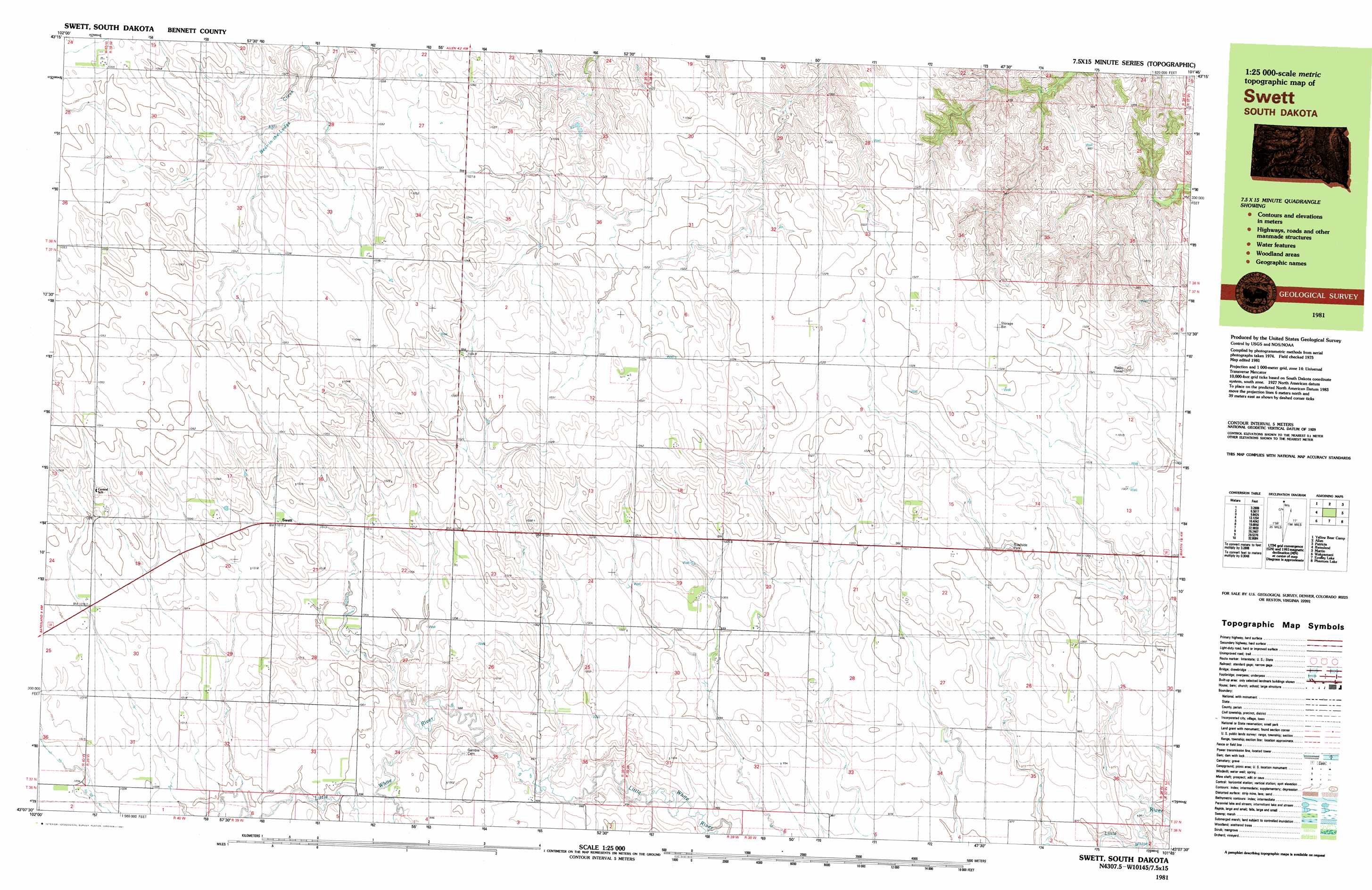
USGS Topo Quad 43101b7 - 1:25,000 scale
| Topo Map Name: | Swett Ne |
| USGS Topo Quad ID: | 43101b7 |
| Print Size: | ca. 39" wide x 24" high |
| Southeast Coordinates: | 43.125° N latitude / 101.75° W longitude |
| Map Center Coordinates: | 43.1875° N latitude / 101.875° W longitude |
| U.S. State: | SD |
| Filename: | k43101b7.jpg |
| Download Map JPG Image: | Swett Ne topo map 1:25,000 scale |
| Map Type: | Topographic |
| Topo Series: | 7.5´x15´ |
| Map Scale: | 1:25,000 |
| Source of Map Images: | United States Geological Survey (USGS) |
| Alternate Map Versions: |
Swett SD 1981, updated 1981 Download PDF Buy paper map |
1:24,000 Topo Quads surrounding Swett Ne
Kyle Ne |
Hisle |
Buzzard Butte |
||
Yellow Bear Camp |
Allen Se |
Patricia |
||
Batesland |
Swett Ne |
Deadmans Lake |
||
Two Lance Lake |
Allan Dam |
Phantom Lake |
||
Hog Island |
Irwin |
Trumbull Lake |
Merriman |
Merriman Ne |
> Back to 43101a1 at 1:100,000 scale
> Back to 43100a1 at 1:250,000 scale
> Back to U.S. Topo Maps home
Swett Ne digital topo map on disk
Buy this Swett Ne topo map showing relief, roads, GPS coordinates and other geographical features, as a high-resolution digital map file on DVD:
Eastern North Dakota & Eastern South Dakota
Buy digital topo maps: Eastern North Dakota & Eastern South Dakota