Patricia Topo Map South Dakota
To zoom in, hover over the map of Patricia
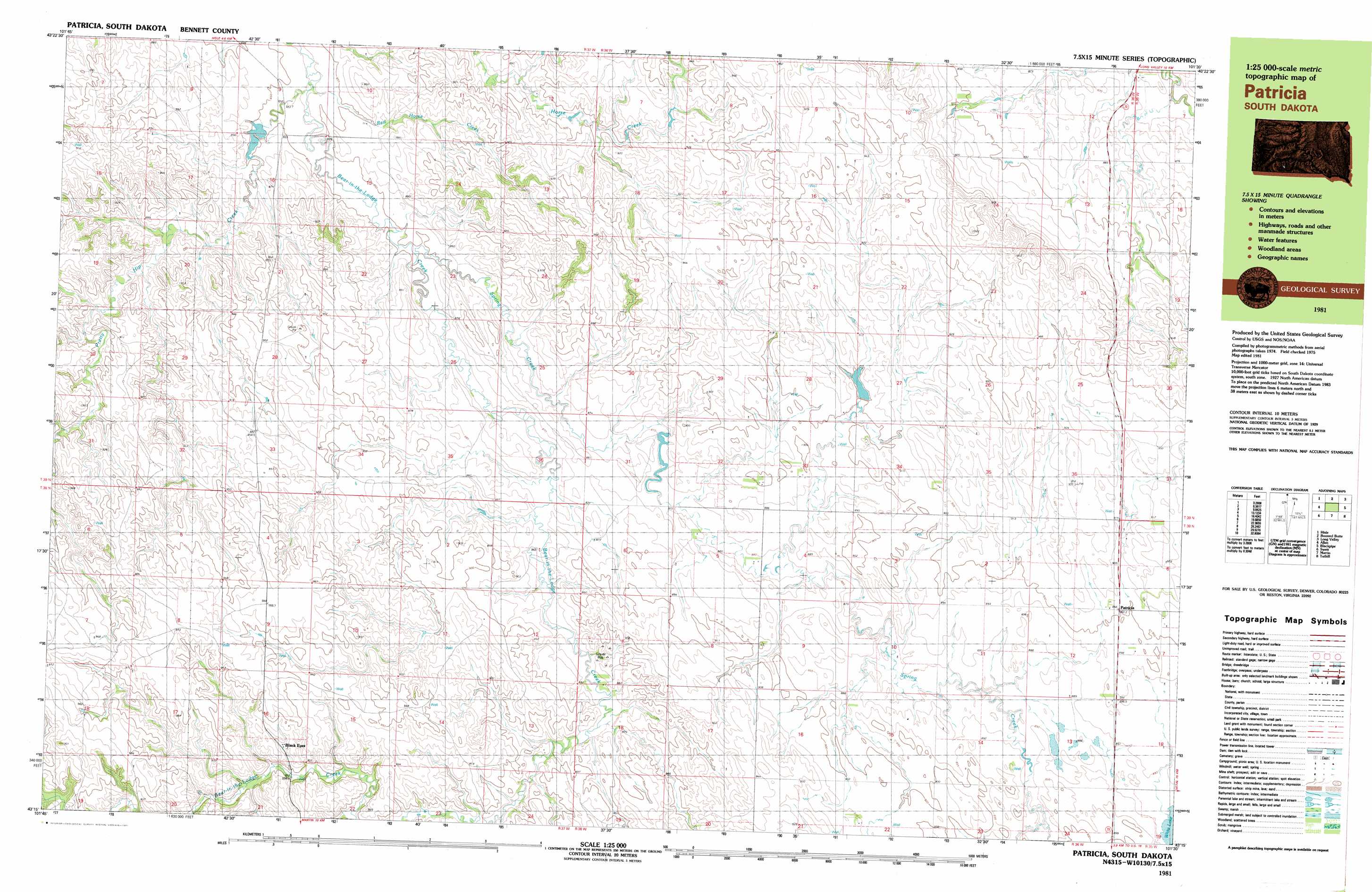
USGS Topo Quad 43101c5 - 1:25,000 scale
| Topo Map Name: | Patricia |
| USGS Topo Quad ID: | 43101c5 |
| Print Size: | ca. 39" wide x 24" high |
| Southeast Coordinates: | 43.25° N latitude / 101.5° W longitude |
| Map Center Coordinates: | 43.3125° N latitude / 101.625° W longitude |
| U.S. State: | SD |
| Filename: | k43101c5.jpg |
| Download Map JPG Image: | Patricia topo map 1:25,000 scale |
| Map Type: | Topographic |
| Topo Series: | 7.5´x15´ |
| Map Scale: | 1:25,000 |
| Source of Map Images: | United States Geological Survey (USGS) |
| Alternate Map Versions: |
Patricia SD 1981, updated 1981 Download PDF Buy paper map |
1:24,000 Topo Quads surrounding Patricia
Interior Se |
Wanblee |
Broken Leg Dam |
Short Bow Creek East |
|
Hisle |
Buzzard Butte |
Long Valley Nw |
||
Allen Se |
Patricia |
Blackpipe |
||
Swett Ne |
Deadmans Lake |
Harrington |
||
Allan Dam |
Phantom Lake |
East Of Scotchman Lake |
> Back to 43101a1 at 1:100,000 scale
> Back to 43100a1 at 1:250,000 scale
> Back to U.S. Topo Maps home
Patricia topo map: Gazetteer
Patricia: Dams
Jacquot Dam elevation 848m 2782′Patricia: Populated Places
Black Eyes elevation 920m 3018′Patricia elevation 901m 2956′
Patricia: Post Offices
Masopia Post Office (historical) elevation 930m 3051′Patricia: Streams
Bad Hair Creek elevation 881m 2890′Pretty Hip Creek elevation 839m 2752′
Red Horse Creek elevation 913m 2995′
Spring Creek elevation 862m 2828′
Patricia digital topo map on disk
Buy this Patricia topo map showing relief, roads, GPS coordinates and other geographical features, as a high-resolution digital map file on DVD:
Eastern North Dakota & Eastern South Dakota
Buy digital topo maps: Eastern North Dakota & Eastern South Dakota