Norris Topo Map South Dakota
To zoom in, hover over the map of Norris
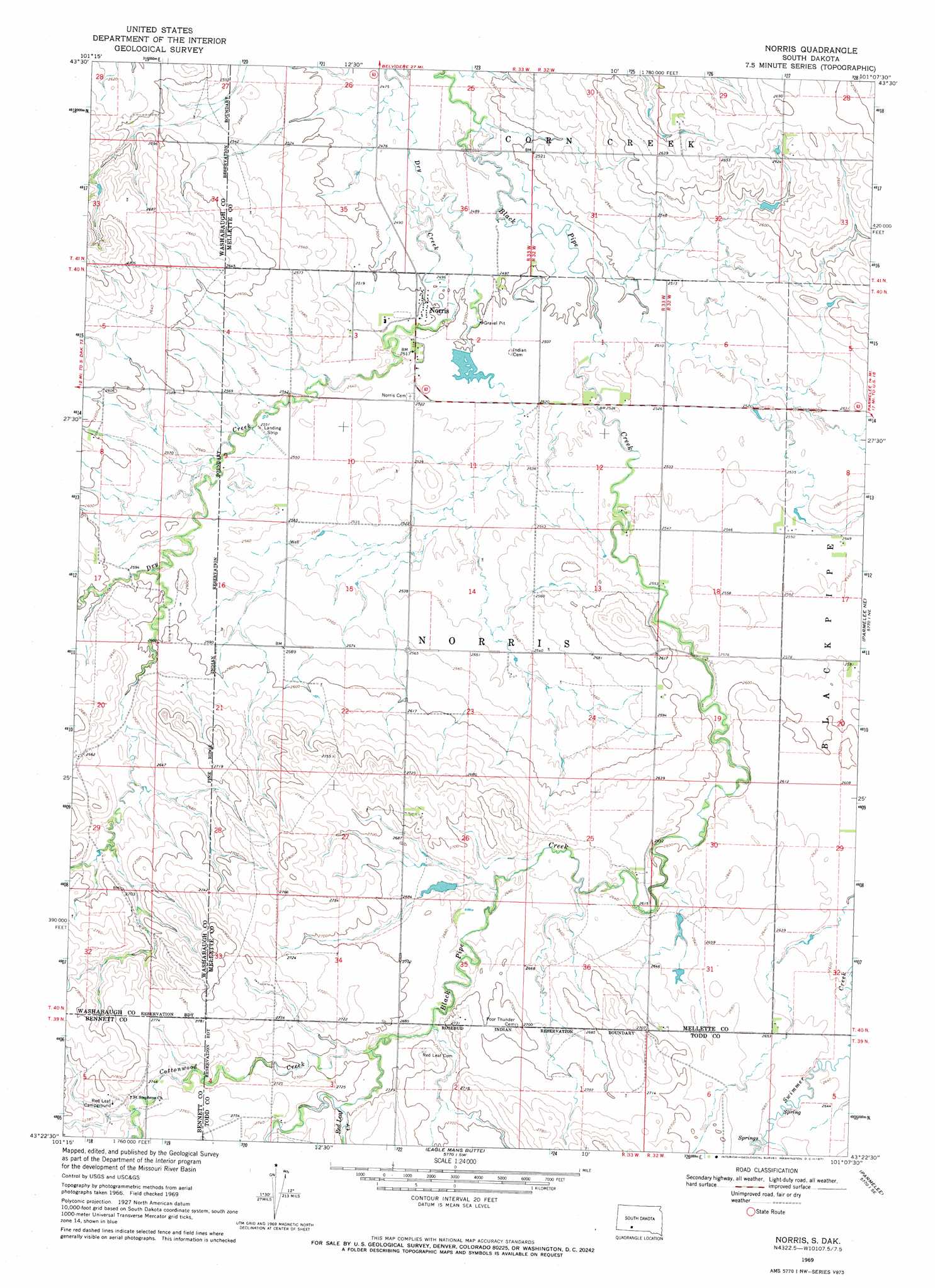
USGS Topo Quad 43101d2 - 1:24,000 scale
| Topo Map Name: | Norris |
| USGS Topo Quad ID: | 43101d2 |
| Print Size: | ca. 21 1/4" wide x 27" high |
| Southeast Coordinates: | 43.375° N latitude / 101.125° W longitude |
| Map Center Coordinates: | 43.4375° N latitude / 101.1875° W longitude |
| U.S. State: | SD |
| Filename: | o43101d2.jpg |
| Download Map JPG Image: | Norris topo map 1:24,000 scale |
| Map Type: | Topographic |
| Topo Series: | 7.5´ |
| Map Scale: | 1:24,000 |
| Source of Map Images: | United States Geological Survey (USGS) |
| Alternate Map Versions: |
Norris SD 1969, updated 1971 Download PDF Buy paper map Norris SD 2012 Download PDF Buy paper map Norris SD 2015 Download PDF Buy paper map |
1:24,000 Topo Quads surrounding Norris
Pass Creek Nw |
Pass Creek Ne |
Cedar Butte Nw |
Cedar Butte Ne |
Murdo 3 Nw |
Short Bow Creek East |
Cedarbutte |
Murdo 3 Sw |
||
Long Valley Nw |
Norris |
Parmelee Ne |
Soldier Creek Nw |
|
Blackpipe |
Eagle Mans Butte |
Parmelee |
Soldier Creek |
|
Harrington |
Iron Shell Flat West |
Iron Shell Flat East |
Saint Francis |
> Back to 43101a1 at 1:100,000 scale
> Back to 43100a1 at 1:250,000 scale
> Back to U.S. Topo Maps home
Norris topo map: Gazetteer
Norris: Populated Places
Norris elevation 762m 2500′Norris: Streams
Cottonwood Creek elevation 817m 2680′Red Leaf Creek elevation 823m 2700′
Norris digital topo map on disk
Buy this Norris topo map showing relief, roads, GPS coordinates and other geographical features, as a high-resolution digital map file on DVD:
Eastern North Dakota & Eastern South Dakota
Buy digital topo maps: Eastern North Dakota & Eastern South Dakota