Long Valley Nw Topo Map South Dakota
To zoom in, hover over the map of Long Valley Nw
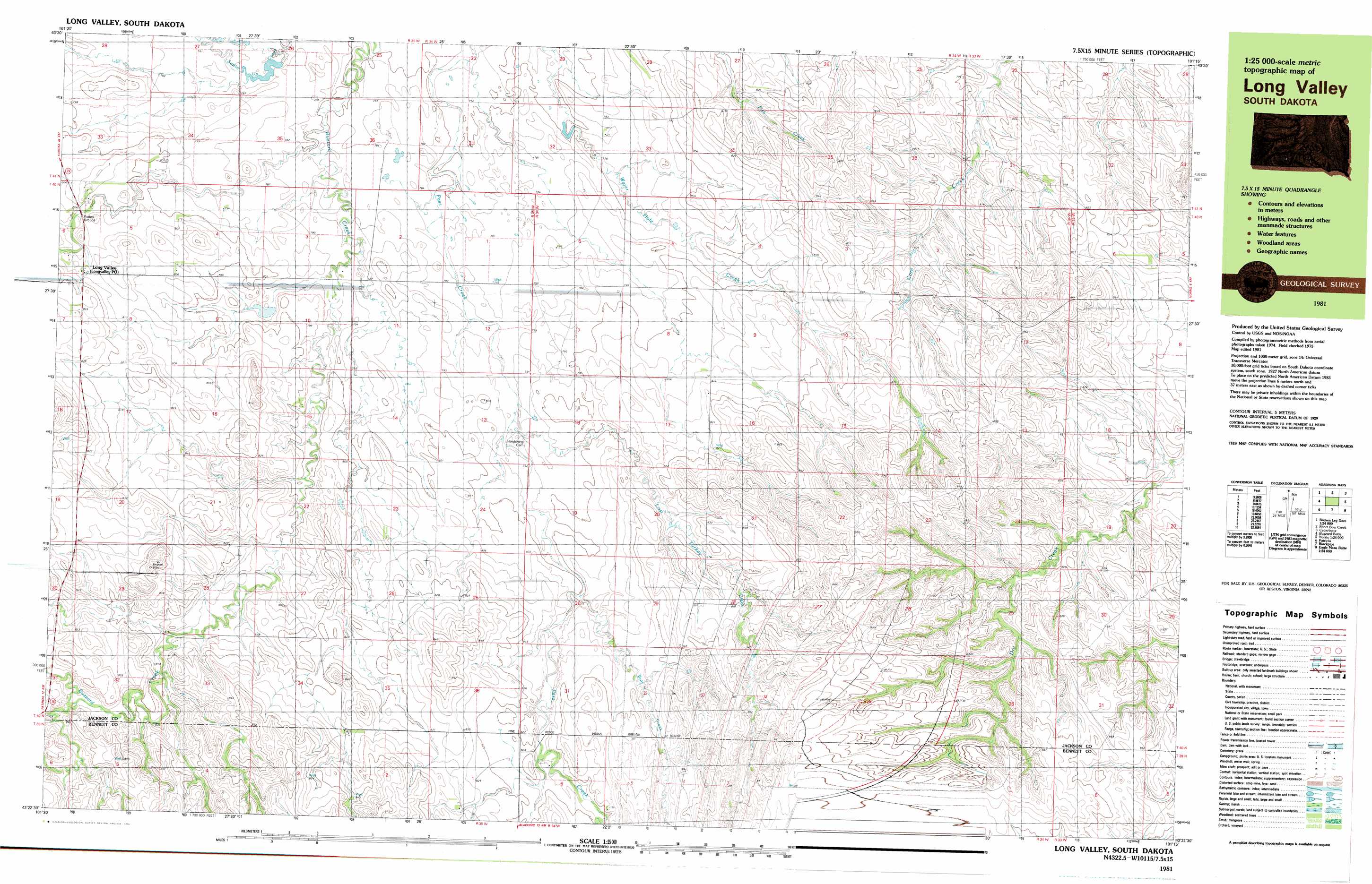
USGS Topo Quad 43101d3 - 1:25,000 scale
| Topo Map Name: | Long Valley Nw |
| USGS Topo Quad ID: | 43101d3 |
| Print Size: | ca. 39" wide x 24" high |
| Southeast Coordinates: | 43.375° N latitude / 101.25° W longitude |
| Map Center Coordinates: | 43.4375° N latitude / 101.375° W longitude |
| U.S. State: | SD |
| Filename: | k43101d3.jpg |
| Download Map JPG Image: | Long Valley Nw topo map 1:25,000 scale |
| Map Type: | Topographic |
| Topo Series: | 7.5´x15´ |
| Map Scale: | 1:25,000 |
| Source of Map Images: | United States Geological Survey (USGS) |
| Alternate Map Versions: |
Long Valley SD 1981, updated 1981 Download PDF Buy paper map |
1:24,000 Topo Quads surrounding Long Valley Nw
Wanblee Ne |
Pass Creek Nw |
Pass Creek Ne |
Cedar Butte Nw |
Cedar Butte Ne |
Broken Leg Dam |
Short Bow Creek East |
Cedarbutte |
||
Buzzard Butte |
Long Valley Nw |
Norris |
Parmelee Ne |
|
Patricia |
Blackpipe |
Eagle Mans Butte |
Parmelee |
|
Deadmans Lake |
Harrington |
Iron Shell Flat West |
Iron Shell Flat East |
> Back to 43101a1 at 1:100,000 scale
> Back to 43100a1 at 1:250,000 scale
> Back to U.S. Topo Maps home
Long Valley Nw topo map: Gazetteer
Long Valley Nw: Populated Places
Long Valley elevation 813m 2667′Long Valley Nw: Post Offices
Longvalley Post Office elevation 814m 2670′Long Valley Nw: Streams
Bull Creek elevation 801m 2627′Lost Turkey Creek elevation 788m 2585′
Long Valley Nw digital topo map on disk
Buy this Long Valley Nw topo map showing relief, roads, GPS coordinates and other geographical features, as a high-resolution digital map file on DVD:
Eastern North Dakota & Eastern South Dakota
Buy digital topo maps: Eastern North Dakota & Eastern South Dakota