Potato Creek Topo Map South Dakota
To zoom in, hover over the map of Potato Creek
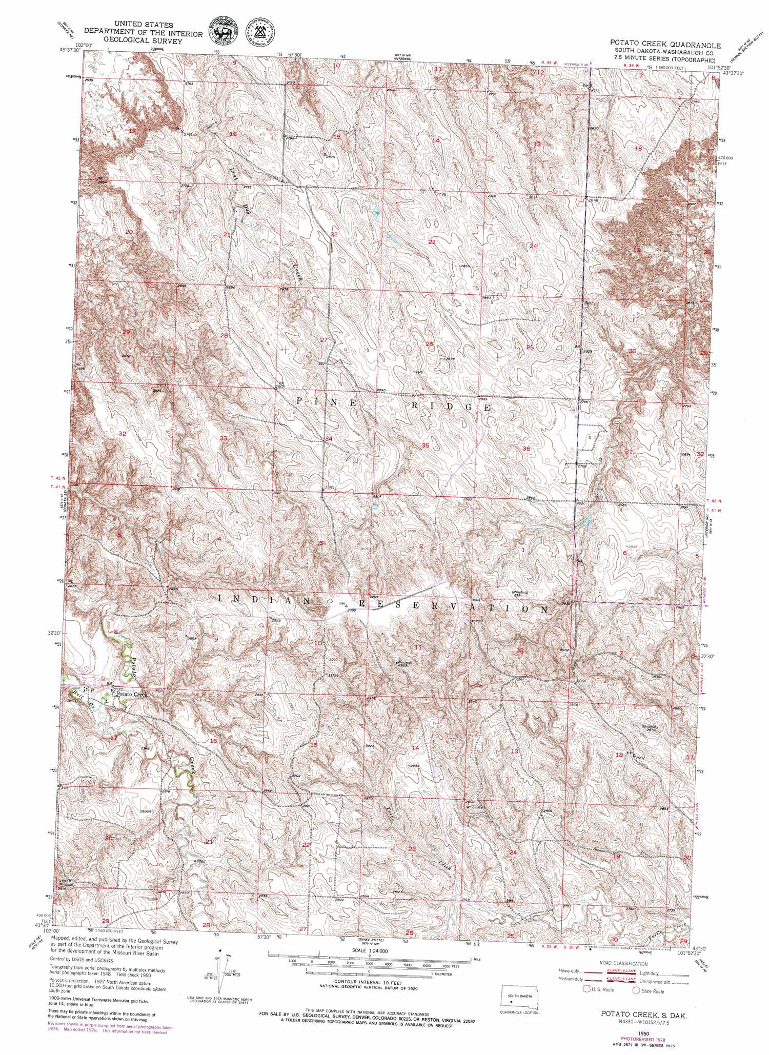
USGS Topo Quad 43101e8 - 1:24,000 scale
| Topo Map Name: | Potato Creek |
| USGS Topo Quad ID: | 43101e8 |
| Print Size: | ca. 21 1/4" wide x 27" high |
| Southeast Coordinates: | 43.5° N latitude / 101.875° W longitude |
| Map Center Coordinates: | 43.5625° N latitude / 101.9375° W longitude |
| U.S. State: | SD |
| Filename: | o43101e8.jpg |
| Download Map JPG Image: | Potato Creek topo map 1:24,000 scale |
| Map Type: | Topographic |
| Topo Series: | 7.5´ |
| Map Scale: | 1:24,000 |
| Source of Map Images: | United States Geological Survey (USGS) |
| Alternate Map Versions: |
Potato Creek SD 1950, updated 1952 Download PDF Buy paper map Potato Creek SD 2012 Download PDF Buy paper map Potato Creek SD 2015 Download PDF Buy paper map |
1:24,000 Topo Quads surrounding Potato Creek
Wall Sw |
Wall Se |
Cottonwood Sw |
Cottonwood Se |
Weta |
Conata |
Conata Ne |
Interior |
School Section Butte |
Wanblee Nw |
Conata Sw |
Conata Se |
Potato Creek |
Interior Se |
Wanblee |
Kyle Ne |
Hisle |
|||
Yellow Bear Camp |
Allen Se |
> Back to 43101e1 at 1:100,000 scale
> Back to 43100a1 at 1:250,000 scale
> Back to U.S. Topo Maps home
Potato Creek topo map: Gazetteer
Potato Creek: Populated Places
Potato Creek elevation 833m 2732′Potato Creek: Streams
Bull Creek elevation 829m 2719′Potato Creek digital topo map on disk
Buy this Potato Creek topo map showing relief, roads, GPS coordinates and other geographical features, as a high-resolution digital map file on DVD:
Eastern North Dakota & Eastern South Dakota
Buy digital topo maps: Eastern North Dakota & Eastern South Dakota