Pass Creek Ne Topo Map South Dakota
To zoom in, hover over the map of Pass Creek Ne
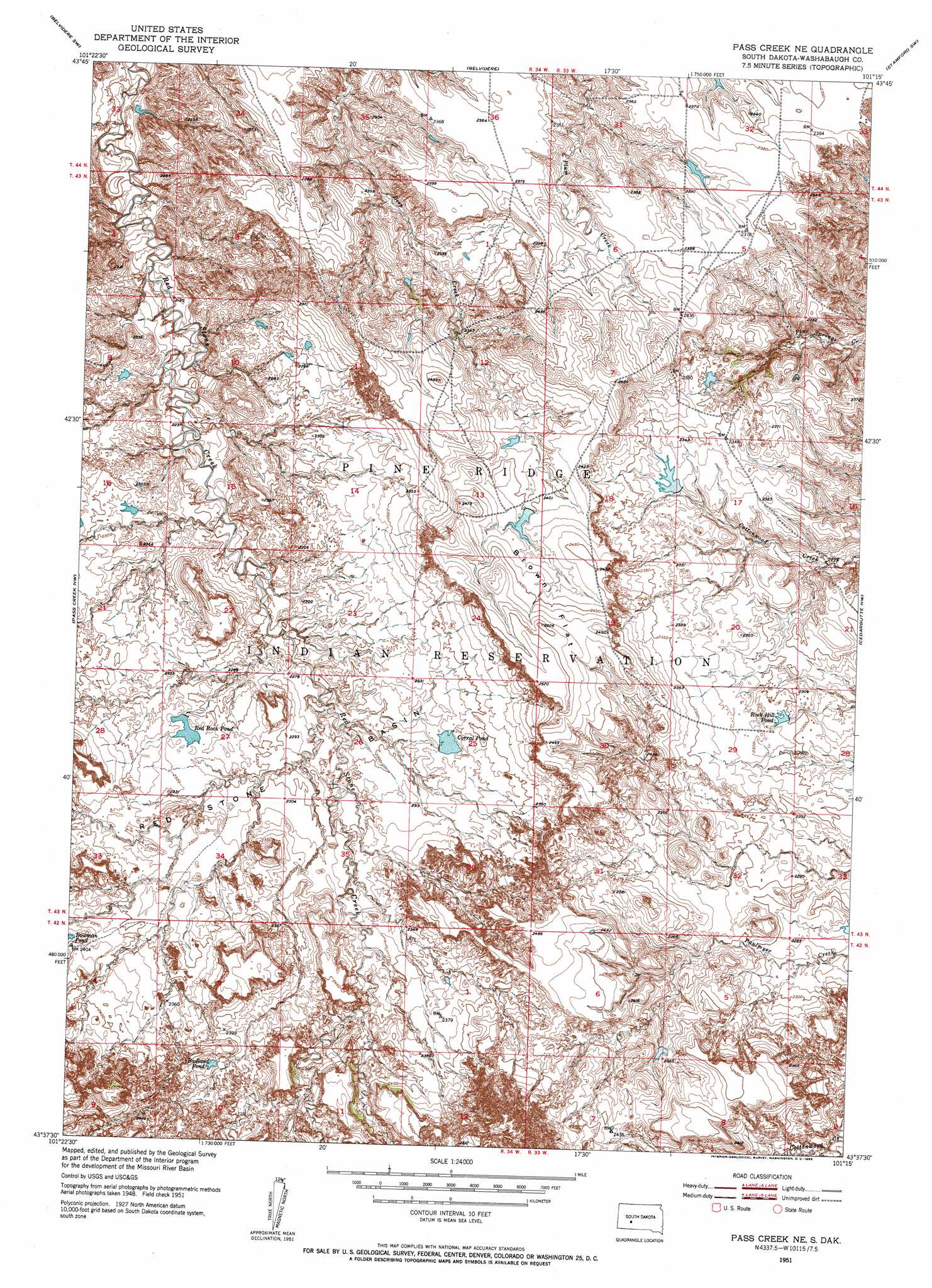
USGS Topo Quad 43101f3 - 1:24,000 scale
| Topo Map Name: | Pass Creek Ne |
| USGS Topo Quad ID: | 43101f3 |
| Print Size: | ca. 21 1/4" wide x 27" high |
| Southeast Coordinates: | 43.625° N latitude / 101.25° W longitude |
| Map Center Coordinates: | 43.6875° N latitude / 101.3125° W longitude |
| U.S. State: | SD |
| Filename: | o43101f3.jpg |
| Download Map JPG Image: | Pass Creek Ne topo map 1:24,000 scale |
| Map Type: | Topographic |
| Topo Series: | 7.5´ |
| Map Scale: | 1:24,000 |
| Source of Map Images: | United States Geological Survey (USGS) |
| Alternate Map Versions: |
Pass Creek NE SD 1951, updated 1953 Download PDF Buy paper map Pass Creek NE SD 2012 Download PDF Buy paper map Pass Creek NE SD 2015 Download PDF Buy paper map |
1:24,000 Topo Quads surrounding Pass Creek Ne
Kadoka Ne |
Belvidere Nw |
Belvidere Ne |
Stamford Nw |
Stamford |
Kadoka |
Belvidere Sw |
Belvidere |
Stamford Sw |
Stamford Se |
Wanblee Ne |
Pass Creek Nw |
Pass Creek Ne |
Cedar Butte Nw |
Cedar Butte Ne |
Broken Leg Dam |
Short Bow Creek East |
Cedarbutte |
||
Buzzard Butte |
Long Valley Nw |
Norris |
Parmelee Ne |
> Back to 43101e1 at 1:100,000 scale
> Back to 43100a1 at 1:250,000 scale
> Back to U.S. Topo Maps home
Pass Creek Ne topo map: Gazetteer
Pass Creek Ne: Basins
Red Stone Basin elevation 710m 2329′Pass Creek Ne: Flats
Brown Flat elevation 747m 2450′Pass Creek Ne: Reservoirs
Badland Pond elevation 732m 2401′Corral Pond elevation 708m 2322′
Red Rock Pond elevation 705m 2312′
Rock Hill Pond elevation 702m 2303′
Pass Creek Ne digital topo map on disk
Buy this Pass Creek Ne topo map showing relief, roads, GPS coordinates and other geographical features, as a high-resolution digital map file on DVD:
Eastern North Dakota & Eastern South Dakota
Buy digital topo maps: Eastern North Dakota & Eastern South Dakota