Cottonwood Sw Topo Map South Dakota
To zoom in, hover over the map of Cottonwood Sw
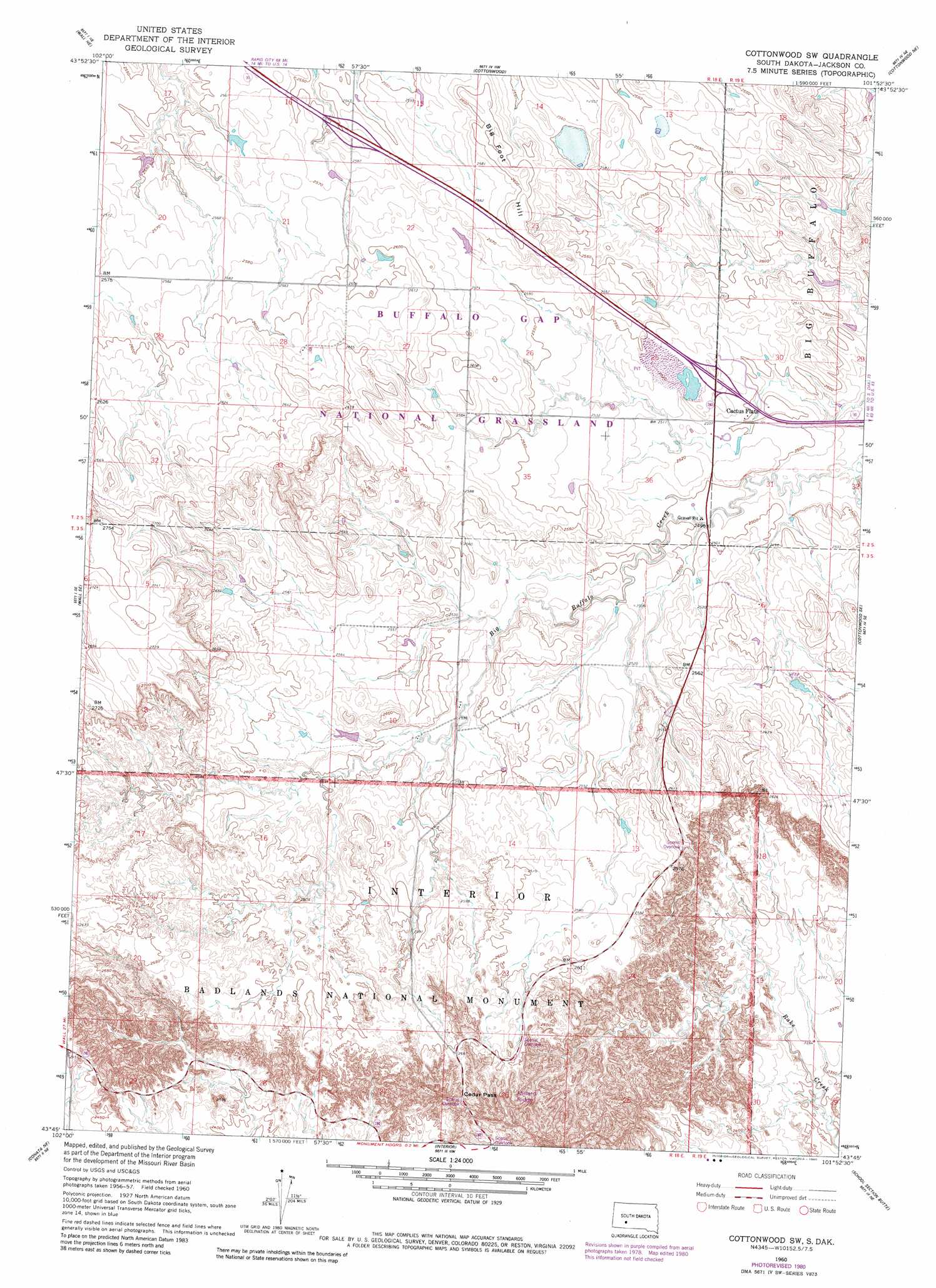
USGS Topo Quad 43101g8 - 1:24,000 scale
| Topo Map Name: | Cottonwood Sw |
| USGS Topo Quad ID: | 43101g8 |
| Print Size: | ca. 21 1/4" wide x 27" high |
| Southeast Coordinates: | 43.75° N latitude / 101.875° W longitude |
| Map Center Coordinates: | 43.8125° N latitude / 101.9375° W longitude |
| U.S. State: | SD |
| Filename: | o43101g8.jpg |
| Download Map JPG Image: | Cottonwood Sw topo map 1:24,000 scale |
| Map Type: | Topographic |
| Topo Series: | 7.5´ |
| Map Scale: | 1:24,000 |
| Source of Map Images: | United States Geological Survey (USGS) |
| Alternate Map Versions: |
Cottonwood SW SD 1960, updated 1962 Download PDF Buy paper map Cottonwood SW SD 1960, updated 1980 Download PDF Buy paper map Cottonwood SW SD 2012 Download PDF Buy paper map Cottonwood SW SD 2015 Download PDF Buy paper map |
| FStopo: | US Forest Service topo Cottonwood SW is available: Download FStopo PDF Download FStopo TIF |
1:24,000 Topo Quads surrounding Cottonwood Sw
Lake Hill |
Elm Creek Ranch |
Grindstone Sw |
Bowen Ranch |
Philip |
Wall |
Wall Ne |
Cottonwood |
Cottonwood Ne |
Philip Junction |
Wall Sw |
Wall Se |
Cottonwood Sw |
Cottonwood Se |
Weta |
Conata |
Conata Ne |
Interior |
School Section Butte |
Wanblee Nw |
Conata Sw |
Conata Se |
Potato Creek |
Interior Se |
Wanblee |
> Back to 43101e1 at 1:100,000 scale
> Back to 43100a1 at 1:250,000 scale
> Back to U.S. Topo Maps home
Cottonwood Sw topo map: Gazetteer
Cottonwood Sw: Airports
Badlands Airfield elevation 744m 2440′Cottonwood Sw: Gaps
Cedar Pass elevation 822m 2696′Cottonwood Sw: Populated Places
Cactus Flat elevation 762m 2500′Cottonwood Sw: Ridges
Millard Ridge elevation 803m 2634′Cottonwood Sw: Summits
Big Foot Hill elevation 793m 2601′Cottonwood Sw digital topo map on disk
Buy this Cottonwood Sw topo map showing relief, roads, GPS coordinates and other geographical features, as a high-resolution digital map file on DVD:
Eastern North Dakota & Eastern South Dakota
Buy digital topo maps: Eastern North Dakota & Eastern South Dakota