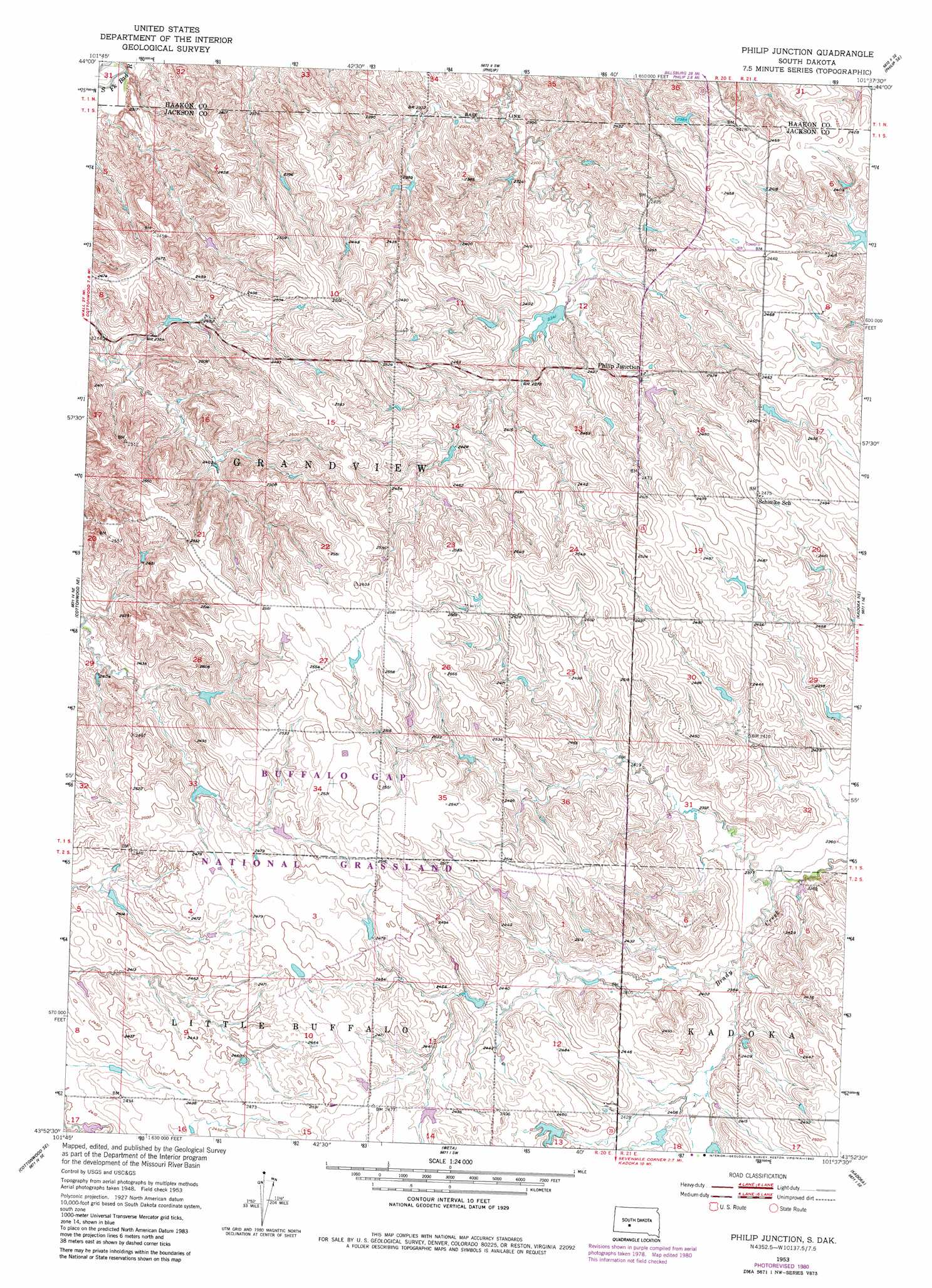
Philip Junction Topo Map South Dakota
To zoom in, hover over the map of Philip Junction
USGS Topo Quad 43101h6 - 1:24,000 scale
| Topo Map Name: | Philip Junction |
| USGS Topo Quad ID: | 43101h6 |
| Print Size: | ca. 21 1/4" wide x 27" high |
| Southeast Coordinates: | 43.875° N latitude / 101.625° W longitude |
| Map Center Coordinates: | 43.9375° N latitude / 101.6875° W longitude |
| U.S. State: | SD |
| Filename: | o43101h6.jpg |
| Download Map JPG Image: | Philip Junction topo map 1:24,000 scale |
| Map Type: | Topographic |
| Topo Series: | 7.5´ |
| Map Scale: | 1:24,000 |
| Source of Map Images: | United States Geological Survey (USGS) |
| Alternate Map Versions: |
Philip Junction SD 1953, updated 1955 Download PDF Buy paper map Philip Junction SD 1953, updated 1980 Download PDF Buy paper map Philip Junction SD 2012 Download PDF Buy paper map Philip Junction SD 2015 Download PDF Buy paper map |
| FStopo: | US Forest Service topo Philip Junction is available: Download FStopo PDF Download FStopo TIF |
1:24,000 Topo Quads surrounding Philip Junction
Grindstone |
Grindstone Butte |
Elevenmile Corner |
Lucerne |
Powell Nw |
Grindstone Sw |
Bowen Ranch |
Philip |
Philip Se |
Powell |
Cottonwood |
Cottonwood Ne |
Philip Junction |
Kadoka Ne |
Belvidere Nw |
Cottonwood Sw |
Cottonwood Se |
Weta |
Kadoka |
Belvidere Sw |
Interior |
School Section Butte |
Wanblee Nw |
Wanblee Ne |
Pass Creek Nw |
> Back to 43101e1 at 1:100,000 scale
> Back to 43100a1 at 1:250,000 scale
> Back to U.S. Topo Maps home
Philip Junction topo map: Gazetteer
Philip Junction: Populated Places
Philip Junction elevation 726m 2381′Philip Junction digital topo map on disk
Buy this Philip Junction topo map showing relief, roads, GPS coordinates and other geographical features, as a high-resolution digital map file on DVD:
Eastern North Dakota & Eastern South Dakota
Buy digital topo maps: Eastern North Dakota & Eastern South Dakota