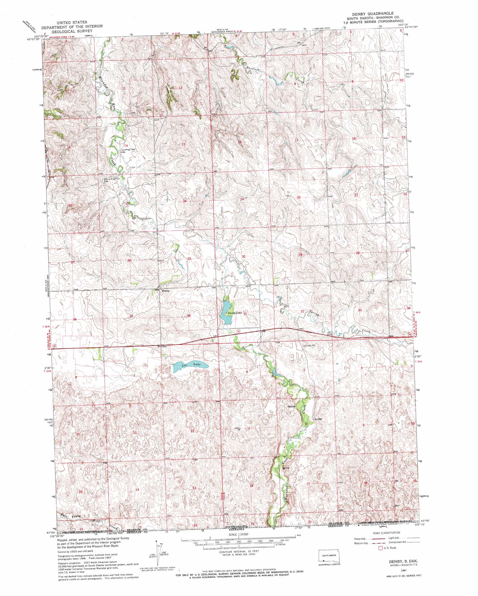
Denby Topo Map South Dakota
To zoom in, hover over the map of Denby
USGS Topo Quad 43102a3 - 1:24,000 scale
| Topo Map Name: | Denby |
| USGS Topo Quad ID: | 43102a3 |
| Print Size: | ca. 21 1/4" wide x 27" high |
| Southeast Coordinates: | 43° N latitude / 102.25° W longitude |
| Map Center Coordinates: | 43.0625° N latitude / 102.3125° W longitude |
| U.S. State: | SD |
| Filename: | o43102a3.jpg |
| Download Map JPG Image: | Denby topo map 1:24,000 scale |
| Map Type: | Topographic |
| Topo Series: | 7.5´ |
| Map Scale: | 1:24,000 |
| Source of Map Images: | United States Geological Survey (USGS) |
| Alternate Map Versions: |
Denby SD 1967, updated 1970 Download PDF Buy paper map Denby SD 2012 Download PDF Buy paper map Denby SD 2015 Download PDF Buy paper map |
1:24,000 Topo Quads surrounding Denby
Rockyford Se |
Evergreen |
Yellow Bear Camp |
||
Pine Ridge Ne |
Manderson |
Wounded Knee |
Batesland |
|
Pine Ridge |
Manderson Sw |
Denby |
Two Lance Lake |
|
Whiteclay |
Clinton Nw |
Clinton Ne |
Gordon Nw |
Hog Island |
Whiteclay Se |
Clinton Sw |
Clinton |
Gordon |
Gordon Se |
> Back to 43102a1 at 1:100,000 scale
> Back to 43102a1 at 1:250,000 scale
> Back to U.S. Topo Maps home
Denby topo map: Gazetteer
Denby: Dams
Denby Dam elevation 1025m 3362′Denby: Lakes
Lee Lake elevation 1047m 3435′Denby: Populated Places
Denby elevation 1027m 3369′Denby: Reservoirs
Denby Lake elevation 1024m 3359′Denby: Streams
Spring Creek elevation 1015m 3330′Denby digital topo map on disk
Buy this Denby topo map showing relief, roads, GPS coordinates and other geographical features, as a high-resolution digital map file on DVD:
Eastern Wyoming & Western South Dakota
Buy digital topo maps: Eastern Wyoming & Western South Dakota