Manderson Topo Map South Dakota
To zoom in, hover over the map of Manderson
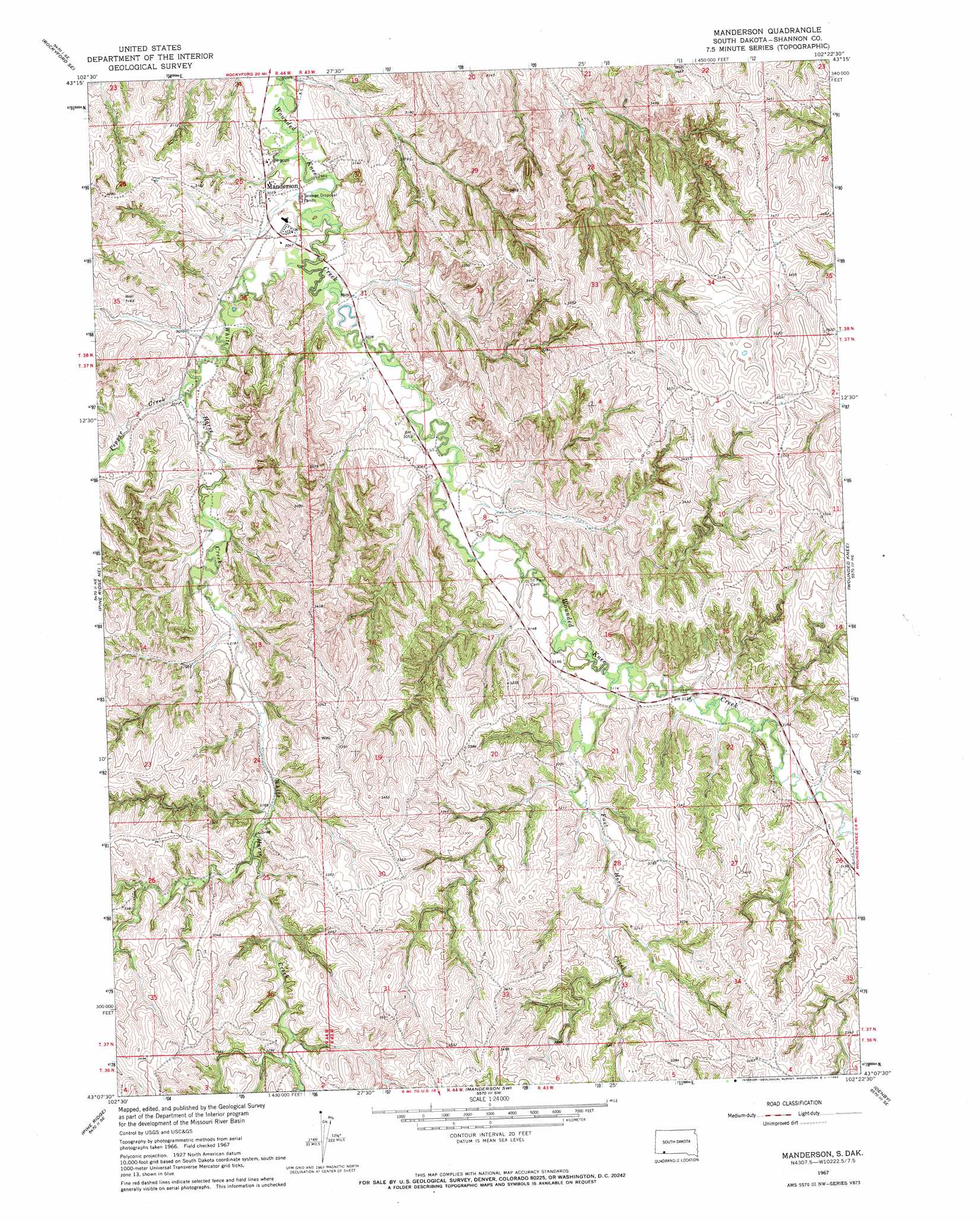
USGS Topo Quad 43102b4 - 1:24,000 scale
| Topo Map Name: | Manderson |
| USGS Topo Quad ID: | 43102b4 |
| Print Size: | ca. 21 1/4" wide x 27" high |
| Southeast Coordinates: | 43.125° N latitude / 102.375° W longitude |
| Map Center Coordinates: | 43.1875° N latitude / 102.4375° W longitude |
| U.S. State: | SD |
| Filename: | o43102b4.jpg |
| Download Map JPG Image: | Manderson topo map 1:24,000 scale |
| Map Type: | Topographic |
| Topo Series: | 7.5´ |
| Map Scale: | 1:24,000 |
| Source of Map Images: | United States Geological Survey (USGS) |
| Alternate Map Versions: |
Manderson SD 1967, updated 1969 Download PDF Buy paper map Manderson SD 2012 Download PDF Buy paper map Manderson SD 2015 Download PDF Buy paper map |
1:24,000 Topo Quads surrounding Manderson
Rockyford Nw |
Rockyford |
Sharpes Corner |
Evergreen Ne |
|
Rockyford Sw |
Rockyford Se |
Evergreen |
||
Oglala |
Pine Ridge Ne |
Manderson |
Wounded Knee |
|
Pine Ridge Sw |
Pine Ridge |
Manderson Sw |
Denby |
|
Beaver Wall |
Whiteclay |
Clinton Nw |
Clinton Ne |
Gordon Nw |
> Back to 43102a1 at 1:100,000 scale
> Back to 43102a1 at 1:250,000 scale
> Back to U.S. Topo Maps home
Manderson topo map: Gazetteer
Manderson: Populated Places
Manderson elevation 926m 3038′Manderson: Streams
Fast Horse Creek elevation 949m 3113′Pepper Creek elevation 933m 3061′
White Horse Creek elevation 915m 3001′
Manderson digital topo map on disk
Buy this Manderson topo map showing relief, roads, GPS coordinates and other geographical features, as a high-resolution digital map file on DVD:
Eastern Wyoming & Western South Dakota
Buy digital topo maps: Eastern Wyoming & Western South Dakota