Oglala Topo Map South Dakota
To zoom in, hover over the map of Oglala
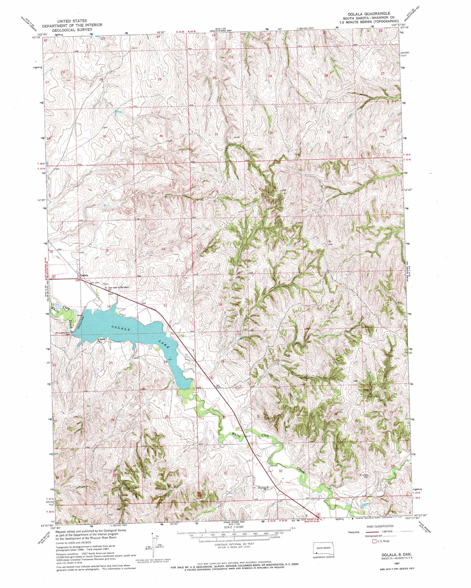
USGS Topo Quad 43102b6 - 1:24,000 scale
| Topo Map Name: | Oglala |
| USGS Topo Quad ID: | 43102b6 |
| Print Size: | ca. 21 1/4" wide x 27" high |
| Southeast Coordinates: | 43.125° N latitude / 102.625° W longitude |
| Map Center Coordinates: | 43.1875° N latitude / 102.6875° W longitude |
| U.S. State: | SD |
| Filename: | o43102b6.jpg |
| Download Map JPG Image: | Oglala topo map 1:24,000 scale |
| Map Type: | Topographic |
| Topo Series: | 7.5´ |
| Map Scale: | 1:24,000 |
| Source of Map Images: | United States Geological Survey (USGS) |
| Alternate Map Versions: |
Oglala SD 1967, updated 1969 Download PDF Buy paper map Oglala SD 2012 Download PDF Buy paper map Oglala SD 2015 Download PDF Buy paper map |
1:24,000 Topo Quads surrounding Oglala
Willow Creek Nw |
Willow Creek Ne |
Rockyford Nw |
Rockyford |
Sharpes Corner |
Willow Creek Sw |
Willow Creek |
Rockyford Sw |
Rockyford Se |
|
Slim Butte Nw |
Slim Butte Ne |
Oglala |
Pine Ridge Ne |
Manderson |
Slim Butte Sw |
Slim Butte |
Pine Ridge Sw |
Pine Ridge |
Manderson Sw |
Isinglass Buttes |
Chadron Ne |
Beaver Wall |
Whiteclay |
Clinton Nw |
> Back to 43102a1 at 1:100,000 scale
> Back to 43102a1 at 1:250,000 scale
> Back to U.S. Topo Maps home
Oglala topo map: Gazetteer
Oglala: Dams
Oglala Dam elevation 911m 2988′Oglala: Populated Places
Oglala elevation 915m 3001′Oglala: Reservoirs
Oglala Lake elevation 911m 2988′Oglala digital topo map on disk
Buy this Oglala topo map showing relief, roads, GPS coordinates and other geographical features, as a high-resolution digital map file on DVD:
Eastern Wyoming & Western South Dakota
Buy digital topo maps: Eastern Wyoming & Western South Dakota