Slim Butte Nw Topo Map South Dakota
To zoom in, hover over the map of Slim Butte Nw
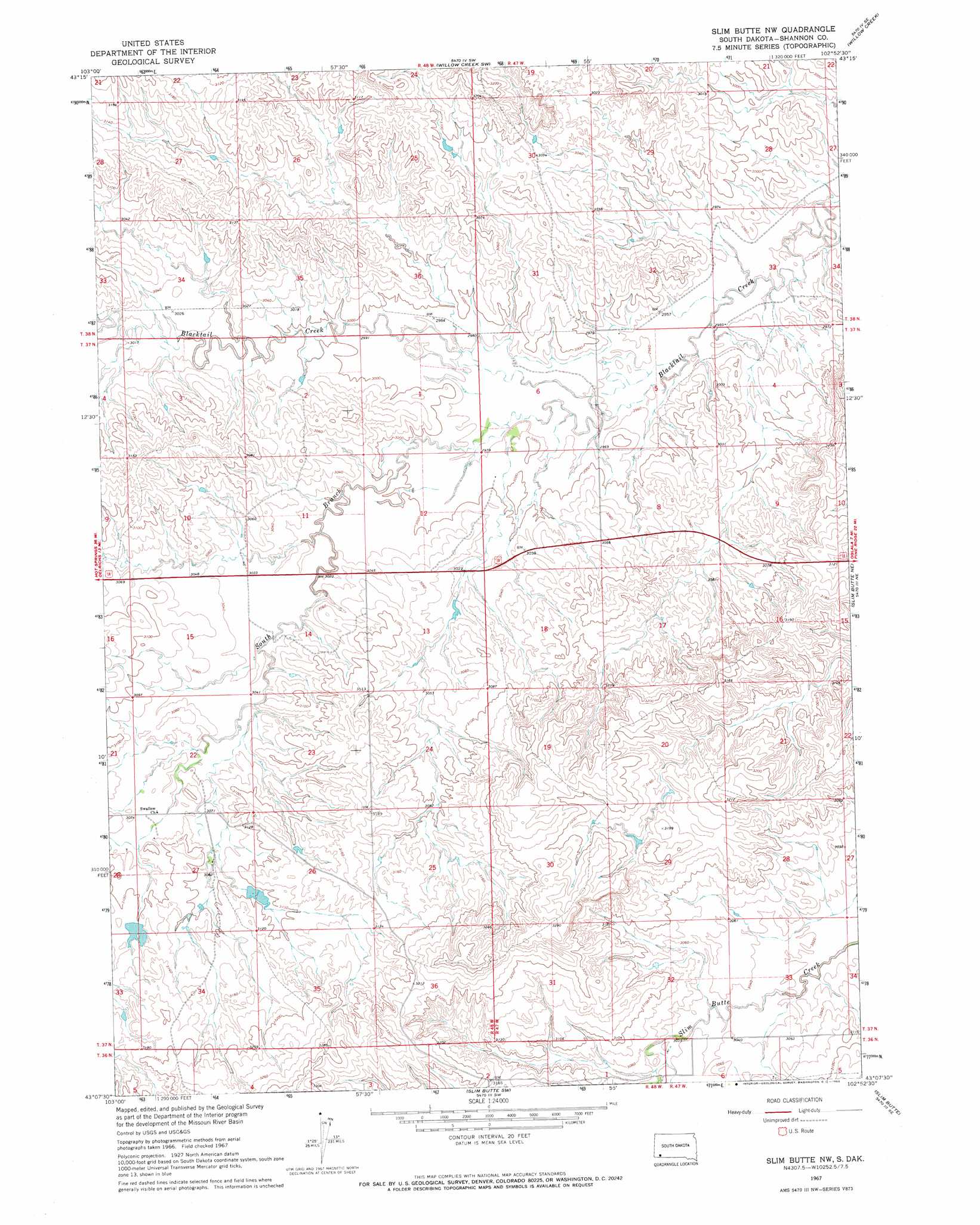
USGS Topo Quad 43102b8 - 1:24,000 scale
| Topo Map Name: | Slim Butte Nw |
| USGS Topo Quad ID: | 43102b8 |
| Print Size: | ca. 21 1/4" wide x 27" high |
| Southeast Coordinates: | 43.125° N latitude / 102.875° W longitude |
| Map Center Coordinates: | 43.1875° N latitude / 102.9375° W longitude |
| U.S. State: | SD |
| Filename: | o43102b8.jpg |
| Download Map JPG Image: | Slim Butte Nw topo map 1:24,000 scale |
| Map Type: | Topographic |
| Topo Series: | 7.5´ |
| Map Scale: | 1:24,000 |
| Source of Map Images: | United States Geological Survey (USGS) |
| Alternate Map Versions: |
Slim Butte NW SD 1967, updated 1969 Download PDF Buy paper map Slim Butte NW SD 2012 Download PDF Buy paper map Slim Butte NW SD 2015 Download PDF Buy paper map |
1:24,000 Topo Quads surrounding Slim Butte Nw
Smithwick Nw |
Smithwick Ne |
Willow Creek Nw |
Willow Creek Ne |
Rockyford Nw |
Smithwick |
Hay Canyon Butte |
Willow Creek Sw |
Willow Creek |
Rockyford Sw |
Oelrichs |
Oelrichs Ne |
Slim Butte Nw |
Slim Butte Ne |
Oglala |
Oelrichs Sw |
Heinne Creek |
Slim Butte Sw |
Slim Butte |
Pine Ridge Sw |
Wayside |
Bohemian Creek |
Isinglass Buttes |
Chadron Ne |
Beaver Wall |
> Back to 43102a1 at 1:100,000 scale
> Back to 43102a1 at 1:250,000 scale
> Back to U.S. Topo Maps home
Slim Butte Nw topo map: Gazetteer
Slim Butte Nw: Streams
South Branch Blacktail Creek elevation 903m 2962′Slim Butte Nw digital topo map on disk
Buy this Slim Butte Nw topo map showing relief, roads, GPS coordinates and other geographical features, as a high-resolution digital map file on DVD:
Eastern Wyoming & Western South Dakota
Buy digital topo maps: Eastern Wyoming & Western South Dakota