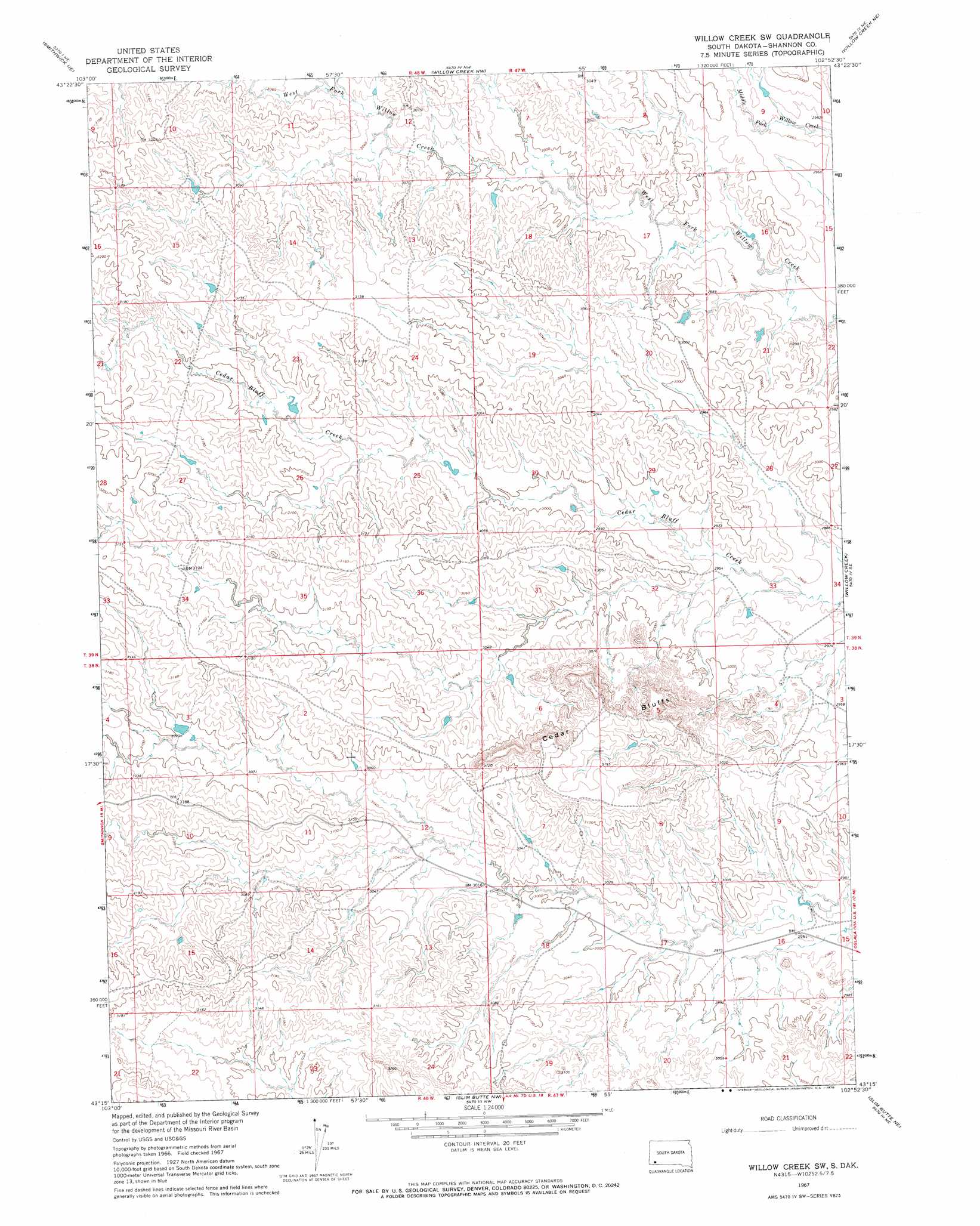
Willow Creek Sw Topo Map South Dakota
To zoom in, hover over the map of Willow Creek Sw
USGS Topo Quad 43102c8 - 1:24,000 scale
| Topo Map Name: | Willow Creek Sw |
| USGS Topo Quad ID: | 43102c8 |
| Print Size: | ca. 21 1/4" wide x 27" high |
| Southeast Coordinates: | 43.25° N latitude / 102.875° W longitude |
| Map Center Coordinates: | 43.3125° N latitude / 102.9375° W longitude |
| U.S. State: | SD |
| Filename: | o43102c8.jpg |
| Download Map JPG Image: | Willow Creek Sw topo map 1:24,000 scale |
| Map Type: | Topographic |
| Topo Series: | 7.5´ |
| Map Scale: | 1:24,000 |
| Source of Map Images: | United States Geological Survey (USGS) |
| Alternate Map Versions: |
Willow Creek SW SD 1967, updated 1970 Download PDF Buy paper map Willow Creek SW SD 2012 Download PDF Buy paper map Willow Creek SW SD 2015 Download PDF Buy paper map |
1:24,000 Topo Quads surrounding Willow Creek Sw
Fairburn Sw |
Fairburn Se |
Red Shirt Sw |
Cuny Table West |
Cuny Table East |
Smithwick Nw |
Smithwick Ne |
Willow Creek Nw |
Willow Creek Ne |
Rockyford Nw |
Smithwick |
Hay Canyon Butte |
Willow Creek Sw |
Willow Creek |
Rockyford Sw |
Oelrichs |
Oelrichs Ne |
Slim Butte Nw |
Slim Butte Ne |
Oglala |
Oelrichs Sw |
Heinne Creek |
Slim Butte Sw |
Slim Butte |
Pine Ridge Sw |
> Back to 43102a1 at 1:100,000 scale
> Back to 43102a1 at 1:250,000 scale
> Back to U.S. Topo Maps home
Willow Creek Sw digital topo map on disk
Buy this Willow Creek Sw topo map showing relief, roads, GPS coordinates and other geographical features, as a high-resolution digital map file on DVD:
Eastern Wyoming & Western South Dakota
Buy digital topo maps: Eastern Wyoming & Western South Dakota