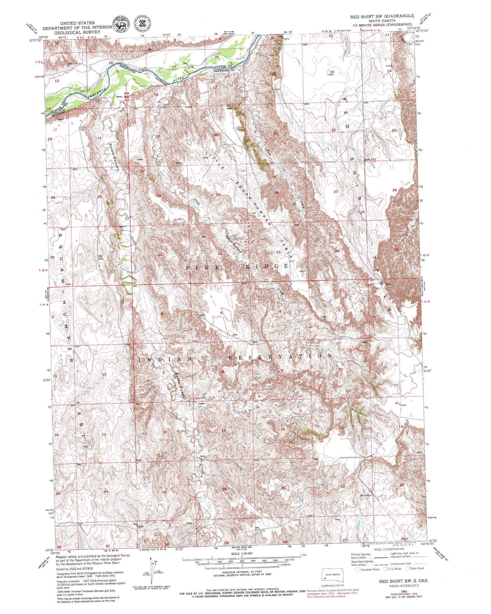
Red Shirt Sw Topo Map South Dakota
To zoom in, hover over the map of Red Shirt Sw
USGS Topo Quad 43102e8 - 1:24,000 scale
| Topo Map Name: | Red Shirt Sw |
| USGS Topo Quad ID: | 43102e8 |
| Print Size: | ca. 21 1/4" wide x 27" high |
| Southeast Coordinates: | 43.5° N latitude / 102.875° W longitude |
| Map Center Coordinates: | 43.5625° N latitude / 102.9375° W longitude |
| U.S. State: | SD |
| Filename: | o43102e8.jpg |
| Download Map JPG Image: | Red Shirt Sw topo map 1:24,000 scale |
| Map Type: | Topographic |
| Topo Series: | 7.5´ |
| Map Scale: | 1:24,000 |
| Source of Map Images: | United States Geological Survey (USGS) |
| Alternate Map Versions: |
Red Shirt SW SD 1951, updated 1953 Download PDF Buy paper map Red Shirt SW SD 1951, updated 1979 Download PDF Buy paper map Red Shirt SW SD 2012 Download PDF Buy paper map Red Shirt SW SD 2015 Download PDF Buy paper map |
| FStopo: | US Forest Service topo Red Shirt SW is available: Download FStopo PDF Download FStopo TIF |
1:24,000 Topo Quads surrounding Red Shirt Sw
Hermosa |
Hermosa Se |
Caputa Sw |
Folsom |
Scenic Sw |
Fairburn |
Fairburn Ne |
Red Shirt |
Red Shirt Ne |
Heutmacher Table |
Fairburn Sw |
Fairburn Se |
Red Shirt Sw |
Cuny Table West |
Cuny Table East |
Smithwick Nw |
Smithwick Ne |
Willow Creek Nw |
Willow Creek Ne |
Rockyford Nw |
Smithwick |
Hay Canyon Butte |
Willow Creek Sw |
Willow Creek |
Rockyford Sw |
> Back to 43102e1 at 1:100,000 scale
> Back to 43102a1 at 1:250,000 scale
> Back to U.S. Topo Maps home
Red Shirt Sw topo map: Gazetteer
Red Shirt Sw: Streams
Little Squaw-Humper Creek elevation 828m 2716′Pass Creek elevation 823m 2700′
Squaw-Humper Creek elevation 832m 2729′
Red Shirt Sw: Summits
Little Squaw-Humper Table elevation 942m 3090′Red Shirt Table elevation 937m 3074′
Squaw-Humper Table elevation 937m 3074′
Red Shirt Sw digital topo map on disk
Buy this Red Shirt Sw topo map showing relief, roads, GPS coordinates and other geographical features, as a high-resolution digital map file on DVD:
Eastern Wyoming & Western South Dakota
Buy digital topo maps: Eastern Wyoming & Western South Dakota