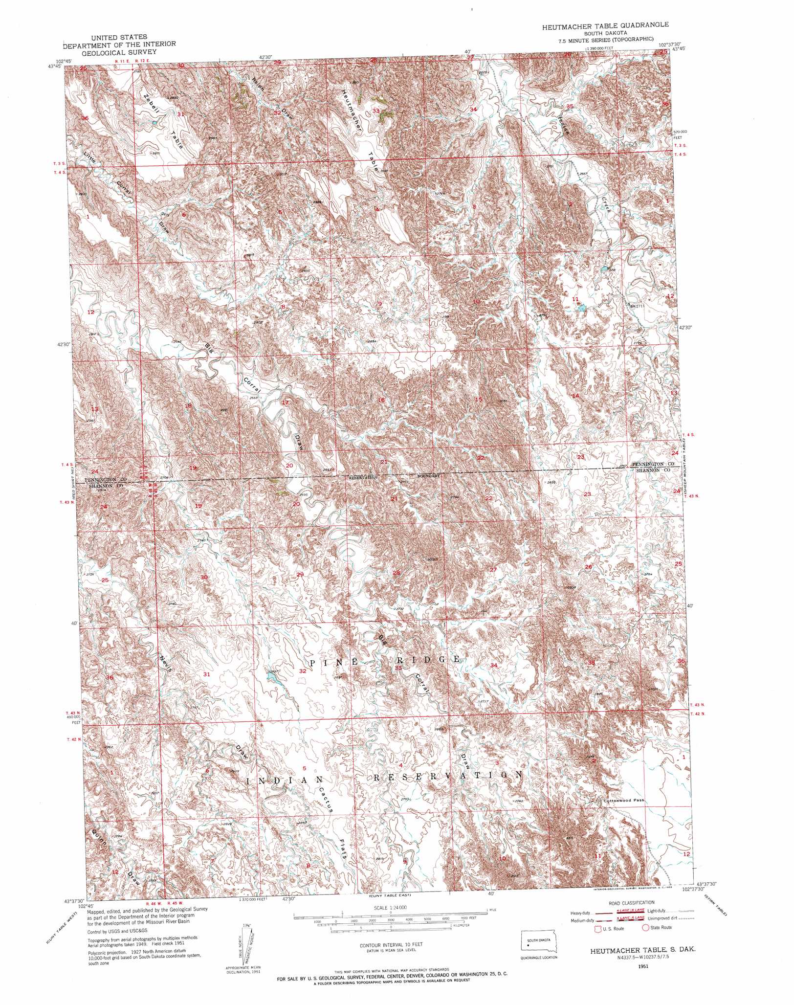
Heutmacher Table Topo Map South Dakota
To zoom in, hover over the map of Heutmacher Table
USGS Topo Quad 43102f6 - 1:24,000 scale
| Topo Map Name: | Heutmacher Table |
| USGS Topo Quad ID: | 43102f6 |
| Print Size: | ca. 21 1/4" wide x 27" high |
| Southeast Coordinates: | 43.625° N latitude / 102.625° W longitude |
| Map Center Coordinates: | 43.6875° N latitude / 102.6875° W longitude |
| U.S. State: | SD |
| Filename: | o43102f6.jpg |
| Download Map JPG Image: | Heutmacher Table topo map 1:24,000 scale |
| Map Type: | Topographic |
| Topo Series: | 7.5´ |
| Map Scale: | 1:24,000 |
| Source of Map Images: | United States Geological Survey (USGS) |
| Alternate Map Versions: |
Heutmacher Table SD 1951, updated 1953 Download PDF Buy paper map Heutmacher Table SD 2012 Download PDF Buy paper map Heutmacher Table SD 2015 Download PDF Buy paper map |
| FStopo: | US Forest Service topo Heutmacher Table is available: Download FStopo PDF Download FStopo TIF |
1:24,000 Topo Quads surrounding Heutmacher Table
Caputa |
Caputa Ne |
Creston |
Brennan Flat |
Quinn Table |
Caputa Sw |
Folsom |
Scenic Sw |
Scenic |
Quinn Table Sw |
Red Shirt |
Red Shirt Ne |
Heutmacher Table |
Sheep Mountain Table |
Imlay |
Red Shirt Sw |
Cuny Table West |
Cuny Table East |
Stirk Table |
Imlay Sw |
Willow Creek Nw |
Willow Creek Ne |
Rockyford Nw |
Rockyford |
Sharpes Corner |
> Back to 43102e1 at 1:100,000 scale
> Back to 43102a1 at 1:250,000 scale
> Back to U.S. Topo Maps home
Heutmacher Table topo map: Gazetteer
Heutmacher Table: Flats
Cactus Flats elevation 867m 2844′Heutmacher Table: Gaps
Cottonwood Pass elevation 858m 2814′Heutmacher Table: Summits
Hutmacher Table elevation 925m 3034′Zebell Table elevation 866m 2841′
Heutmacher Table digital topo map on disk
Buy this Heutmacher Table topo map showing relief, roads, GPS coordinates and other geographical features, as a high-resolution digital map file on DVD:
Eastern Wyoming & Western South Dakota
Buy digital topo maps: Eastern Wyoming & Western South Dakota