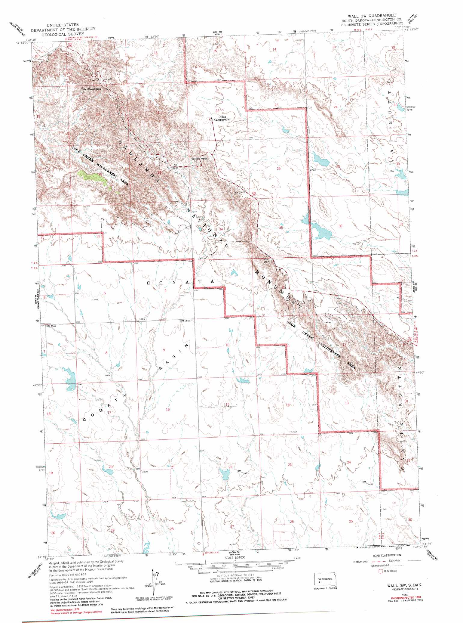
Wall Sw Topo Map South Dakota
To zoom in, hover over the map of Wall Sw
USGS Topo Quad 43102g2 - 1:24,000 scale
| Topo Map Name: | Wall Sw |
| USGS Topo Quad ID: | 43102g2 |
| Print Size: | ca. 21 1/4" wide x 27" high |
| Southeast Coordinates: | 43.75° N latitude / 102.125° W longitude |
| Map Center Coordinates: | 43.8125° N latitude / 102.1875° W longitude |
| U.S. State: | SD |
| Filename: | o43102g2.jpg |
| Download Map JPG Image: | Wall Sw topo map 1:24,000 scale |
| Map Type: | Topographic |
| Topo Series: | 7.5´ |
| Map Scale: | 1:24,000 |
| Source of Map Images: | United States Geological Survey (USGS) |
| Alternate Map Versions: |
Wall SW SD 1960, updated 1962 Download PDF Buy paper map Wall SW SD 1960, updated 1983 Download PDF Buy paper map Wall SW SD 2012 Download PDF Buy paper map Wall SW SD 2015 Download PDF Buy paper map |
| FStopo: | US Forest Service topo Wall SW is available: Download FStopo PDF Download FStopo TIF |
1:24,000 Topo Quads surrounding Wall Sw
Wasta |
Wasta Se |
Lake Hill |
Elm Creek Ranch |
Grindstone Sw |
Quinn Table |
Quinn Table Ne |
Wall |
Wall Ne |
Cottonwood |
Quinn Table Sw |
Quinn Table Se |
Wall Sw |
Wall Se |
Cottonwood Sw |
Imlay |
Bouquet Table |
Conata |
Conata Ne |
Interior |
Imlay Sw |
Imlay Se |
Conata Sw |
Conata Se |
Potato Creek |
> Back to 43102e1 at 1:100,000 scale
> Back to 43102a1 at 1:250,000 scale
> Back to U.S. Topo Maps home
Wall Sw topo map: Gazetteer
Wall Sw: Basins
Conata Basin elevation 780m 2559′Wall Sw: Dams
Conata East 302 Dam elevation 763m 2503′Virgil Horton 1 Dam elevation 818m 2683′
Virgil Horton 2 Dam elevation 835m 2739′
Virgil Horton 4 Dam elevation 820m 2690′
William Huether Dam elevation 784m 2572′
Wall Sw: Gaps
Dillon Pass elevation 822m 2696′Wall Sw: Pillars
The Pinnacles elevation 943m 3093′Wall Sw: Reservoirs
Conata East 302 Reservoir elevation 763m 2503′Wall Sw digital topo map on disk
Buy this Wall Sw topo map showing relief, roads, GPS coordinates and other geographical features, as a high-resolution digital map file on DVD:
Eastern Wyoming & Western South Dakota
Buy digital topo maps: Eastern Wyoming & Western South Dakota