Lone Well Creek East Topo Map South Dakota
To zoom in, hover over the map of Lone Well Creek East
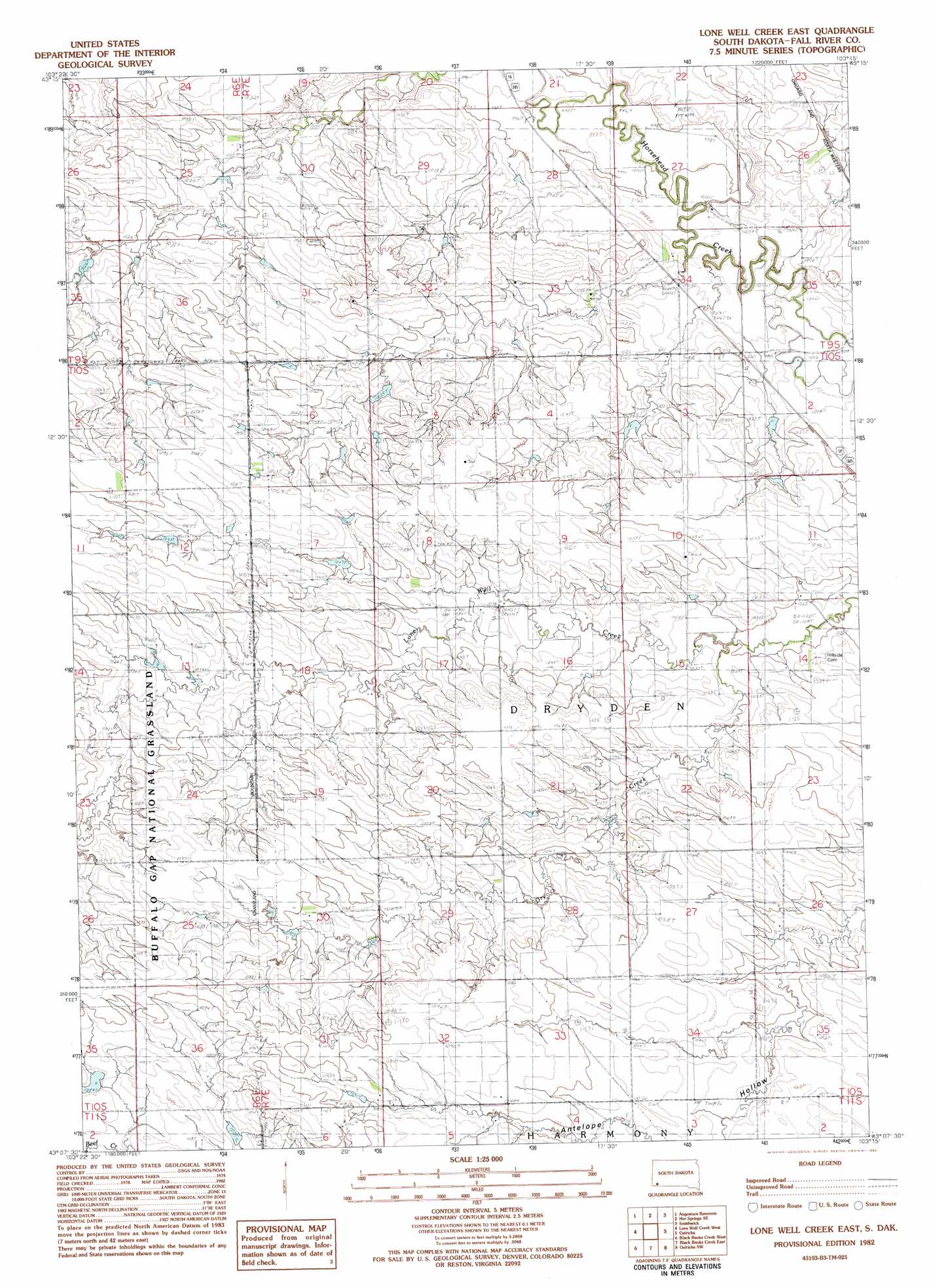
USGS Topo Quad 43103b3 - 1:25,000 scale
| Topo Map Name: | Lone Well Creek East |
| USGS Topo Quad ID: | 43103b3 |
| Print Size: | ca. 21 1/4" wide x 27" high |
| Southeast Coordinates: | 43.125° N latitude / 103.25° W longitude |
| Map Center Coordinates: | 43.1875° N latitude / 103.3125° W longitude |
| U.S. State: | SD |
| Filename: | l43103b3.jpg |
| Download Map JPG Image: | Lone Well Creek East topo map 1:25,000 scale |
| Map Type: | Topographic |
| Topo Series: | 7.5´ |
| Map Scale: | 1:25,000 |
| Source of Map Images: | United States Geological Survey (USGS) |
| Alternate Map Versions: | |
| FStopo: | US Forest Service topo Lone Well Creek East is available: Download FStopo PDF Download FStopo TIF |
1:24,000 Topo Quads surrounding Lone Well Creek East
Minnekahta Ne |
Hot Springs |
Buffalo Gap |
Smithwick Nw |
Smithwick Ne |
Cascade Springs |
Angostura Reservoir |
Hot Springs Se |
Smithwick |
Hay Canyon Butte |
Heppner |
Lone Well Creek West |
Lone Well Creek East |
Oelrichs |
Oelrichs Ne |
Ardmore Se |
Black Banks Creek West |
Black Banks Creek East |
Oelrichs Sw |
Heinne Creek |
Orella |
Wolf Butte |
Lone Tree Ranch |
Wayside |
Bohemian Creek |
> Back to 43103a1 at 1:100,000 scale
> Back to 43102a1 at 1:250,000 scale
> Back to U.S. Topo Maps home
Lone Well Creek East topo map: Gazetteer
Lone Well Creek East: Dams
Bogner Dam elevation 1088m 3569′Williams Dam elevation 1065m 3494′
Lone Well Creek East: Streams
Day Creek elevation 1025m 3362′Lone Well Creek East digital topo map on disk
Buy this Lone Well Creek East topo map showing relief, roads, GPS coordinates and other geographical features, as a high-resolution digital map file on DVD:
Eastern Wyoming & Western South Dakota
Buy digital topo maps: Eastern Wyoming & Western South Dakota