Hot Springs Se Topo Map South Dakota
To zoom in, hover over the map of Hot Springs Se
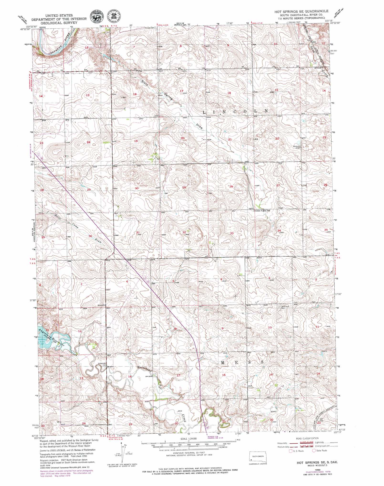
USGS Topo Quad 43103c3 - 1:24,000 scale
| Topo Map Name: | Hot Springs Se |
| USGS Topo Quad ID: | 43103c3 |
| Print Size: | ca. 21 1/4" wide x 27" high |
| Southeast Coordinates: | 43.25° N latitude / 103.25° W longitude |
| Map Center Coordinates: | 43.3125° N latitude / 103.3125° W longitude |
| U.S. State: | SD |
| Filename: | o43103c3.jpg |
| Download Map JPG Image: | Hot Springs Se topo map 1:24,000 scale |
| Map Type: | Topographic |
| Topo Series: | 7.5´ |
| Map Scale: | 1:24,000 |
| Source of Map Images: | United States Geological Survey (USGS) |
| Alternate Map Versions: |
Hot Springs SE SD 1950, updated 1952 Download PDF Buy paper map Hot Springs SE SD 2012 Download PDF Buy paper map Hot Springs SE SD 2015 Download PDF Buy paper map |
1:24,000 Topo Quads surrounding Hot Springs Se
Pringle |
Wind Cave |
Boland Ridge |
Fairburn Sw |
Fairburn Se |
Minnekahta Ne |
Hot Springs |
Buffalo Gap |
Smithwick Nw |
Smithwick Ne |
Cascade Springs |
Angostura Reservoir |
Hot Springs Se |
Smithwick |
Hay Canyon Butte |
Heppner |
Lone Well Creek West |
Lone Well Creek East |
Oelrichs |
Oelrichs Ne |
Ardmore Se |
Black Banks Creek West |
Black Banks Creek East |
Oelrichs Sw |
Heinne Creek |
> Back to 43103a1 at 1:100,000 scale
> Back to 43102a1 at 1:250,000 scale
> Back to U.S. Topo Maps home
No gazetteer data is available for the Hot Springs Se topo map sheet.
Hot Springs Se digital topo map on disk
Buy this Hot Springs Se topo map showing relief, roads, GPS coordinates and other geographical features, as a high-resolution digital map file on DVD:
Eastern Wyoming & Western South Dakota
Buy digital topo maps: Eastern Wyoming & Western South Dakota