Fairburn Se Topo Map South Dakota
To zoom in, hover over the map of Fairburn Se
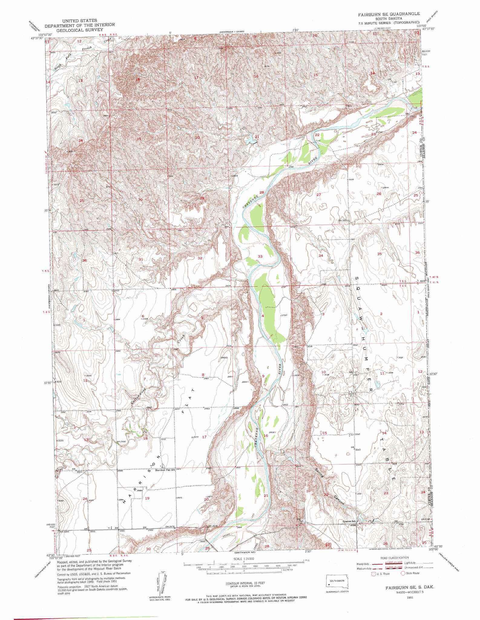
USGS Topo Quad 43103e1 - 1:24,000 scale
| Topo Map Name: | Fairburn Se |
| USGS Topo Quad ID: | 43103e1 |
| Print Size: | ca. 21 1/4" wide x 27" high |
| Southeast Coordinates: | 43.5° N latitude / 103° W longitude |
| Map Center Coordinates: | 43.5625° N latitude / 103.0625° W longitude |
| U.S. State: | SD |
| Filename: | o43103e1.jpg |
| Download Map JPG Image: | Fairburn Se topo map 1:24,000 scale |
| Map Type: | Topographic |
| Topo Series: | 7.5´ |
| Map Scale: | 1:24,000 |
| Source of Map Images: | United States Geological Survey (USGS) |
| Alternate Map Versions: |
Fairburn SE SD 1951 Download PDF Buy paper map Fairburn SE SD 1951, updated 1953 Download PDF Buy paper map Fairburn SE SD 2012 Download PDF Buy paper map Fairburn SE SD 2015 Download PDF Buy paper map |
| FStopo: | US Forest Service topo Fairburn SE is available: Download FStopo PDF Download FStopo TIF |
1:24,000 Topo Quads surrounding Fairburn Se
Hayward |
Hermosa |
Hermosa Se |
Caputa Sw |
Folsom |
Butcher Hill |
Fairburn |
Fairburn Ne |
Red Shirt |
Red Shirt Ne |
Boland Ridge |
Fairburn Sw |
Fairburn Se |
Red Shirt Sw |
Cuny Table West |
Buffalo Gap |
Smithwick Nw |
Smithwick Ne |
Willow Creek Nw |
Willow Creek Ne |
Hot Springs Se |
Smithwick |
Hay Canyon Butte |
Willow Creek Sw |
Willow Creek |
> Back to 43103e1 at 1:100,000 scale
> Back to 43102a1 at 1:250,000 scale
> Back to U.S. Topo Maps home
Fairburn Se topo map: Gazetteer
Fairburn Se: Flats
Harrison Flat elevation 911m 2988′Fairburn Se: Streams
Cottonwood Creek elevation 841m 2759′Fairburn Se: Valleys
Spring Canyon elevation 860m 2821′Fairburn Se digital topo map on disk
Buy this Fairburn Se topo map showing relief, roads, GPS coordinates and other geographical features, as a high-resolution digital map file on DVD:
Eastern Wyoming & Western South Dakota
Buy digital topo maps: Eastern Wyoming & Western South Dakota