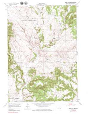
Jewel Cave Sw Topo Map South Dakota
To zoom in, hover over the map of Jewel Cave Sw
USGS Topo Quad 43103e8 - 1:24,000 scale
| Topo Map Name: | Jewel Cave Sw |
| USGS Topo Quad ID: | 43103e8 |
| Print Size: | ca. 21 1/4" wide x 27" high |
| Southeast Coordinates: | 43.5° N latitude / 103.875° W longitude |
| Map Center Coordinates: | 43.5625° N latitude / 103.9375° W longitude |
| U.S. State: | SD |
| Filename: | o43103e8.jpg |
| Download Map JPG Image: | Jewel Cave Sw topo map 1:24,000 scale |
| Map Type: | Topographic |
| Topo Series: | 7.5´ |
| Map Scale: | 1:24,000 |
| Source of Map Images: | United States Geological Survey (USGS) |
| Alternate Map Versions: |
Jewel Cave SW SD 1954, updated 1956 Download PDF Buy paper map Jewel Cave SW SD 1954, updated 1976 Download PDF Buy paper map Jewel Cave SW SD 1954, updated 1979 Download PDF Buy paper map Jewel Cave SW SD 2012 Download PDF Buy paper map Jewel Cave SW SD 2015 Download PDF Buy paper map |
| FStopo: | US Forest Service topo Jewel Cave SW is available: Download FStopo PDF Download FStopo TIF |
1:24,000 Topo Quads surrounding Jewel Cave Sw
> Back to 43103e1 at 1:100,000 scale
> Back to 43102a1 at 1:250,000 scale
> Back to U.S. Topo Maps home
Jewel Cave Sw topo map: Gazetteer
Jewel Cave Sw: Dams
Breasne Dam elevation 1379m 4524′Putnam Dam elevation 1371m 4498′
Jewel Cave Sw: Springs
Cedar Spring elevation 1334m 4376′Jewel Cave Sw: Summits
Pilger Mountain elevation 1461m 4793′Jewel Cave Sw: Valleys
Hell Canyon elevation 1189m 3900′Red Point Canyon elevation 1189m 3900′
Schenk Canyon elevation 1236m 4055′
Tepee Canyon elevation 1173m 3848′
Jewel Cave Sw: Wells
Pass Creek Well elevation 1140m 3740′Walsh Well elevation 1177m 3861′
Jewel Cave Sw digital topo map on disk
Buy this Jewel Cave Sw topo map showing relief, roads, GPS coordinates and other geographical features, as a high-resolution digital map file on DVD:
Eastern Wyoming & Western South Dakota
Buy digital topo maps: Eastern Wyoming & Western South Dakota


