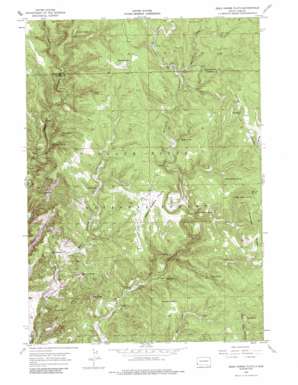
Dead Horse Flats Topo Map South Dakota
To zoom in, hover over the map of Dead Horse Flats
USGS Topo Quad 43103g8 - 1:24,000 scale
| Topo Map Name: | Dead Horse Flats |
| USGS Topo Quad ID: | 43103g8 |
| Print Size: | ca. 21 1/4" wide x 27" high |
| Southeast Coordinates: | 43.75° N latitude / 103.875° W longitude |
| Map Center Coordinates: | 43.8125° N latitude / 103.9375° W longitude |
| U.S. State: | SD |
| Filename: | o43103g8.jpg |
| Download Map JPG Image: | Dead Horse Flats topo map 1:24,000 scale |
| Map Type: | Topographic |
| Topo Series: | 7.5´ |
| Map Scale: | 1:24,000 |
| Source of Map Images: | United States Geological Survey (USGS) |
| Alternate Map Versions: |
Dead Horse Flats SD 1955, updated 1956 Download PDF Buy paper map Dead Horse Flats SD 1955, updated 1976 Download PDF Buy paper map Dead Horse Flats SD 1955, updated 1988 Download PDF Buy paper map Dead Horse Flats SD 2012 Download PDF Buy paper map Dead Horse Flats SD 2015 Download PDF Buy paper map |
| FStopo: | US Forest Service topo Dead Horse Flats is available: Download FStopo PDF Download FStopo TIF |
1:24,000 Topo Quads surrounding Dead Horse Flats
> Back to 43103e1 at 1:100,000 scale
> Back to 43102a1 at 1:250,000 scale
> Back to U.S. Topo Maps home
Dead Horse Flats topo map: Gazetteer
Dead Horse Flats: Flats
Dead Horse Flats elevation 1750m 5741′Dead Horse Flats: Ridges
Antelope Ridge elevation 1839m 6033′Cooper Ridge elevation 1917m 6289′
Dead Horse Flats: Springs
Barrel Spring elevation 1646m 5400′Blowout Spring elevation 1554m 5098′
Buck Spring elevation 1666m 5465′
Compton Spring elevation 1744m 5721′
Dead Horse Spring elevation 1630m 5347′
Ellis Spring elevation 1621m 5318′
Gooseberry Spring elevation 1788m 5866′
Hop Spring elevation 1524m 5000′
Middle Antelope Spring elevation 1789m 5869′
North Antelope Spring elevation 1796m 5892′
Poplar Spring elevation 1688m 5538′
Red Bank Spring elevation 1629m 5344′
South Antelope Spring elevation 1749m 5738′
Tepee Spring elevation 1716m 5629′
The Seeps elevation 1891m 6204′
Townley Spring elevation 1844m 6049′
Wells Spring elevation 1758m 5767′
Dead Horse Flats: Summits
Red Butte elevation 1680m 5511′Surveyors Hill elevation 1720m 5643′
Yellow Butte elevation 1660m 5446′
Dead Horse Flats: Valleys
Hop Draw elevation 1469m 4819′Sled Canyon elevation 1707m 5600′
Wildcat Draw elevation 1788m 5866′
Wolf Draw elevation 1781m 5843′
Dead Horse Flats digital topo map on disk
Buy this Dead Horse Flats topo map showing relief, roads, GPS coordinates and other geographical features, as a high-resolution digital map file on DVD:
Eastern Wyoming & Western South Dakota
Buy digital topo maps: Eastern Wyoming & Western South Dakota


