Coyote Gap Topo Map Wyoming
To zoom in, hover over the map of Coyote Gap
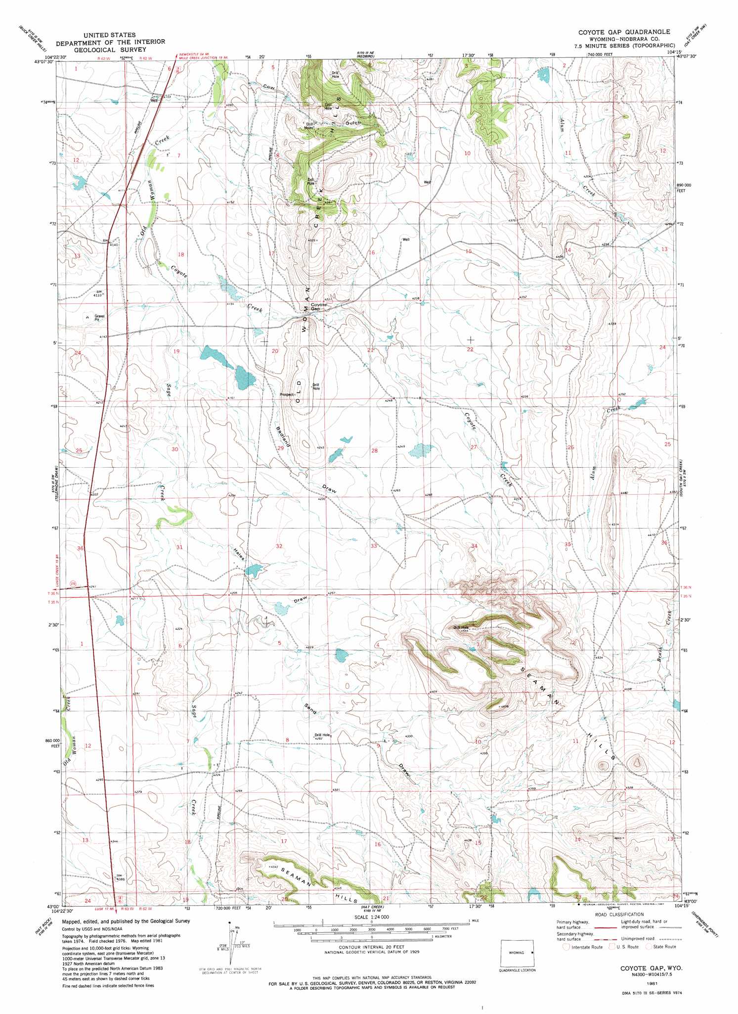
USGS Topo Quad 43104a3 - 1:24,000 scale
| Topo Map Name: | Coyote Gap |
| USGS Topo Quad ID: | 43104a3 |
| Print Size: | ca. 21 1/4" wide x 27" high |
| Southeast Coordinates: | 43° N latitude / 104.25° W longitude |
| Map Center Coordinates: | 43.0625° N latitude / 104.3125° W longitude |
| U.S. State: | WY |
| Filename: | o43104a3.jpg |
| Download Map JPG Image: | Coyote Gap topo map 1:24,000 scale |
| Map Type: | Topographic |
| Topo Series: | 7.5´ |
| Map Scale: | 1:24,000 |
| Source of Map Images: | United States Geological Survey (USGS) |
| Alternate Map Versions: |
Coyote Gap WY 1981, updated 1981 Download PDF Buy paper map Coyote Gap WY 2012 Download PDF Buy paper map Coyote Gap WY 2015 Download PDF Buy paper map |
1:24,000 Topo Quads surrounding Coyote Gap
Boggy Reservoir |
Greasewood Creek |
Bowen Flat |
Mule Creek |
Mule Creek Se |
Funny Rock |
Buck Creek Hills |
Redbird |
Oat Creek Nw |
Coffee Flats |
Rabbit Mountains |
Telephone Draw |
Coyote Gap |
South Oat Creek |
Oat Creek |
Manville Ne |
Hat Rock |
Hat Creek |
Shepherds Point |
Sherrill Hills |
Manville |
Lusk |
Signature Rock |
Kirtley Sw |
Kirtley |
> Back to 43104a1 at 1:100,000 scale
> Back to 43104a1 at 1:250,000 scale
> Back to U.S. Topo Maps home
Coyote Gap topo map: Gazetteer
Coyote Gap: Dams
Bad Land Number 1 Dam elevation 1263m 4143′Bad Land Number 2 Dam elevation 1269m 4163′
Clark and Metzger Dam elevation 1282m 4206′
Fred Number 1 Dam elevation 1296m 4251′
Younkin Number 2 Dam elevation 1298m 4258′
Coyote Gap: Gaps
Coyote Gap elevation 1271m 4169′Coyote Gap: Reservoirs
Bad Land Number 1 Reservoir elevation 1263m 4143′Bad Land Number 2 Reservoir elevation 1269m 4163′
Clark and Metzger Reservoir elevation 1282m 4206′
Fred Number 1 Reservoir elevation 1296m 4251′
Younkin Number 2 Reservoir elevation 1298m 4258′
Coyote Gap: Streams
Coyote Creek elevation 1251m 4104′Sage Creek elevation 1257m 4124′
Coyote Gap: Valleys
Badland Draw elevation 1257m 4124′Hales Draw elevation 1269m 4163′
Park Draw elevation 1323m 4340′
Sand Draw elevation 1275m 4183′
Coyote Gap digital topo map on disk
Buy this Coyote Gap topo map showing relief, roads, GPS coordinates and other geographical features, as a high-resolution digital map file on DVD:
Eastern Wyoming & Western South Dakota
Buy digital topo maps: Eastern Wyoming & Western South Dakota