Rabbit Mountains Topo Map Wyoming
To zoom in, hover over the map of Rabbit Mountains
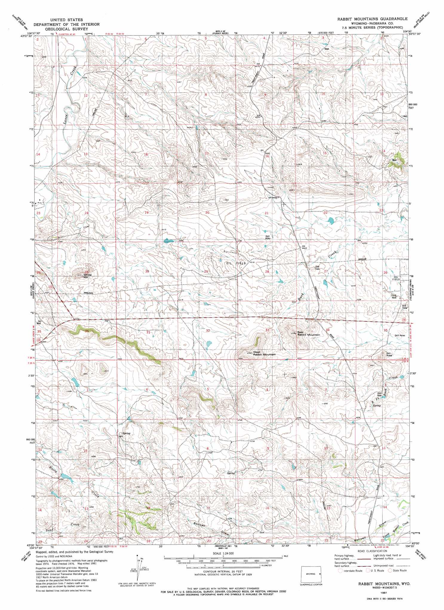
USGS Topo Quad 43104a5 - 1:24,000 scale
| Topo Map Name: | Rabbit Mountains |
| USGS Topo Quad ID: | 43104a5 |
| Print Size: | ca. 21 1/4" wide x 27" high |
| Southeast Coordinates: | 43° N latitude / 104.5° W longitude |
| Map Center Coordinates: | 43.0625° N latitude / 104.5625° W longitude |
| U.S. State: | WY |
| Filename: | o43104a5.jpg |
| Download Map JPG Image: | Rabbit Mountains topo map 1:24,000 scale |
| Map Type: | Topographic |
| Topo Series: | 7.5´ |
| Map Scale: | 1:24,000 |
| Source of Map Images: | United States Geological Survey (USGS) |
| Alternate Map Versions: |
Rabbit Mountains WY 1981, updated 1981 Download PDF Buy paper map Rabbit Mountains WY 2012 Download PDF Buy paper map Rabbit Mountains WY 2015 Download PDF Buy paper map |
1:24,000 Topo Quads surrounding Rabbit Mountains
Calf Draw |
Dixon Ranch |
Boggy Reservoir |
Greasewood Creek |
Bowen Flat |
Mercer Draw |
Lance Creek Nw |
Funny Rock |
Buck Creek Hills |
Redbird |
Mikes Draw |
Lance Creek |
Rabbit Mountains |
Telephone Draw |
Coyote Gap |
Cooley Draw |
Flat Top |
Manville Ne |
Hat Rock |
Hat Creek |
Keeline |
Bills Creek |
Manville |
Lusk |
Signature Rock |
> Back to 43104a1 at 1:100,000 scale
> Back to 43104a1 at 1:250,000 scale
> Back to U.S. Topo Maps home
Rabbit Mountains topo map: Gazetteer
Rabbit Mountains: Dams
Carrico Number 1 Dam elevation 1354m 4442′Provost Number 2 Dam elevation 1456m 4776′
Rabbit Mountains: Reservoirs
Carrico Number 1 Reservoir elevation 1354m 4442′Provost Number 2 Reservoir elevation 1456m 4776′
Rabbit Mountains: Streams
East Fork Buck Creek elevation 1316m 4317′Rabbit Mountains: Summits
East Rabbit Mountain elevation 1388m 4553′West Rabbit Mountain elevation 1407m 4616′
White Hill elevation 1393m 4570′
Rabbit Mountains digital topo map on disk
Buy this Rabbit Mountains topo map showing relief, roads, GPS coordinates and other geographical features, as a high-resolution digital map file on DVD:
Eastern Wyoming & Western South Dakota
Buy digital topo maps: Eastern Wyoming & Western South Dakota