Dixon Ranch Topo Map Wyoming
To zoom in, hover over the map of Dixon Ranch
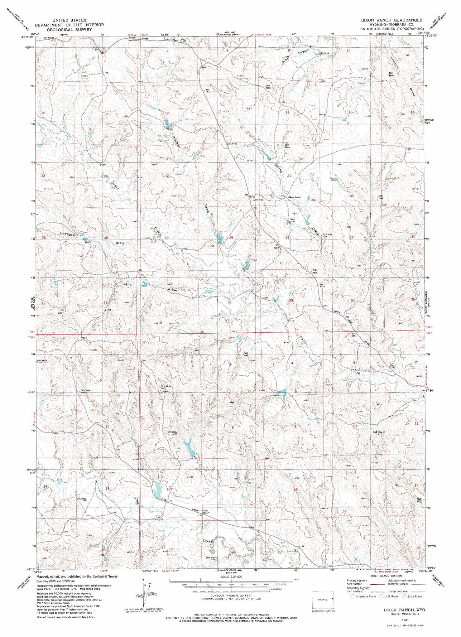
USGS Topo Quad 43104c6 - 1:24,000 scale
| Topo Map Name: | Dixon Ranch |
| USGS Topo Quad ID: | 43104c6 |
| Print Size: | ca. 21 1/4" wide x 27" high |
| Southeast Coordinates: | 43.25° N latitude / 104.625° W longitude |
| Map Center Coordinates: | 43.3125° N latitude / 104.6875° W longitude |
| U.S. State: | WY |
| Filename: | o43104c6.jpg |
| Download Map JPG Image: | Dixon Ranch topo map 1:24,000 scale |
| Map Type: | Topographic |
| Topo Series: | 7.5´ |
| Map Scale: | 1:24,000 |
| Source of Map Images: | United States Geological Survey (USGS) |
| Alternate Map Versions: |
Dixon Ranch WY 1981, updated 1981 Download PDF Buy paper map Dixon Ranch WY 2012 Download PDF Buy paper map Dixon Ranch WY 2015 Download PDF Buy paper map |
1:24,000 Topo Quads surrounding Dixon Ranch
Lion Creek |
Poddy Creek |
The Nose West |
The Nose East |
Morrisey |
Wagonhound Creek |
Wagonhound Creek Ne |
Garland Draw |
Horseshoe Bend |
Threemile Butte |
Pinnacle Rocks |
Calf Draw |
Dixon Ranch |
Boggy Reservoir |
Greasewood Creek |
Split Hill |
Mercer Draw |
Lance Creek Nw |
Funny Rock |
Buck Creek Hills |
Split Hill Sw |
Mikes Draw |
Lance Creek |
Rabbit Mountains |
Telephone Draw |
> Back to 43104a1 at 1:100,000 scale
> Back to 43104a1 at 1:250,000 scale
> Back to U.S. Topo Maps home
Dixon Ranch topo map: Gazetteer
Dixon Ranch: Dams
Deuel Dam elevation 1242m 4074′Taylor Dam elevation 1265m 4150′
Thompson Number 1 Dam elevation 1286m 4219′
Timber Draw Number 2 Dam elevation 1289m 4229′
Dixon Ranch: Reservoirs
Deuel Brothers Reservoir elevation 1242m 4074′Taylor Reservoir elevation 1265m 4150′
Thompson Number 1 Reservoir elevation 1286m 4219′
Timber Draw Number 2 Reservoir elevation 1289m 4229′
Dixon Ranch: Streams
Little Cow Creek elevation 1271m 4169′Spring Creek elevation 1232m 4041′
Dixon Ranch: Valleys
Hooligan Draw elevation 1286m 4219′Jolly Draw elevation 1267m 4156′
Timber Draw elevation 1265m 4150′
Dixon Ranch digital topo map on disk
Buy this Dixon Ranch topo map showing relief, roads, GPS coordinates and other geographical features, as a high-resolution digital map file on DVD:
Eastern Wyoming & Western South Dakota
Buy digital topo maps: Eastern Wyoming & Western South Dakota