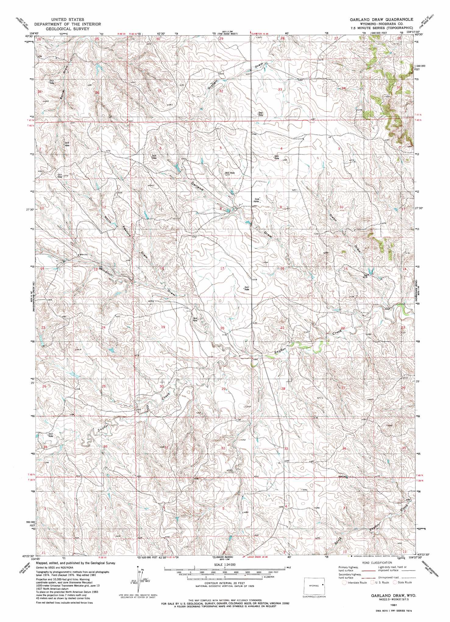
Garland Draw Topo Map Wyoming
To zoom in, hover over the map of Garland Draw
USGS Topo Quad 43104d6 - 1:24,000 scale
| Topo Map Name: | Garland Draw |
| USGS Topo Quad ID: | 43104d6 |
| Print Size: | ca. 21 1/4" wide x 27" high |
| Southeast Coordinates: | 43.375° N latitude / 104.625° W longitude |
| Map Center Coordinates: | 43.4375° N latitude / 104.6875° W longitude |
| U.S. State: | WY |
| Filename: | o43104d6.jpg |
| Download Map JPG Image: | Garland Draw topo map 1:24,000 scale |
| Map Type: | Topographic |
| Topo Series: | 7.5´ |
| Map Scale: | 1:24,000 |
| Source of Map Images: | United States Geological Survey (USGS) |
| Alternate Map Versions: |
Garland Draw WY 1981, updated 1981 Download PDF Buy paper map Garland Draw WY 2012 Download PDF Buy paper map Garland Draw WY 2015 Download PDF Buy paper map |
1:24,000 Topo Quads surrounding Garland Draw
Darlington Draw West |
Darlington Draw East |
Clareton |
Dupont Creek |
Timber Creek |
Lion Creek |
Poddy Creek |
The Nose West |
The Nose East |
Morrisey |
Wagonhound Creek |
Wagonhound Creek Ne |
Garland Draw |
Horseshoe Bend |
Threemile Butte |
Pinnacle Rocks |
Calf Draw |
Dixon Ranch |
Boggy Reservoir |
Greasewood Creek |
Split Hill |
Mercer Draw |
Lance Creek Nw |
Funny Rock |
Buck Creek Hills |
> Back to 43104a1 at 1:100,000 scale
> Back to 43104a1 at 1:250,000 scale
> Back to U.S. Topo Maps home
Garland Draw topo map: Gazetteer
Garland Draw: Dams
Ballard Number 3 Dam elevation 1279m 4196′Ballard Number 4 Dam elevation 1287m 4222′
Dixon Dam elevation 1267m 4156′
Helen Dixon Number 1 Dam elevation 1242m 4074′
Helen Dixon Number 2 Dam elevation 1230m 4035′
Spring Draw Dam elevation 1285m 4215′
Windmill Number 1 Dam elevation 1330m 4363′
Garland Draw: Reservoirs
Ballard Reservoir Number 3 elevation 1279m 4196′Ballard Reservoir Number 4 elevation 1287m 4222′
Dixon Reservoir elevation 1267m 4156′
Helen Dixon Number 1 Reservoir elevation 1242m 4074′
Helen Dixon Number 2 Reservoir elevation 1230m 4035′
Spring Draw Reservoir elevation 1285m 4215′
Windmill Number 1 Reservoir elevation 1330m 4363′
Garland Draw: Valleys
Clayton Draw elevation 1234m 4048′Dixon Draw elevation 1214m 3982′
Garland Draw elevation 1228m 4028′
North Pasture Draw elevation 1261m 4137′
Windmill Draw elevation 1245m 4084′
Garland Draw digital topo map on disk
Buy this Garland Draw topo map showing relief, roads, GPS coordinates and other geographical features, as a high-resolution digital map file on DVD:
Eastern Wyoming & Western South Dakota
Buy digital topo maps: Eastern Wyoming & Western South Dakota