Lion Creek Topo Map Wyoming
To zoom in, hover over the map of Lion Creek
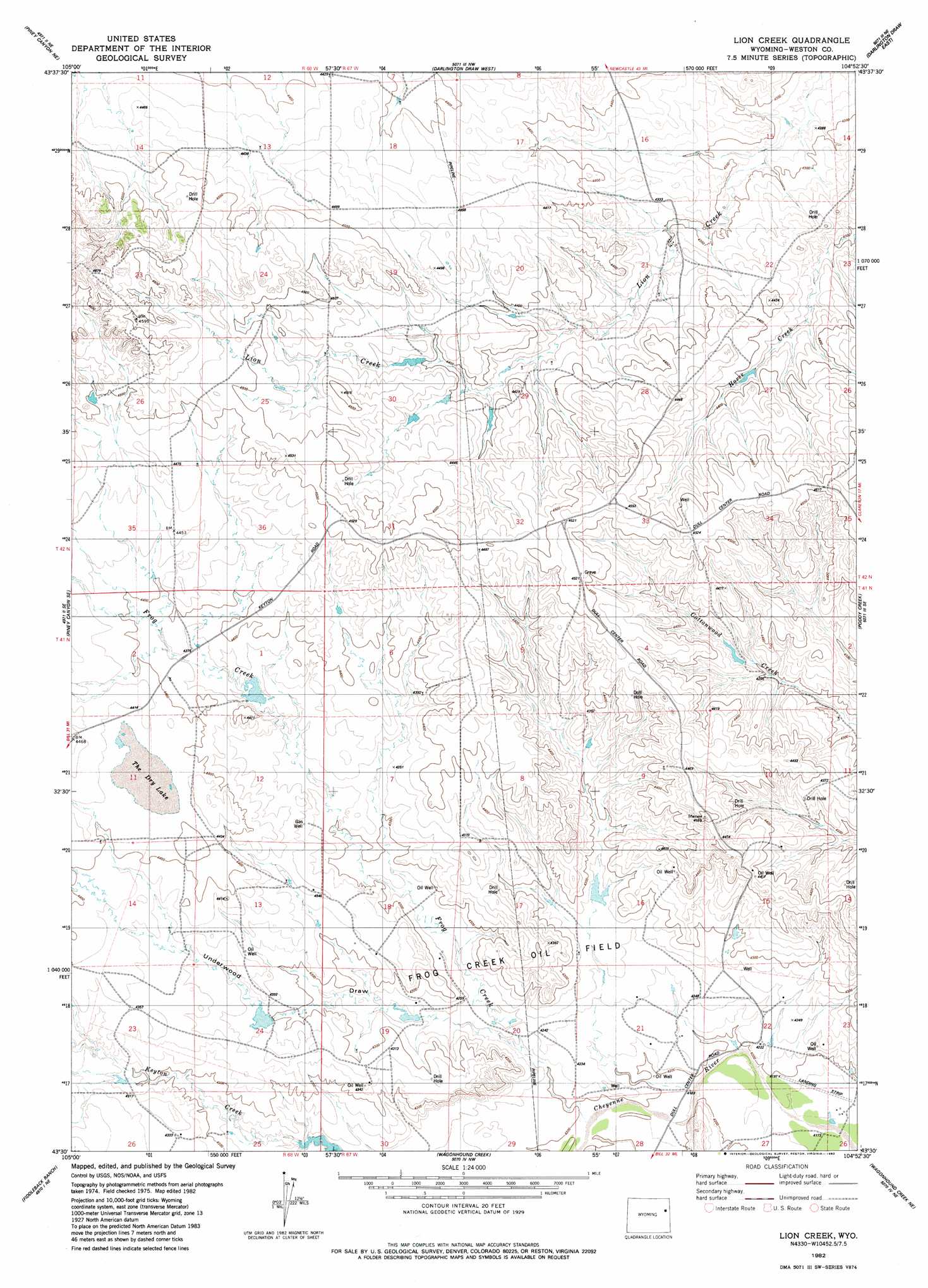
USGS Topo Quad 43104e8 - 1:24,000 scale
| Topo Map Name: | Lion Creek |
| USGS Topo Quad ID: | 43104e8 |
| Print Size: | ca. 21 1/4" wide x 27" high |
| Southeast Coordinates: | 43.5° N latitude / 104.875° W longitude |
| Map Center Coordinates: | 43.5625° N latitude / 104.9375° W longitude |
| U.S. State: | WY |
| Filename: | o43104e8.jpg |
| Download Map JPG Image: | Lion Creek topo map 1:24,000 scale |
| Map Type: | Topographic |
| Topo Series: | 7.5´ |
| Map Scale: | 1:24,000 |
| Source of Map Images: | United States Geological Survey (USGS) |
| Alternate Map Versions: |
Lion Creek WY 1982, updated 1982 Download PDF Buy paper map Lion Creek WY 2012 Download PDF Buy paper map Lion Creek WY 2015 Download PDF Buy paper map |
| FStopo: | US Forest Service topo Lion Creek is available: Download FStopo PDF Download FStopo TIF |
1:24,000 Topo Quads surrounding Lion Creek
Open A Ranch |
Buck Creek |
Wildlife Draw West |
Wildlife Draw East |
Fairview |
Piney Canyon Nw |
Piney Canyon Ne |
Darlington Draw West |
Darlington Draw East |
Clareton |
Piney Canyon Sw |
Piney Canyon Se |
Lion Creek |
Poddy Creek |
The Nose West |
Coal Bank Draw |
Fiddleback Ranch |
Wagonhound Creek |
Wagonhound Creek Ne |
Garland Draw |
Tin Can Lake |
Esau Spring |
Pinnacle Rocks |
Calf Draw |
Dixon Ranch |
> Back to 43104e1 at 1:100,000 scale
> Back to 43104a1 at 1:250,000 scale
> Back to U.S. Topo Maps home
Lion Creek topo map: Gazetteer
Lion Creek: Dams
Keaton Number Fs 9 249 13 Dam elevation 1306m 4284′Lion Creek: Lakes
The Dry Lake elevation 1345m 4412′Lion Creek: Oilfields
Frog Creek Oil Field elevation 1322m 4337′Lion Creek: Reservoirs
Keaton Number Fs 9 249 13 Reservoir elevation 1306m 4284′Lion Creek: Streams
Frog Creek elevation 1280m 4199′Lion Creek: Valleys
Underwood Draw elevation 1286m 4219′Lion Creek digital topo map on disk
Buy this Lion Creek topo map showing relief, roads, GPS coordinates and other geographical features, as a high-resolution digital map file on DVD:
Eastern Wyoming & Western South Dakota
Buy digital topo maps: Eastern Wyoming & Western South Dakota