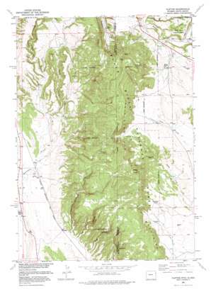
Clifton Topo Map Wyoming
To zoom in, hover over the map of Clifton
USGS Topo Quad 43104f1 - 1:24,000 scale
| Topo Map Name: | Clifton |
| USGS Topo Quad ID: | 43104f1 |
| Print Size: | ca. 21 1/4" wide x 27" high |
| Southeast Coordinates: | 43.625° N latitude / 104° W longitude |
| Map Center Coordinates: | 43.6875° N latitude / 104.0625° W longitude |
| U.S. States: | WY, SD |
| Filename: | o43104f1.jpg |
| Download Map JPG Image: | Clifton topo map 1:24,000 scale |
| Map Type: | Topographic |
| Topo Series: | 7.5´ |
| Map Scale: | 1:24,000 |
| Source of Map Images: | United States Geological Survey (USGS) |
| Alternate Map Versions: |
Clifton WY 1951, updated 1953 Download PDF Buy paper map Clifton WY 1951, updated 1972 Download PDF Buy paper map Clifton WY 1951, updated 1977 Download PDF Buy paper map Clifton WY 1951, updated 1977 Download PDF Buy paper map Clifton WY 2012 Download PDF Buy paper map Clifton WY 2015 Download PDF Buy paper map |
| FStopo: | US Forest Service topo Clifton is available: Download FStopo PDF Download FStopo TIF |
1:24,000 Topo Quads surrounding Clifton
> Back to 43104e1 at 1:100,000 scale
> Back to 43104a1 at 1:250,000 scale
> Back to U.S. Topo Maps home
Clifton topo map: Gazetteer
Clifton: Mines
Alray Prospect elevation 1208m 3963′Foster Mine elevation 1202m 3943′
L. Shuck Property Mine elevation 1310m 4297′
Clifton: Populated Places
Clifton elevation 1206m 3956′Clifton: Ranges
Elk Mountains elevation 1561m 5121′Clifton: Springs
Barrel Spring elevation 1252m 4107′Dugout Spring elevation 1439m 4721′
Ferguson Spring elevation 1399m 4589′
Gurney Spring elevation 1693m 5554′
Lower Dugout Spring elevation 1409m 4622′
Mix Spring elevation 1469m 4819′
North Spring elevation 1627m 5337′
Sheep Wagon Spring elevation 1389m 4557′
Slate Spring elevation 1324m 4343′
Clifton: Summits
Wildcat Peak elevation 1679m 5508′Clifton: Valleys
Buck Spring Canyon elevation 1434m 4704′Carr Canyon elevation 1207m 3959′
Carr Canyon elevation 1210m 3969′
Clifton Canyon elevation 1208m 3963′
Kouba Canyon elevation 1203m 3946′
Kouba Canyon elevation 1201m 3940′
Rock Canyon elevation 1238m 4061′
Clifton digital topo map on disk
Buy this Clifton topo map showing relief, roads, GPS coordinates and other geographical features, as a high-resolution digital map file on DVD:
Eastern Wyoming & Western South Dakota
Buy digital topo maps: Eastern Wyoming & Western South Dakota


