Klodt Reservoir Topo Map Wyoming
To zoom in, hover over the map of Klodt Reservoir
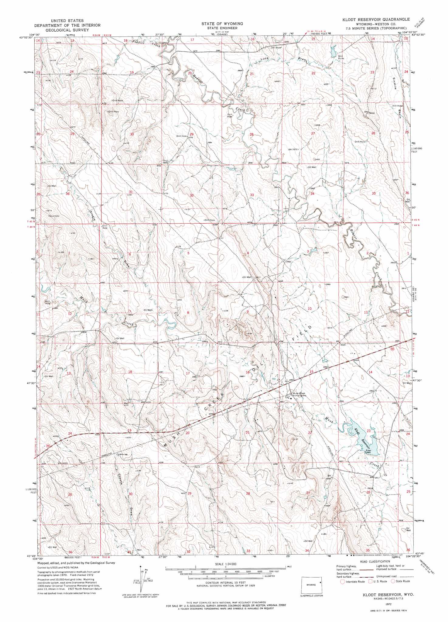
USGS Topo Quad 43104g4 - 1:24,000 scale
| Topo Map Name: | Klodt Reservoir |
| USGS Topo Quad ID: | 43104g4 |
| Print Size: | ca. 21 1/4" wide x 27" high |
| Southeast Coordinates: | 43.75° N latitude / 104.375° W longitude |
| Map Center Coordinates: | 43.8125° N latitude / 104.4375° W longitude |
| U.S. State: | WY |
| Filename: | o43104g4.jpg |
| Download Map JPG Image: | Klodt Reservoir topo map 1:24,000 scale |
| Map Type: | Topographic |
| Topo Series: | 7.5´ |
| Map Scale: | 1:24,000 |
| Source of Map Images: | United States Geological Survey (USGS) |
| Alternate Map Versions: |
Klodt Reservoir WY 1972, updated 1977 Download PDF Buy paper map Klodt Reservoir WY 2012 Download PDF Buy paper map Klodt Reservoir WY 2015 Download PDF Buy paper map |
| FStopo: | US Forest Service topo Klodt Reservoir is available: Download FStopo PDF Download FStopo TIF |
1:24,000 Topo Quads surrounding Klodt Reservoir
Upton West |
Upton East |
Clay Spur |
Skull Creek |
Four Corners |
Sheep Canyon Creek West |
Sheep Canyon Creek East |
Osage |
Pedro |
Cambria |
Fairview |
Lassen Creek |
Klodt Reservoir |
Osage Se |
Newcastle |
Clareton |
Dupont Creek |
Timber Creek |
Morrisey Ne |
Owens |
The Nose West |
The Nose East |
Morrisey |
Morrisey Se |
Dewey Sw |
> Back to 43104e1 at 1:100,000 scale
> Back to 43104a1 at 1:250,000 scale
> Back to U.S. Topo Maps home
Klodt Reservoir topo map: Gazetteer
Klodt Reservoir: Dams
Klodt Dam elevation 1195m 3920′Six Mile Dam elevation 1192m 3910′
Klodt Reservoir: Oilfields
Mush Creek Oil Field elevation 1233m 4045′Klodt Reservoir: Reservoirs
Klodt Reservoir elevation 1195m 3920′Klodt Reservoir elevation 1199m 3933′
Lissolo 9-364-3 Reservoir elevation 1192m 3910′
Klodt Reservoir: Streams
Fiddler Creek elevation 1205m 3953′Klodt Reservoir: Valleys
Luce Draw elevation 1199m 3933′Slagle Draw elevation 1220m 4002′
Klodt Reservoir digital topo map on disk
Buy this Klodt Reservoir topo map showing relief, roads, GPS coordinates and other geographical features, as a high-resolution digital map file on DVD:
Eastern Wyoming & Western South Dakota
Buy digital topo maps: Eastern Wyoming & Western South Dakota